4. ROUTES
4-3
5. After you have entered all the points you require, press the
ESC/MENU
key. The
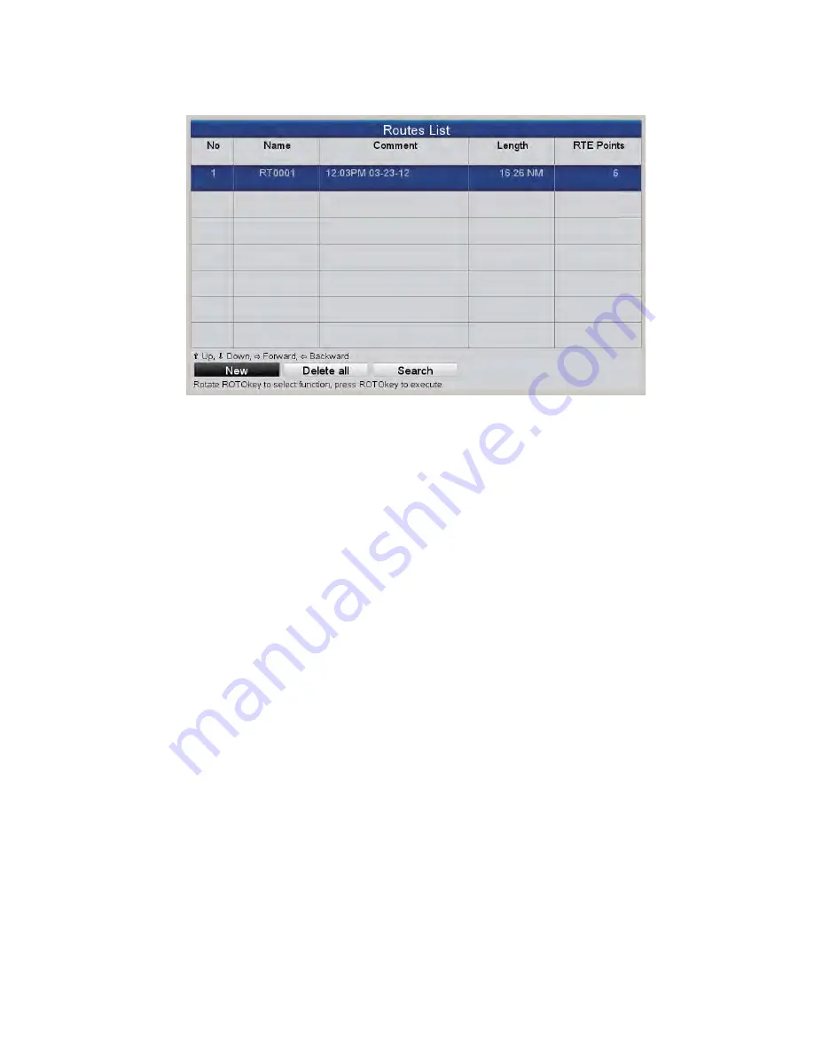
[Routes List] reappears, showing the newly entered route.
4.2.3
How to create a route with the Easy Routing feature
The Easy Routing feature automatically constructs a route between two points, taking
into consideration the preset values for safe depths, safe heights and boat’s width, to
provide you with an estimate of a safe route to your destination. Easy Routing can be
initiated on points, on quick points, on track points, on route legs, on a position fix, on
MOB position, on DSC points, on a cartographic object, and chart.
You simply set a start position and a destination. This can newly entered points or any
of the points mentioned above that are currently on the screen. (The total distance can
not be longer than 100 NM.) Easy Routing then analyzes the path between the two
points and creates a route, inserting legs in the route when necessary to get you away
from areas which exceed the safety values set on the menu. Easy Routing analyzes
each leg for safety in three levels: safe leg, potentially dangerous leg, and unsafe leg,
and color codes them accordingly, green for safe, yellow for potentially dangerous and
red for unsafe.
EASY ROUTING DISCLAIMER
: The accuracy of Easy Routing is limited by the avail-
ability of electronic charts loaded on your navigation system and the accuracy of orig-
inal source material used in producing such charts. Always remember that you should
navigate with the most detailed and up-to-date chart available from FURUNO, and
new information from National Hydrographic Offices may render your charts obsolete
at any time. Easy Routing is only an aid to navigation and must be used in conjunction
with conventional navigation practices. As the navigator of your vessel, you are re-
sponsible for reviewing the suggested route against the official nautical publications
and situational awareness. You must edit and/or approve the suggested route before
using it for navigation purposes
Summary of Contents for GP-1670
Page 1: ...OPERATOR S MANUAL www furuno com GPS PLOTTER GP 1670 GP 1870 ...
Page 44: ...2 TRACK 2 4 This page is intentionally left blank ...
Page 86: ...8 MEMORY CARD OPERATIONS 8 6 This page is intentionally left blank ...
Page 94: ...9 OTHER FUNCTIONS 9 8 This page is intentionally left blank ...
Page 100: ...10 CUSTOMIZING YOUR UNIT 10 6 This page is intentionally left blank ...
Page 105: ...11 MAINTENANCE TROUBLESHOOTING 11 5 License DAM report ...
Page 106: ...11 MAINTENANCE TROUBLESHOOTING 11 6 This page is intentionally left blank ...
Page 134: ...6 Apr 2012 H Maki D 1 ...
Page 135: ...6 Apr 2012 H Maki D 2 ...
Page 136: ...6 Apr 2012 H Maki D 3 ...
Page 137: ...6 Apr 2012 H Maki D 4 ...
Page 141: ......
Page 142: ......


