15
EN
After selecting and clicking a trap, the trap page is shown. Here you find all of the data belonging to the trap inclusive capture
data. Further you can set a timer for CO
2
release and fan and counter operation.
Trap Location
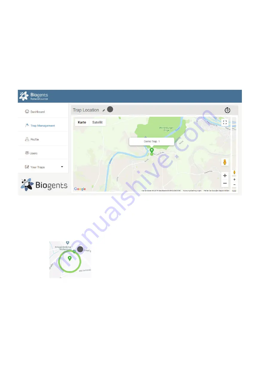
On top of the trap page the trap location is shown in a Google map. When rolling over the marker with the mouse, the name
of the trap is shown:
Types of coordinates
Location is normally determined using the build-in GPS.
With “zoom in“ the circle will get visible:
GPS Location: Green circle, accuracy about 50 m (10). The
counter must be outdoors for GPS location to work.
Setting “Exact” coordinates
Since mosquito counts are strongly correlated with exact
trap location (down to the nearest bush perhaps), it is possi-
ble to use Google Maps to set the exact location of the trap.
Click on the pencil icon next to “Trap Location” (11). Now, an
arrow is shown below the trap label which points to the exact
location. Click and drag the label to the desired location,
zooming in and switching between map and satellite view
as required. The location is saved when clicking on an item
outside the map.
Default location
If a newly registered trap has not yet transmitted a location
signal, the location displayed will be either the last known
location (which can be some distance away from the present
location) or the location of the prime meridian in Greenwich,
UK.
The location displayed is the last known location. For histo-
ric data, the best estimate of the location on the day selected
in the main chart is shown.
Trap Page
11
10


