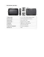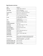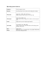
Introduction :
Thank you for buying the X-Map 4000 or 5000 outdoor map & chart navigation system.
We take great pride in designing each of our products. Our goal is to provide high-end
rugged products. We strive to improve our quality by using up-to-date high performance
technology.
At X-Systems we reinvest 100% of our earnings back into the company. This enables us to
support research and development to ensure our reliability in the future.
We advise you to read this manual carefully as we will guide you through the functions of
the system. Instructions about the navigation system will be given and in about 2 minutes
you will enjoy the possibilities of this all-round product.
Please read through the User’s Manual before using. When you use the product, we think
you have read through this manual.
The information provided in this manual, is as accurate as possible after being revised
carefully. If any printing error or translating mistake occurred in the manual, our company
would not bear the outcome due to such mistake or error.
The X-Map is hi-tech product, including operating system and the software provided by the
third parties. The producer has fulfilled its obligation in the manufacturing of hardware and
in the developing and applying of software to ensure the product works normally. If there is
something wrong with the product, the producer will shoulder the repair responsibility
against the Quality Warrant and will not make any compensation to the property and
economy losses incurred from using the product.
The electronics map to be used by the X-Map is provided by the third party, who has the
copyright of the electronics map and the copyright is subject to the law. The users are not
allowed to replicate or use for other purpose, except to use of the X-Map 4000 & 5000.
The X-Map producer will not make any warrant or guarantee in denotation or in
pretermission to the validity, integrity and accuracy of the information in the electronic map
used by the navigator. The producer will not make any compensation to the person and
property and economy losses incurred from using the electronic map.
The ownership and copyright of the manual belong to our company. The manual is not
allowed to replicate or translate in whole or in part for any commercial activity. Our
company reserves the final explanation right to the manual contents.
GPS navigating equipment works by receiving the signals from geostationary satellites for
positioning. It may not receive the signals inside the room or in dense buildings, and the
signals under viaduct may fade. When receiving signals from geostationary satellites, the
GPS navigating equipment is corresponding to different satellites in different locations,
which is called “ephemeris”. An ephemeris covers 300KMs at most. If an ephemeris is
confirmed in Location A, you move over 300km with your X-Map it will shut off, the X-Map
will be under another ephemeris. The satellites searched last time will be all researched to
determine the ephemeris, which will last a longer time. It will save plenty of time to click
“GPS Reset” button to clean up all the previous satellites with “GPS Test” function for
another search.
In high speed moving, it is a little difficult for GPS navigator to search satellite. You’d better
stop your vehicle to search satellite to determine your location.
When you charge your X-Map with travel charger or home charger, you are required to
use our company’s original charger. You are required not to charge with your own charger;
otherwise you bear the loss incurred from it.


