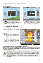
Fig.7.0-2
Fig.7.0-3
25.54m
Waypoints
Connected
GPS
03:58:45
AUTO Mode
18
2.4G
98%
51.98V
GPS Ready
15 m
D
H
H.S
V.S
17.1 m
0.0 m/s
0.0 m/s
P
0.0°
R
0.0°
Y
0.0°
RoutePlant
Input
Center
Down
N
Map lock
No-fly zone display
Map switch
Heading of the aircraft
5
4
3
m
15
14
Route
planning
Route
flying
Latitude and longitude input
104° 15.5123E / 22° 06.0902N
104° 15.5123E / 22° 06.0902N
5
4
3
m
15
14
25.54m
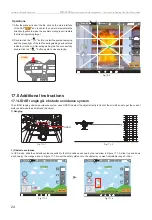
After enabling the automatic obstacle avoidance function,
swipe up and down to set the safe distance for automatic
obstacle avoidance
Distance between the aircraft
and the object directly in front
Connected
GPS
03:58:45
AUTO Mode
18
2.4G
98%
51.98V
GPS Ready
15 m
D
H
H.S
V.S
17.1 m
0.0 m/s
0.0 m/s
P
0.0°
R
0.0°
Y
0.0°
104° 15.5123E / 22° 06.0902N
104° 15.5123E / 22° 06.0902N
Center
Down
N
00:00
T
W
2X
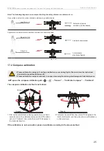
The aircraft must be operated so that it is within optimum communication range. Adjust the
orientation and distance between the operator and the aircraft in a timely manner to ensure
that the aircraft is always within optimum communication range.
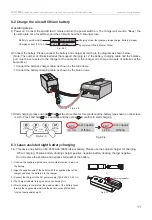
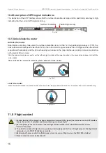
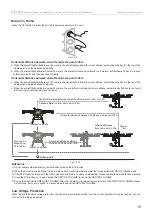
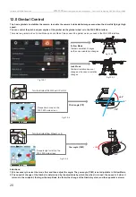
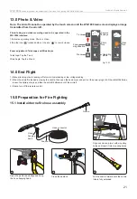
Install antennas
Install the left and right antennas and adjust their position.
Fig.8.0-1
Fig.8.0-2
Strong
Weak
13
Walkera All Rights Reserved
WK-1800
Airborne dry powder fire extinguisher
, Fire Hose Fire Fighting UAV Quick Start Guide
8.0 Prepare the Remote Control
21) Flight status parameters:
D-Distance: horizontal distance between the aircraft and
the point of return.
H-Height: vertical distance between the aircraft and the
point of return.
H.S - Horizontal Speed: the speed of the aircraft in the
horizontal direction.
V.S - Vertical Speed: the speed of the aircraft in the vertical
direction.
P - Pitch Angle: the front and rear tilt angle of the aircraft.
R- Roll Angle: the left and right tilt angle of the aircraft.
Y - Yaw Angle: the left and right turning angle of the aircraft.
22) Map thumbnail: tap the map thumbnail to quickly switch to
the map interface (Before flight, please turn off the aircraft,
and tap “Map Thumbnail” to cache the map, as shown in
Figure 7.0-2).
23) Automatic obstacle avoidance switch: Enable or disable the
automatic obstacle avoidance function (After enabling the
function, swipe up and down to set the safe distance for
automatic obstacle avoidance).
24) Navigator.
25) Distance measurement value: Display the distance between
the aircraft and the object directly in front in real time.
26) Throttle meter: real-time current throttle amount.
Содержание ZHUN WK-1800
Страница 2: ......


