The chart will automatically start to move when the cur-
sor reaches the edge of the screen. When the cursor is
switched off
[CLR]
, the chart will return to the ship’s po-
sition. See also "Cursor function" in sec.3.1.1.
0LACE CURSOR ON ANY #-!0 OBJECT LIGHT BUOY ETC
OR OWN RECORDINGS MARK WAYPOINT ETC 2EPEAT PRESS
ING
[ENT]
TO SCROLL THROUGH ALL AVAILABLE INFORMATION
INCLUDING CHART SCALE
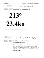
,OAD #HART SETUP
- In this display you can custom-
ize the presentation of C-MAP charts.
To obtain a ’cleaner’ view
of the chart details, you
can turn some of the set-
tings
OFF
if they do not
contribute to the clarity of
the chart area you wish to
explore.
The ’Chart detail level’
can also help to control
the amount of details
shown on the chart. The
advanced zoom feature
will automatically expand
or compress charts for the
scale you have selected
and attempt to compensate for missing charts. When-
ever a chart is compressed, however, it tends to get clut-
tered with details. Choose between five settings:
.
AUTO HIGH
(default) - compressed charts will display
depth lines and buoys.
.
AUTO LOW
- compression of charts will occur in two
1,5
MENU
# H A R T S E T U P
Chart boundary lines:
ON
Location names:
ON
Navigation marks:
ON
Lights:
ON
Depth lines:
ON
Depth 1:
0 - 003 m
Depth 2:
3 - 006 m
Depth 3:
6 -
MAX
Chart detail level:
AUTO HIGH
Restricted areas:
ON
Land settings:
ON
Marine settings:
ON
Naval aid settings:
ON
Paper chart settings:
ON
#HART SETUP
KEYS TO PRESS
ENT
#% -+)) #HART AND POSITION MENUS
#HAPTER
19
Содержание ce32 mkii
Страница 84: ... HAPTER 3ETUP 84 ...
Страница 118: ... PPENDIX 4IDE4RACKER 118 ...


