PAGE 21 OF 33
UG-TN200 V1.3
TN-200
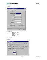
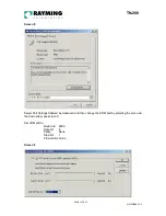
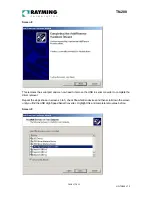
Click the drop down arrow on COM Port Number and scroll to the desired COM port. Click OK. Please
ensure that you do not select a COM port that is in use. Note this is particularly useful for programs,
such as HyperTerminal, which only work with COM1 through to COM4.
VERIFY COM PORT ASSIGNMENT
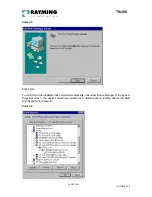
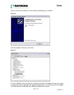
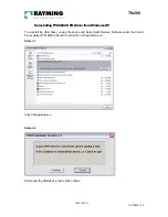
To verify the COM port assigned to your GPS, you must open the “Control Panel,” click on “System,”
select “Device Manager” and look for the heading “Port (COM & LPT) and maximize it by clicking on
the “+” sign. You should see “USB to Serial Port” assigned to a COM port, (generally COM3, but this
may vary from PC to PC).
NOTE: Also from within your street mapping software, you may need to manually configure the
selection of the COM port, which was assigned to the GPS receiver in order to properly communicate
between the GPS receiver and mapping program. (Most software requires that you manually configure
the COM port setting for any GPS device.
IMPORTANT:
1. You must change the default baud rate setting of your mapping software to 4800 if this is not the
default setting otherwise GPS data cannot be received.
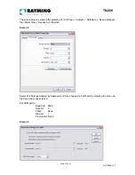
2. Set COM port to :
Baud rate: 4800
Data bit: 8
Parity: None
Stop bit: 1
Flow control: None
INITIALIZING YOUR GPS RECEIVER
Before using your TripNav GPS for navigation (especially for the first time), the receiver must obtain a
local GPS fix (coordinates) of the current position. To do this, take your laptop PC (with your USB
driver and the mapping software loaded and configured) to an open area that has a clear view to the
sky (such as a park or empty field). Start your street map software and wait for initialization of the GPS
to complete. This may take a few minutes depending on various factors such as the distance of the
current coordinates from the last time the GPS receiver was activated, GPS signal strength and
surrounding terrain (tall trees and buildings can block the satellite signals). Once the RAW GPS data is
displayed onto the screen, or a fix has indicated that initialization is complete (this will depend on the
actual software being used). In some cases initialization can take up to several minutes depending on
the conditions mentioned above before complete GPS data will be displayed on the screen.
Coordinates scrolling with zero’s means that the COM port connection is correct, but the satellite data is
not being received yet (possibly still initializing or in a bad area for satellite reception).
3. USING TRIPNAV
Once the TripNav’s driver and your personal mapping software have been installed and configured
properly, you can begin to use TripNav navigation system by plugging the TripNav into your laptop’s
USB port and launching your mapping software.
Always select an area in the vehicle where the GPS unit will be secure and not obstruct normal driving,
visibility and safety, but still maintaining a “view to the sky” in order to receive satellite data.

