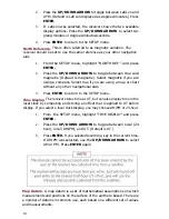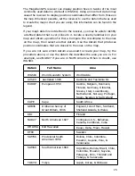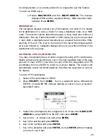
1. From the SETUP menu, highlight "MAP DATUM" and press
ENTER.
2. The first four datums are displayed. Press the DOWN ARROW
to scroll through the 12 datums until the desired one is
highlighted.
3. Press ENTER to return to the SETUP menu.
Elevation Mode.
This setting determines whether the receiver will compute
position only or position and elevation. The 2D mode is recommended for
use at sea, where 2D will provide the best accuracy and often the best
performance. The 3D mode is recommended for land use. Automatic (AUTO)
switches between 3D and 2D, depending an the number of visible satellites.
(Default is 2D.)
Position accuracy in 2D Operation is affected by the accuracy of the elevation
entered during initialization. An accurate elevation will produce more
accurate position fixes.
1. From the SETUP menu, highlight "ELEV. MODE" and press
ENTER.
2. Press the UP/DOWN ARROW to select the desired operating
mode.
3. Press ENTER to return to the SETUP menu.
4. Press the UP ARROW to access INITIALIZE. Key in the current
elevation, then press ENTER to return to the SETUP menu.
Distance Units.
The receiver can display distance and Speed measurements
as nautical miles (NM) and knots, statute miles (ST. MILES) and miles per hour,
or kilometers (KM) and kilometers per hour. (Default is statute miles and miles
per hour.)
1. From the SETUP menu, highlight "DIST. UNITS" and press
ENTER.
2. Press the UP/DOWN ARROW to toggle between NM/KNOTS,
ST.MILES/MPH, and KM/KPH.
3. Press ENTER to return to the SETUP menu.
Elevation Units.
Elevation can be displayed as feet or meters. (Default is
feet.)
1. From the SETUP menu, highlight "ELEV. UNITS" and press
ENTER.
2. Press the UP/DOWN ARROW to select meters or feet.
3. Press ENTER to return to the SETUP menu.
16
Содержание Trailblazer
Страница 1: ...Magellan GPS Satellite Navigator Reference Guide...
Страница 24: ...20...
Страница 31: ...27...
Страница 41: ...960 Overland Court San Dimas CA 91773 909 394 5000 22 60005 012...

