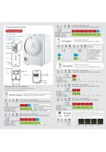
5-3
To scroll the selected ship’s name that is more than 11 letters, press the Joy Stick to the right or
the left.
(
See the following figure and PAGE SCROLL 5.2.1.4
)
‘
▼
’ mark is displayed on the bottom line when the Other Ships List is able to scroll downward. To
move the cursor downward, rotate the Jog Dial counter clockwise. When the cursor is on the
bottom line it has ‘
▼
’ mark, to scroll the Other Ships List downward, rotate the Jog Dial counter
clockwise.
When the cursor is moved upward from the top of the screen by rotating the Jog Dial counter
clockwise the next ship is displayed. (The cursor scrolls one by one in the Other Ships list.)
‘
▲
’ mark is displayed on the top line when the Other Ships List is able to scroll upward. To move
the cursor upward, rotate the Jog Dial clockwise. When the cursor is on the top line it has ‘
▲
’ mark,
to scroll the Other Ships List downward, rotate the Jog Dial clockwise.
Also, pressing the Joy Stick upward or downward can operate above operation similarly.
When the cursor is on the top line with out ‘
▲
’ mark, rotating the Jog Dial clockwise or pressing
upward the Joy Stick moves the cursor to own ship selecting position (See the bellow figure).
When the own ship is selected, pressing the Jog Dial or Joy Stick displays Own Ship’s Detail
Information. (See 5.2.1.3 Own Ship’s Detail Information)
To return to the Other Ships List from the Own Ship’s Detail Information display, press the CLR
key.
When the own ship is selected, rotating the Jog Dial clockwise or pressing upward the Joy Stick
displays the display setup of the Other Ships List. (See 5.2.1.4 Display Setup of Other Ships List
)
To return to the Other Ships List from the display setup of the Other Ships List, press the CLR key.
SORT:NORTH/RANGE UTC11:43
BRG : RNG
NAME / MMSI
270°: 0.18NM
35°: 0.29NM
OCEAN-LINE
QUEEN
* 22°: 0.92NM | BCDEFG-HIJK>
121°: 4.85NM
52°:12.47NM
010°:99.99NM
498755431
AABBCCDD243
111111111
SORT:NORTH/RANGE UTC11:43
BRG : RNG
NAME / MMSI
270°: 0.18NM
35°: 0.29NM
OCEAN-LINE
QUEEN
* 22°: 0.92NM | ABCDEFG-HIJK>
121°: 4.85NM
52°:12.47NM
010°:99.99NM
498755431
AABBCCDD243
111111111
OWN DETAIL UTC11:43
BRG : RNG ■ NAME / MMSI
270°: 0.18NM
35°: 0.29NM
* 22°: 0.92NM
121°: 4.85NM
52°:12.47NM
010°:99.99NM
111°:99.99NM
001°:99.99NM
000°:99.99NM
OCEAN-LINE
QUEEN
ABCDEFG-HIJK>
498755431
AABBCCDD243
111111111
111111112
111111113
111111114
222°:99.99NM
223°:99.99NM
224°:99.99NM
225°:99.99NM
▼228°:99.99NM
111111115
111111116
111111117
111111118
111111123
̲
N 35°32.8484 SOG 15.2KT
̲̲̲
E 123°45.2264 COG 44.4°
̲̲̲
TOTALL:128 CURSOR: 0
Own ship is selected
Scrolling of the ship’s name
Press the Joy Stick to
the right.
Press the Joy Stick to
the left.
Содержание JHS-182 -
Страница 1: ...Automatic Identification System JHS 182 Instruction Manual 7ZPJD0226 ...
Страница 6: ...v External Views NTE 182 AIS Transponder NCM 779 AIS Controller ...
Страница 7: ...vi NQE 3182 Connection Box ...
Страница 8: ...vii NBD 577B Power Supply Unit NQD 4382 Junction Box ...
Страница 13: ...1 3 1 3 3 Configuration System Block Diagram ...
Страница 14: ...1 4 1 4 Outline Outline Drawing of NTE 182 AIS Transponder Unit mm Mass approx 2 6 kg ...
Страница 15: ...1 5 Outline Drawing of NCM 779 AIS Controller Unit mm Mass approx 1 0 kg ...
Страница 16: ...1 6 Outline Drawing of NQE 3182 Connection Box Unit mm Mass approx 2 5 kg ...
Страница 17: ...1 7 Outline Drawing of NBD 577B Power Supply Unit Unit mm Mass approx 3 8 kg ...