Quick Start
22
Map Decluttering
In congested areas, some map detail can be removed without permanently affecting the current
map settings. There are four declutter settings which will respectively display everything (albeit with a
de-emphasized background), remove the background detail (lakes/rivers/highways), remove airspace
boundaries, and — at the highest declutter level — remove all map detail, except for those waypoints
which are part of the selected route. Map decluttering is selected with the
ENTER
key, and is not
available while panning (as described on page 13).
To quickly declutter the Map page (‘Aviation’ mode only):
1. Press
ENTER
once: the background detail (including highways, cities, rivers and smaller lakes)
becomes gray (de-emphasized) on the map to make the aviation data easier to read. This declutter
setting is identifi ed by a ‘CLEAR-1’ indication below the map scale.
2. Press
ENTER
again: the above background map detail is removed from the map display; ‘CLEAR-2’
appears below the map scale.
3. Press
ENTER
again: airspace boundary detail is removed from the map display; ‘CLEAR-3’ appears
below the map scale.
4. Press
ENTER
again: only the waypoints and navaids which are part of the current ‘Goto’ or route
appear on the map display; ‘CLEAR-4’ appears below the map scale.
5. Press
ENTER
again to return ALL detail to the map display.
The Map page can also be decluttered by using the
MENU
key, selecting the ‘Declutter’
option and pressing the
ENTER
key.
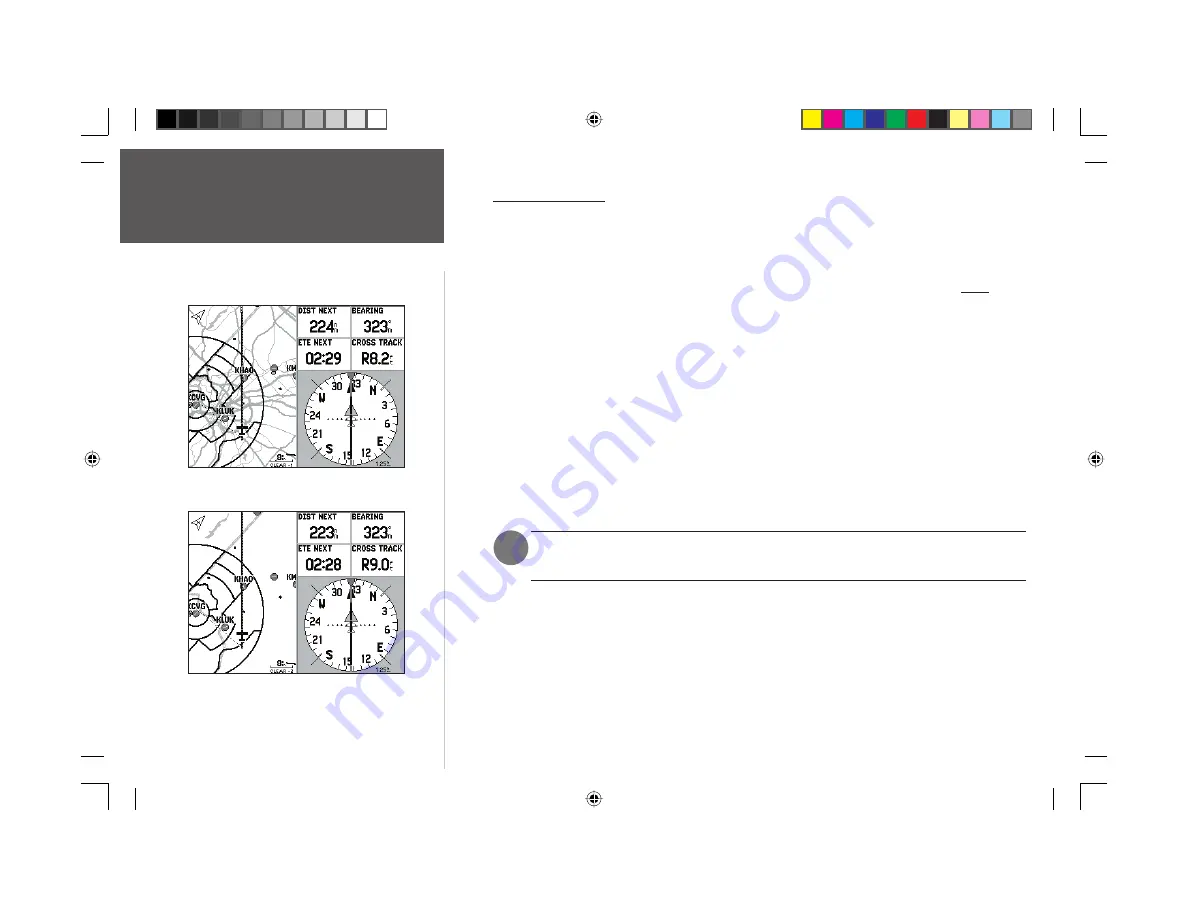
First declutter level with grayed background/basemap detail.
Note the ‘Clear-1’ declutter indication below the map scale.
Second declutter level with background detail Off.
Note the ‘Clear-2’ declutter indication below the map scale.
Map Decluttering
)
190-00283-01_0B.indd 22
2/6/2003, 11:13:09 AM