GNS 530(A) Pilot’s Guide and Reference
190-00181-00 Rev. H
SECTION 3
NAV PAGES
3-10
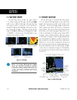
3) ‘Review Airspace?’ should already be
highlighted, if not select it with the small
right
knob. Press the
ENT
Key to display the
Airspace Information Page for the selected
airspace.
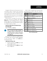
4) To display the COM frequency(ies) for the
controlling agency, turn the large
right
knob to
highlight ‘Frequencies?’ and press the
ENT
Key.
Press the
CLR
Key to return to the Airspace
Information Page.
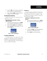
5) Press the
CLR
Key to exit the Airspace
Information Page.
Map Setup
Many of the GNS 530’s functions are menu driven.
Each of the main pages has an options menu, allowing
customization of the corresponding page to the pilot’s
preferences and/or selection of special features which
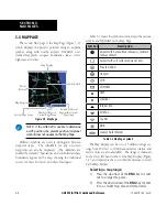
specifically relate to that page. A Map Page Menu (Figure
3-17) provides additional settings to customize the Map
Page and additional features related specifically to the
Map Page.
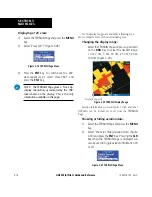
Displaying the Map Page Menu:
Press the
MENU
Key with the Map Page
displayed (Figure 3-17).
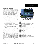
Figure 3-17 Map Page Menu
The following options are available: ‘Setup Map?’,
‘Measure Dist?’, ‘Data Fields Off?’, ‘Change Fields?’, and
‘Restore Defaults?’.
‘Setup Map?’ allows configuration of the Map Display
to individual preferences, including map orientation,
land data enable/disable, Jeppesen data enable/disable,
automatic zoom, airspace boundaries, and text size.
NOTE: Large, medium, and small classifications
are used on the GNS 530 for airports and cities.
Large airports are those with a runway longer
than 8100 feet. Medium airports include those
with a runway longer than 5000 feet or with
a control tower. Large cities are those with
approximate populations greater than 200,000
and medium cities with greater than 50,000.
The following settings are available for each group:
Map
Orientation, AutoZoom, Land Data,
Aviation Data
Weather
Lightning Mode/Symbol
(when applicable)
Traffic
Traffic Mode/Symbol/Label
(when applicable)
Airport
Large/Medium/Small Airports and
Text
NAVAID
VORs, NDBs, Intersections, and Text
Waypoint
User Waypoints, Waypoint Text,
Flight Plan Wpts
Line
Active Flight Plan, Lat/Long
Control
Controlled Airspace: Class B, C, D
(tower zone)
Airspace
Special-Use Airspace: Restricted,
MOA, Other
City
Large/Medium/Small Cities and Text
Road
Freeway, National Highway, Local
Hwy, Local Road
Other
States/Prov, Rivers/Lakes, Railroads,
Wind Vector
Содержание GNS 530
Страница 1: ...GNS 530 A Pilot s Guide and Reference ...
Страница 2: ......
Страница 10: ...GNS 530 A Pilot s Guide and Reference 190 00181 00 Rev H viii WARRANTY Blank Page ...
Страница 82: ...GNS 530 A Pilot s Guide and Reference 190 00181 00 Rev H 5 16 SECTION 5 FLIGHT PLANS Blank Page ...
Страница 116: ...GNS 530 A Pilot s Guide and Reference 190 00181 00 Rev H SECTION 6 PROCEDURES 6 34 Blank Page ...
Страница 142: ...GNS 530 A Pilot s Guide and Reference 190 00181 00 Rev H 7 26 SECTION 7 WPT PAGES Blank Page ...
Страница 190: ...GNS 530 A Pilot s Guide and Reference 190 00181 00 Rev H 10 30 SECTION 10 AUX PAGES Blank Page ...
Страница 270: ...GNS 530 A Pilot s Guide and Reference 190 00181 00 Rev H SECTION 16 MESSAGES ABBREVIATIONS NAV TERMS 16 14 Blank Page ...
Страница 274: ...GNS 530 A Pilot s Guide and Reference 190 00181 00 Rev H APPENDIX B SPECIFICATIONS B 2 Blank Page ...
Страница 286: ...GNS 530 A Pilot s Guide and Reference 190 00181 00 Rev H I 6 INDEX ...
Страница 287: ......

