


4-94
Garmin G500H Pilot’s Guide
190-01150-02 Rev. J
For
ewor
d
Sec 1 System
Sec 2
PFD
Sec 3
MFD
Sec 4
Hazar
d
Avoidance
Sec 5
Additional Featur
es
Sec 6
Annun. & Alerts
Sec 7
Symbols
Sec 8
Glossary
Appendix A
Appendix B
Index
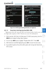
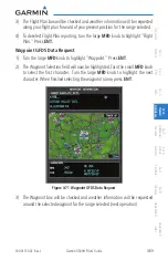
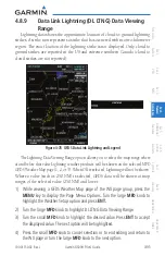
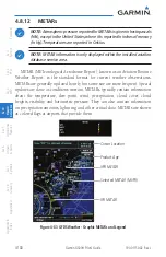
4.8.8
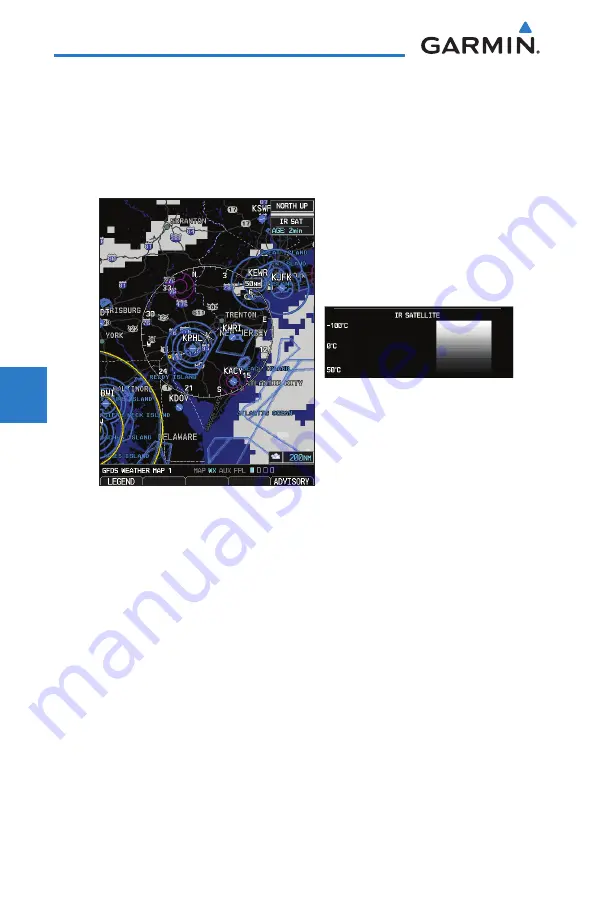
GFDS Infrared Satellite (IR SAT) Data Viewing
Range
IR SAT data is available over North America and Europe and depicts cloud
top temperatures from satellite imagery. Brighter cloud top colors indicate cooler
temperatures occurring at higher altitudes. Information is updated every half
hour.
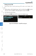
Figure 4-77 GFDS Infrared Satellite Data Map Display and Legend
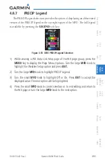
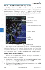
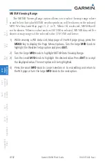
IR SAT Data Viewing Range
The IR SAT Data Viewing Range option allows you to select the map range
where at and below that value IR SAT weather products will be shown on the
selected MFD GFDS Weather Map page (1, 2, or 3). When Off is selected, IR SAT
will not be shown. For the selected value (such as 250 NM) is selected, IR SAT
data will be shown at map ranges of the selected value (250 NM) and lower.
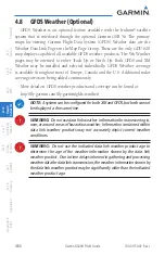
1) While viewing a WX Data Link Map page of the WX page group, press the
MENU
key to display the Page
Menu Options
. Turn the large
MFD
knob to
highlight the Weather Setup option and press
ENT
.
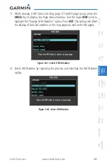
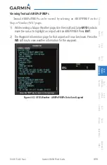
2) Turn the large
MFD
knob to highlight IR SAT Data Viewing Range. Turn the
small
MFD
knob to highlight the desired value.
3) Turn the small
MFD
knob to highlight the desired value. Press
ENT
to accept
the displayed value. The next option will be highlighted.
4) Press the small
MFD
knob to cancel selection or to end editing and return to
the WX page or turn the large
MFD
knob to the next option.
Содержание G500H
Страница 1: ...G500H Pilot s Guide ...
Страница 365: ......


