


2
Select
User Data
>
Routes
.
3
Select a route.
4
Select
View Map
.
Deleting a Route
1
Hold
MENU
.
2
Select
User Data
>
Routes
.
3
Select a route.
4
Select
Delete
>
Yes
.
Reversing a Route
1
Hold
MENU
.
2
Select
User Data
>
Routes
.
3
Select a route.
4
Select
Reverse
.
Tracks
A track is a recording of your path. The track log contains
information about points along the recorded path, including
time, location, and elevation for each point.
The device records a track automatically during any activity that
uses GPS. When you save an activity that uses GPS, the
device saves the track as part of the activity.
Saving a Track
1
After you have completed an activity that uses GPS, select
STOP
>
Save
.
2
Create a track from the saved activity (
).
Creating a Track from a Saved Activity
You create a track from a saved activity. This allows you to
share your track wirelessly with other compatible Garmin
devices.
1
Hold
MENU
.
2
Select
History
>
Activities
.
3
Select an activity.
4
Select
Save as Track
.
Viewing Details about the Track
1
Hold
MENU
.
2
Select
User Data
>
Tracks
.
3
Select a track.
4
Select
View Map
.
The beginning and the end of the track are marked by flags.
5
Select
BACK
>
Details
.
6
Select
UP
and
DOWN
to view information about the track.
Deleting a Track
1
Hold
MENU
.
2
Select
User Data
>
Tracks
.
3
Select a track.
4
Select
Delete
>
Yes
.
Sending and Receiving Data Wirelessly
Before you can share data wirelessly, you must be within 3 m
(10 feet) of a compatible Garmin device.
Your device can send or receive data when connected to
another compatible device. You can share waypoints,
geocaches, routes, and tracks wirelessly.
1
Hold
MENU
.
2
Select
User Data
>
Share Data
>
Unit to Unit
.
3
Select
Send
or
Receive
.
4
Follow the on-screen instructions.
Garmin Adventures
You can create adventures to share your journeys with family,
friends, and the Garmin community. Group related items
together as an adventure. For example, you can create an
adventure for your latest hiking trip. The adventure could
contain the track log of the trip, photos of the trip, and
geocaches you hunted. You can use BaseCamp™ to create and
manage your adventures. For more information, go to
.
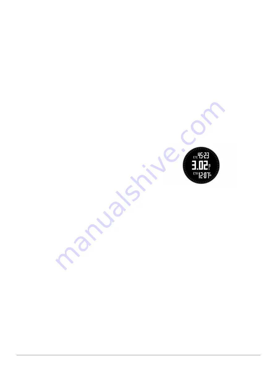
Navigation
You can navigate to a route, track, waypoint, geocache, or any
saved location in the device. You can use the map or the
compass to navigate to your destination.
Navigating to a Destination
You can navigate to waypoints, tracks, routes, geocaches,
POIs, and GPS coordinates. You can also navigate using
TracBack® or Sight 'N Go.
1
Select
START
>
Navigate
.
2
Select a type of destination.
3
Follow the on-screen prompts to select a destination.
The device displays information about your next waypoint.
4
Select
UP
or
DOWN
to view additional navigation data pages
(
Navigating with Sight 'N Go
You can point the device at an object in the distance, such as a
water tower, lock in the direction, and then navigate to the
object.
1
Select
START
>
Navigate
>
Sight 'N Go
.
2
Point the top mark on the bezel at an object.
3
Select
START
>
Set Course
.
4
Navigate using the compass (
).
5
Select
DOWN
to view the map (optional).
Compass
The device has a 3-axis compass with automatic calibration.
The compass features and appearance change depending on
your activity, whether GPS is enabled, and whether you are
navigating to a destination. You can manually change the
compass settings (
).
Navigating Using the Compass
You can use the compass to navigate to your next waypoint.
1
While navigating, select
DOWN
to view the compass page.
The two tick marks at the edge of the screen act as a bearing
pointer, which indicates the direction to your next waypoint.
2
Point the painted mark above the device screen in the
direction you are facing.
The painted mark indicates your heading, or your direction of
travel.
Navigation
3


