54
Appendix C
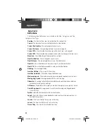
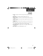
The following data fi eld options are available on the Map, Navigation, and Trip
Computer Main Pages.
Bearing -
The direction from your current location to a destination.
Course -
The direction from your starting location to a destination.
Current Destination -
The next waypoint on your route.
Current Distance -
The remaining distance to your next waypoint.
Current ETA -
The estimated time of day you will arrive at your next waypoint.
Current ETE -
The estimated time needed to arrive at the next waypoint on your route.
Elevation -
The altitude (height) above or below sea level.
Final Destination -
The last waypoint on your route.
Final Distance -
The remaining distance to your fi nal destination.
Final ETA -
The estimated time of day you will reach your fi nal destination.
Final ETE -
The estimated time needed to reach your fi nal destination.
Heading -
Your moving direction.
Location (lat/lon) -
Your current GPS position.
Location (selected) -
The lat/lon of point defi ned on map.
Maximum Speed -
The maximum second-by-second speed recorded since last reset.
Moving Avg. Speed -
Average speed while the unit is moving.
Odometer -
A running tally of distance travelled, based upon the distance between
second-by-second position readings.
Off Course -
The distance left or right you are from the original course (path of travel).
Overall Avg. Speed -
Average speed for unit for both moving and stopped speeds
since last reset.
Pointer -
Indicates the direction to the next destination.
Speed -
Your rate of travel can be displayed in miles per hour, kilometers per hour, or
nautical miles per hour.
Sunrise -
The time at which the sun rises on this day.
Sunset -
The time at which the sun sets on this day.
Time of Day -
The time for the selected time zone.
Data Field
Defi nitions
190-00234-00_0C.indd 54
10/11/2002, 9:49:43 AM
Содержание Etrex Legend - GPS Receiver
Страница 75: ...LegendOMCover indd 3 10 11 2002 9 52 39 AM ...

