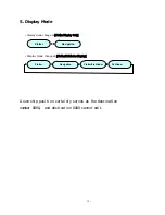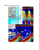
- 16 -
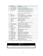
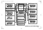
No
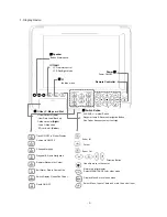
Definition
Description
1
Own ship Latitude
Latitude position of own ship’s
2
Own ship Longitude
Longitude position of own ship’s
3
Own ship Speed
Present Own ship’s Speed, SOG(Speed of Ground)
4
Own ship Course
Present Own ship’s Course COG(Course of Ground)
5
GPS Status
If no GPS or DGPS signal, Displays "Not-Ready"
If GPS is received "GPS", and DGPS is received "DGPS"
Simulation
『
ON
』
, Displays "SIMULATION"
6
Datum
Present using Datum
7
Present Date
It can be Revised Date in case of “NOT-READY”
8
Present Time
It can be Revised Time in case of “NOT-READY”
(L: Local Time, U: Universal Time)
Track Record & Color
Track Record & Color, “T” means Track
9
Track point
Saved current Track point
Mark
Mark type set currently
10
Mark Q’ty
Saved current Mark Q’ty
11 Cursor
Press
(
)button to display on plotter screen
12
Latitude of Cursor
Latitude of current cursor position
13
Longitude of Cursor
Longitude if current cursor position
14
Distance
Distance between current position and cursor
15
Bearing
Bearing from own ship to current cursor
16
Width of Display
Real distance of width in Display (100,000:1)
Waypoint Nav.
N/A
Route Nav.
Display Route number current set
17
Anchor set
Display “ANCHOR”
18
Way Point
Q’ty of Waypoint
19
Latitude of WPT
Latitude of current WPT navigation
20
Longitude of WPT
Longitude of current WPT navigation
21
Distance of WPT
Distance from own ship to WPT
22
Bearing of WPT
Bearing between own ship & WPT
23
Estimated Time
Estimated time to arrive from own ship to WPT
24
Speed of WPT
Approach speed from own ship to WPT
25
Range of Break
Range of own ship’s Breaking course & Steering
26
Navigation Time
Navigation time to WPT
27
28
Depth
North indication mark
Depth in Fish Finder operation
The direction of a red arrow expresses north.
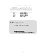
Always power OFF when removing or inserting C-Map card
CAUTION
Содержание FEG-881
Страница 1: ...FEG 881OPERATION MANUAL 8 INCH COLOR GPS PLOTTER FISH FINDER...
Страница 5: ...1 This chapter provides an overview of the GLOBAL POSITIONING SYSTEM GPS 1 GPS PLOTTER...
Страница 17: ...13 GPS Plotter Display 28 2 3 1 4 7 21 22 5 10 12 13 14 15 17 18 16 27 11 8 19 20 23 24 25 26 6 9...
Страница 19: ...15 C MAP Plotter Display 2 3 1 4 7 21 22 5 10 12 13 14 15 17 18 16 27 11 8 19 20 23 24 25 26 6 9...
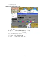
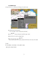
Страница 21: ...17 Day Night Mode in Plotter Display Press Open the menu such as Transparency Day Night mode...
Страница 23: ...19 Fish finder Combo Display Fish finder Display...
Страница 96: ...92 4 7 A SCOPE SET A scope on or off n Press and then go to 4 FISH 7 A SCOPE SET o Select ON OFF and then press...
Страница 105: ...101 APPENDIX 2 CONNECTING PINS...
Страница 106: ...102 DIMENSIONS need more than 100mm for service space in main body rear unit mm...
Страница 107: ...103 INSTALLING TO THE MAIN BODY...
Страница 111: ...107...
Страница 112: ...108 Marine Products Division 601 Fuseminami Bld 3 1 7 Ajiro Higashi Osaka Osaka Japan 577 0841 http www nakanoeng com...

