i
Displays the screen where traffic
information and the GPS reception
conditions can be set and verified.
Cancels waypoint/route.
Finds Places nearby
. You can
search for Points Of Interest (POI) near
the vehicle position.
Displays the route parameters
and the route in its full length on the
map. You can also perform
route-related actions such as editing or
cancelling your route, picking route
alternatives, avoiding parts of the route,
simulating navigation or adding the
destination to your Favourites.
2D
/
3DChanges View mode
. The
map view mode can be changed (2D
north up/2D heading up/3D).
Switches to the Settings screen
where you change navigation settings.
NOTE Some functions are not available
depending on some countries and
regions.
NAVIGATING ON THE MAP
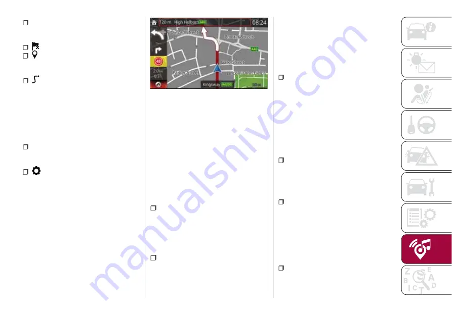
The data fields fig. 160 are different
when you are navigating an active route
and when you have no specified
destination (the burgundy line is not
displayed).
48
: shows the speed limit of the current
road if the map contains it.
2.0km
/
8:31
: shows the distance you
need to travel on the route before
reaching your final destination and the
estimated arrival time at the final
destination of the route.
NOTE Some functions are not available
depending on some countries and
regions.
OBJECTS ON THE MAP
Streets and roads
: the navigation
system shows the roads in different
widths and colours so that they can be
easily identified. A motorway will be
thicker and a different colour than a
small street.
Turn preview and Next street
:
when navigating a route, the top
section of the Map screen shows
information about the next manoeuvre,
street or town. There is an area at the
top left part of screen which indicates
the next operation. Displays both the
event type (such as turning, detouring,
exiting expressways) and the distance
from the current position.
Lane information and Signposts
:
when navigating on multilane roads, it is
important to take the appropriate lane
in order to follow the recommended
route. If lane information is available in
the map data, the navigation system
displays the lanes and their directions
using small arrows at the bottom of the
map. Highlighted arrows represent the
lanes and direction you need to take.
Junction view
: if you are
approaching a motorway exit or a
complex intersection and the needed
information exists, the map is replaced
with a 3D view of the junction.
Motorway exit services
: you may
need a petrol station or a restaurant
during your journey. This feature
displays a new button on the map
when you are driving on motorways.
Select this Open button to open a panel
with the details of the next few exits or
service stations.
Elements of the active route
: the
navigation system shows the route in
the following way.
160
11000001-121-111
199
Содержание 124 Spider
Страница 6: ......
Страница 8: ......
Страница 34: ...32 GETTING TO KNOW YOUR VEHICLE MANUAL CLIMATE CONTROL SYSTEM 24 06010300 122 099...
Страница 36: ...34 GETTING TO KNOW YOUR VEHICLE AUTOMATIC CLIMATE CONTROL SYSTEM 25 06010900 122 990...
Страница 140: ...FUSE BLOCK ENGINE COMPARTMENT 123 07031602 121 001 138 IN CASE OF EMERGENCY...
Страница 143: ...FUSES ON THE LEFT SIDE OF THE VEHICLE 124 07031602 03F 002 141...
Страница 178: ...WEIGHTS Curb weight 1050 kg 176 TECHNICAL SPECIFICATIONS...
Страница 190: ...RADIO 3 FRONT PANEL 153 06020300 121 001 188 MULTIMEDIA...
Страница 206: ......
Страница 207: ......
Страница 209: ...NOTES...
Страница 210: ......
Страница 211: ......


