background image

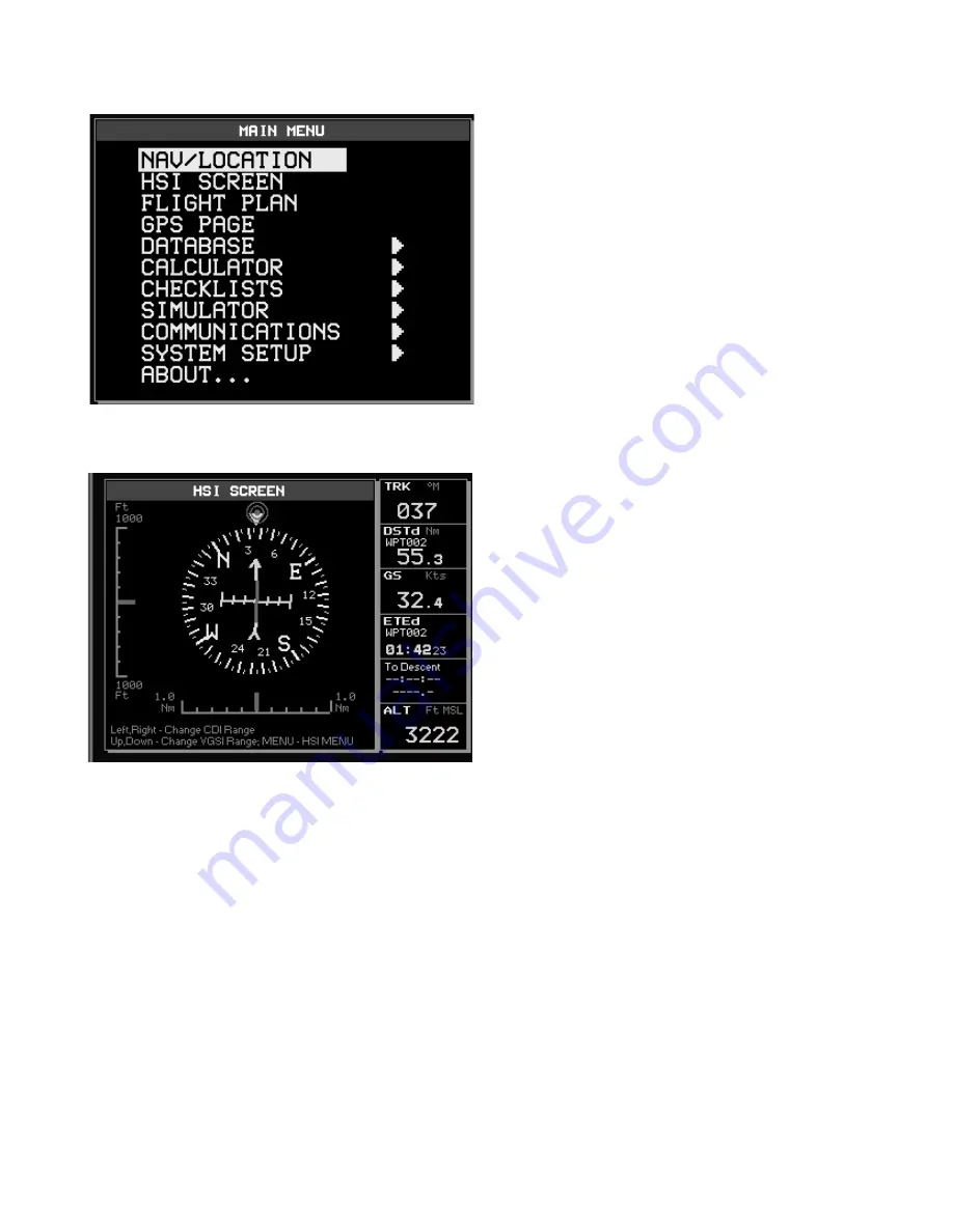
1.2.2 Main Menu

The Main Menu provides access to 

the set up of the main features of the 

GeoPilot. Press and hold for 1 sec 

‘MENU’ to display the Main Menu. From 

the Mainp Menu you can select the 

following features :

Navigation & Location

The Navigation and Location screen 

displays a full page of navigation 

information with

location coordinates.

HSI Screen

The HSI screen presents the desired 

course to be flown and the current 

Track in a graphical format similar to 

the Horizontal Situation Indicator of an 

aircraft; using the compass rose as the 

center of the display.

Flight plan

The Flight Plan mode allows you to 

create a Flight Plan with User Points, 

Temporary

Waypoints or Jeppesen object as 

Waypoints.

GPS Page

The GPS page shows GPS data in graphic mode, displaying satellite availability and 

status.

Database

The Database functions allow the user to search for and display information stored 

in the data cartridges on Airports, VOR, NDB, Intersections and User Waypoints, and 

to save User Data (User Waypoints, Flight Plans and Tracks) in the CF through File 

Manager.

Calculator

The Calculator functions assist the user in preflight and in-flight calculations for 

Содержание GeoPilot II

Страница 1: ...QUICK GUIDE ...

Страница 2: ...www avmap it ...

Страница 3: ...se Displays a list of the 20 nearest objects including private airports which contain runways of at least 500 ft in lenght relative to fix position or cursor position if no fix is available NEAR 1 sec once the GeoPilot2 has been turned On displays the Brightness and the Night Palette Menu The GoTo key Activates a Flight Plan to the cursor position in Moving Map or to selected object in other modes...

Страница 4: ...r area by changing the chart scale and zooming in on the map display If pressed outside the Moving Map it can be used as an ENTER key The Esc key Rejects an action closes a window or activates Home or Auto Zoom mode Esc 3 sec on the moving map changes the position of the fix icon one configuration displays the fix icon on the 20 central area of the Moving Map and the other on the exact center of t...

Страница 5: ... to select the priority of the map display and color selections among AERO TERRESTRIAL AERONAUTICAL MARINE settings Automatic Info The display of Automatic Information is controlled by this setting VFR Airspace Land Marine and other Settings The following menus enable disable the display of categories of data Terrains With this you can enable disable Terrain Depiction or the TAWS Selective Display...

Страница 6: ...Situation Indicator of an aircraft using the compass rose as the center of the display Flight plan The Flight Plan mode allows you to create a Flight Plan with User Points Temporary Waypoints or Jeppesen object as Waypoints GPS Page The GPS page shows GPS data in graphic mode displaying satellite availability and status Database The Database functions allow the user to search for and display infor...

Страница 7: ...tions Menu contains options that control the GPS data output 1 2 3 System Setup Menu The System Setup Menu allows the user to change how the GeoPilot2 displays information Press MENU 3 times to display the Main Menu From the System Setup you can select the following options General Setup The General Setup sub menu controls the general GeoPilot settings like sound scale language etc Fix Setup The F...

Страница 8: ...ilot2 emits one rapid beep sound and a Title page containing information about the Product name Software version library version and cartridges installed is displayed This data can also be viewed in the About page in the Main Menu After a few seconds the Warning page is displayed reminding you that the GeoPilot2 is an aid to navigation and should be used with appropriate prudence The electronic ch...

Страница 9: ...eld is highlighted Enter or edit data by pressing up down cursor key to step through the available characters until the desired character is displayed Press right cursor key to move the cursor to the right Use left cursor key to move the cursor to the left Some pilot entered data requires either a or a hemisphere identification Move the cursor over the displayed symbol and press up down cursor key...

Страница 10: ...ps of AvMap car navigators Geosat 4 series thus adding a new depth to the navigation In order to use GeoPilot II as a Car navigator please consult the Geosat 4 manual available on line at www avmap it This conversion table shows how to convert the Keyboard from Geopilot II to Geosat MENU MENU GOTO FIND ESC ESC NEAR PAGE ...

Страница 11: ......

Страница 12: ...SATELLITE NAVIGATION 133 Falmouth Rd Suite E Mashpee MA 02649 www avmap us AvMap ...

Отзывы: