14
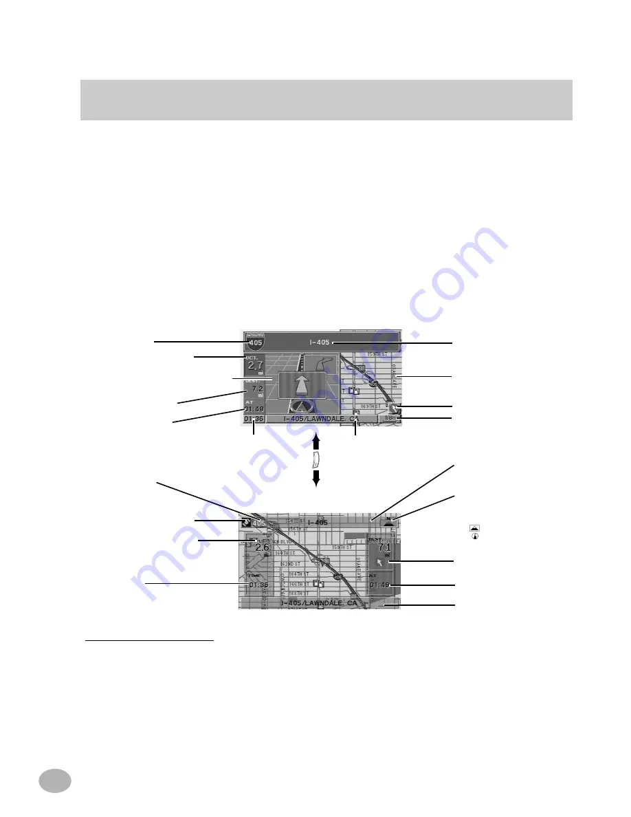
Switching between Split Screen Display and Detailed Map Display
*GPS Signal Strength Color Key
Dark Gray: No satellite information being received.
Blue: Information from 1 to 3 satellites being received. Latitude and longitude information can be determined.
Yellow: Signals from 4 or more satellites being received. Indicates full signal strength. Latitude and longitude can be
accurately determined.
MP
/RG
Split Screen Display
Street/highway name of
next maneuver
Detailed Map Display
Direction to Distance
Map Scale
Freeway number
Distance to next maneuver
Basic Guidance Display or Zoomed
Intersection Map Display
Estimated Remaining/
Arrival Time
Distance to destination
Current Time
Current Road and City Name
Compass Icon
Indicates North and heading mode on
the current map.
N : North
: North Up icon
: Heading Up icon
(The arrowhead shows the
direction of north)
Detailed Map Display
Distance to next maneuver
Street/highway name of
next maneuver
Distance and Direction to
Destination
Estimated Remaining/
Arrival Time
Current Road and City Name
Current Time
Freeway number
GPS Signal Strength Icon*
Once the route has been calculated and driving begins, the navigation system will
guide the driver, turn-by-turn, to the destination. Real time voice directions and map
displays aid the driver throughout the entire route.
The type of display that appears during your trip can be selected according to your
preference.
The Basic Guidance Display automatically appears when the destination is selected
while the vehicle is in motion. When the Split Screen is set to ON in the Setup menu
(See page 65), pressing the MP/RG button on the remote control toggles the display
between the Split Screen Display and the Detailed Map Display.


