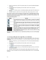
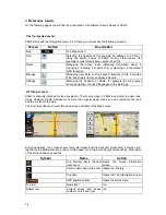
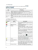
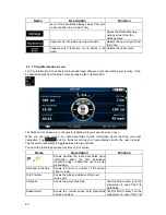
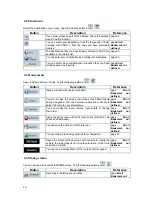

Symbol
Name
Action
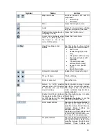
available in 3D mode.
Tap&hold any of the buttons to set
alue to the current tilt and
, or to reset it to its
nal value.
its v
zoom levels
origi
Current G
position (on
PS
nearest road)
n/a
Cursor
(selected map
location)
n/a
Lane information
n/a
Signpost information
n/a
Blue line
Active route
n/a
Map scale (2D map only)
n/a
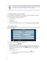
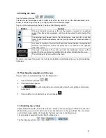
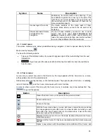
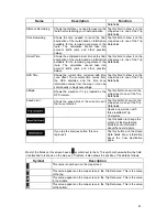
4.1.1 Icons on the map
s on the map. Most of them also function as a button. The information
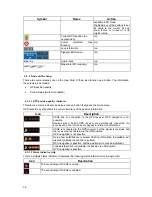
GPS position quality
This area is
s indicator, and also acts as a button th
ick menu.
GPS reception quality shows
There are several status icon
they provide is as follows:
Sound status (muted or enabled)
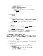
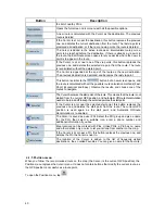
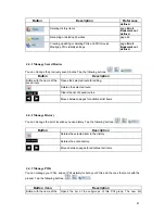
4.1.1.1 GPS position quality indicator
a statu
at opens the Qu
the current accuracy of the position information.
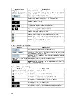
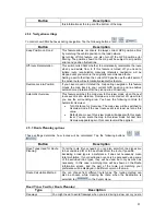
Icon
Description
l circumstances.
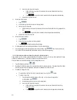
XSG2 has no connection to the GPS receiver: GPS navigation is not
possible.
Devices with a built-in GPS receiver are permanently connected. On
ppear in norma
such devices, the icon does not a
XSG2 is connected to the GPS receiver, but the signal is too weak and
the receiver cannot determine the GPS position.
GPS navigation is not possible.
Only a few satellites are received. Position information is av
calculated.
ailable, but
ay be significant.
elevation (altitude) cannot be
navigation is possible, but the position error m
GPS
Altitude information is available, the position is a 3D position.
GPS navigation is possible.
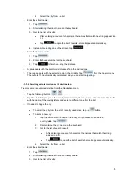
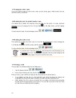
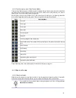
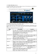
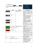
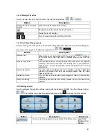
4.1.
tus indicator strip
This is a multiple
ing status information on a single strip:
1.2 Sta
status indicator. It indicates the follow
Icon
Description
The sound output of XSG2 is muted.
The sound output of XSG2 is enabled.
36


