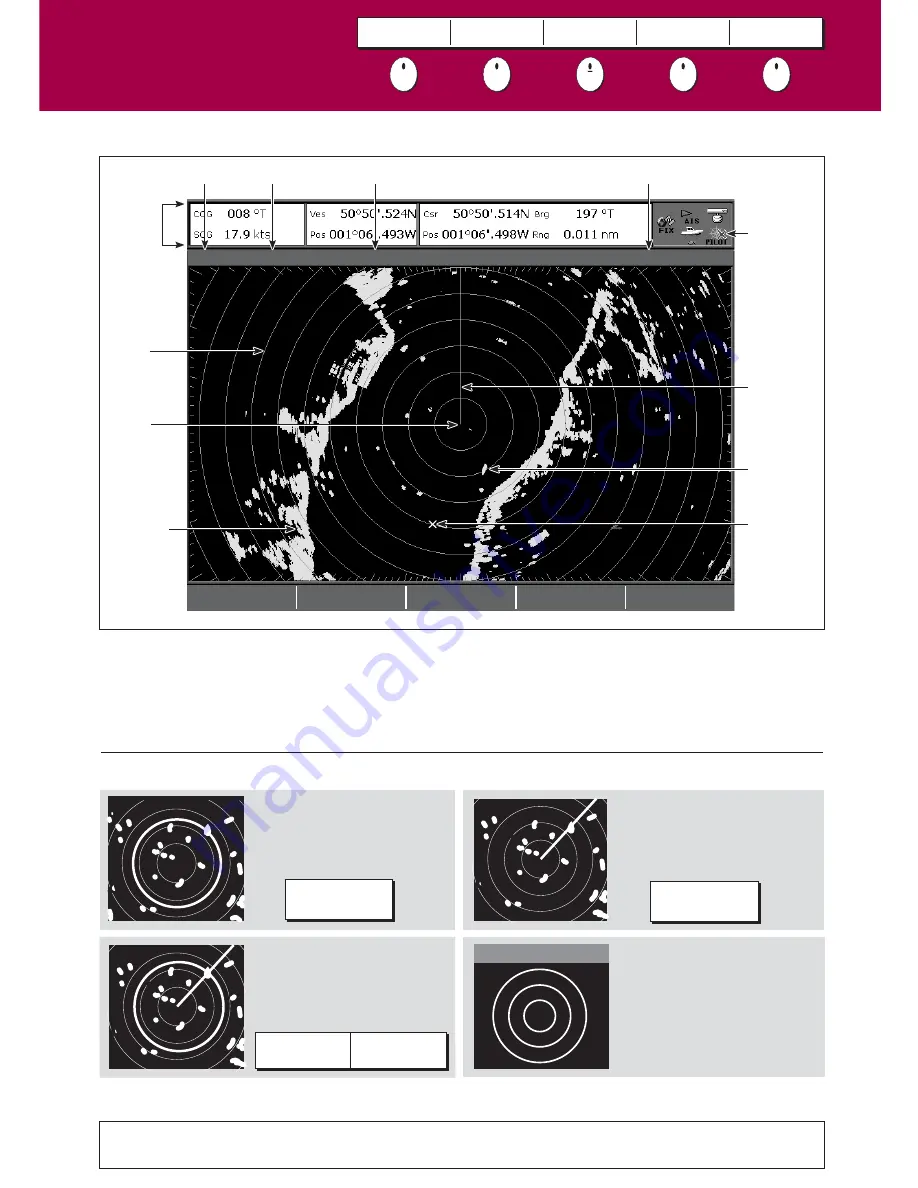
What does the radar show me?....
How do I measure distances, ranges and bearings with the radar?
See the 'Using the Radar' chapter of the Reference Manual
3nm
Head-Up
Relative Motion
Rings ½nm
VRM/EBL...
GAIN...
PRESENTATION...
TARGET
TRACKING...
ENHANCE
ECHOES...
Orientation
Data bar
Surface
vessel
Waypoint
D6731-4
Ship's
heading
marker
Icon
confirming
radar
connection
Range
ring
Landmass
Boat's
position
Range
Motion mode
Range ring spacing
Typically your boat's position is at the centre of the display, and its dead ahead bearing is indicated by a vertical
heading line, known as the Ship's Heading Marker (SHM).
Remember that the radar picture may vary from visual observations that you make; a nearby small object may
appear the same size on the screen as a distant large object. However, with experience the approximate size of
different objects can be determined by the relative size and brightness of the echoes.
What is around me?
Understanding the radar
Card 13
VRM/EBL
TARGET
TRACKING
GAIN
ENHANCE
ECHOES...
PRESENTATION
Range rings
Use the range rings to gauge
the approximate distances
between two points or from
your boat.
VRMs
Align a VRM on a target to
display its range from your
boat:
EBLs
Align an EBL on a target to
display its bearing relative to
your boat's heading:
Combined VRM/EBL
Combine a VRM and EBL to
measure range and bearing of
specified target.
ADJUST VRM
1.800nm
ADJUST VRM
1.800nm
Note: Range/bearing also displayed when VRM/EBL selected with the cursor.
e.g.
ADJUST EBL
30.0
0
S
ADJUST EBL
30.0
0
S
e.g.
e.g.
Rings
1/
2
nm
?
More information...


