


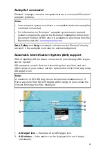


36
4.2 Routes
Routes are used to plan your journey in advance. You can plan your
journey directly on your display, or at home using software capable of
exporting waypoints and routes in standard .gpx format.
Routes consist of a number of waypoints. Your display can store up
to 50 routes, each route consisting of up to 250 waypoints. When
creating routes the route capacity is subject to the display’s 5,000
waypoint limit (e.g.: your display could store 20 routes each containing
250 waypoints).
To navigate a saved route, place the cursor over the route and press
the
OK
button, then select
Follow route
from the context menu.
Routes can be imported and exported from the display. For more
information, refer to:
Creating a Route
Follow the steps below to build a new route
Routes can be created in the Chart app.
Important:
Before following a route, you must ensure that each waypoint and
leg of your route is safe for your vessel to navigate.
1. Select the location for the first waypoint.
2. Select
Build route
from the context menu.