background image

Page 82

957 Operator’s Manual, Rev. B

Chapter 6 - Understanding the Waypoints Function

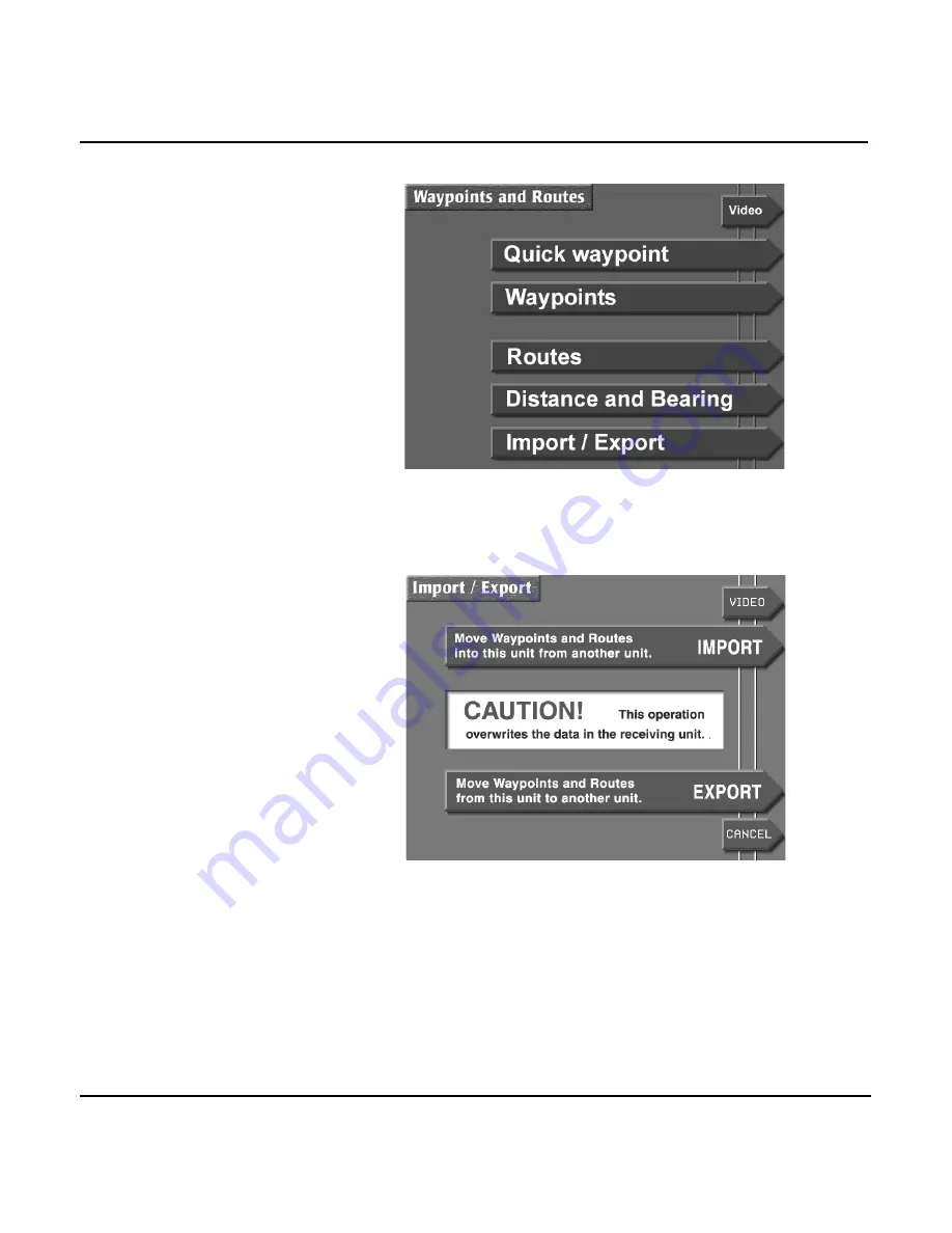
3. Press the 

IMPORT/EXPORT

 menu key to display the

IMPORT/EXPORT

 screen.


4. Press the 

EXPORT 

menu key to display the 

EXPORT

DATA

 screen. The status bar in the center of the screen

displays the message 

READY TO TRANSFER

 to show that

the transfer is ready to start. 

5. Before transferring, check the communication link

between the two units by pressing the 

TEST COMM

 key. If

the status bar now displays the message 

REMOTE LINK

OK

, you may begin to transfer waypoints.    

Summary of Contents for 957

Page 1: ...NORTHSTAR 957 GPS WAAS CHART NAVIGATOR Operator s Manual ...

Page 2: ......

Page 3: ...of the owner To be covered by this warranty the Northstar equipment must have been in normal use This warranty does not apply to 957 s with defects caused by improper installation phys ical damage abuse tampering lightning or other abnormal electrical discharge or to 957 s with defaced or altered serial numbers or to 957 s repaired by unauthorized persons or repaired in a manner that violates Nort...

Page 4: ...he sole source of navigation guidance Exercise caution and good judgment when underway CAUTION The electronic chart is an aid to navigation designed to facili tate the use of authorized government charts not replace them Only official government charts and notices to mariners contain all the information needed for safe navigation and as always the user is responsible for their prudent use ...

Page 5: ...oducing the controls 18 Introducing the display screen 19 Introducing the 957 s special functions 22 Maintaining the 957 23 Interfacing the 957 24 Using the Controls 25 Using the PWR key 26 Using the five function keys 26 Using the CURSOR PAD 28 Using the SAVE key 29 Using the MOB key 29 Using the alphanumeric KEYPAD 30 Using the menu keys 31 Using the BRIGHTNESS key 32 Using the IN and OUT keys 3...

Page 6: ...point coordinates 66 Creating new waypoints 67 Creating avoidance area waypoints 72 Editing waypoints 75 Updating waypoint coordinates 76 Moving waypoints routes between units 77 Transferring waypoints to and from a PC 83 Understanding the Routes Function 85 Introducing routes 86 Creating routes from the chart 87 Creating routes from a waypoints list 89 Saving a route as you travel 89 Editing a ro...

Page 7: ...eo display option 133 Setting up your 957 137 Changing your display settings 138 Changing your navigation settings 141 Changing your receiver settings 146 Changing your port settings 151 Setting up the fishfinder 151 Installing software updates 152 Displaying manufacturer s information 152 Changing the time zone 155 Appendix A Understanding GPS and WAAS 157 Appendix B System Features 163 Appendix ...

Page 8: ...Page iv 957 Operator s Manual Rev B ...

Page 9: ... screen 7 Using chart data 9 Displaying detailed position information 12 Displaying the fishfinder 13 Displaying a video image 14 Using demo mode 14 Going to a quick waypoint now 15 This chapter introduces this manual familiarizes you with the 957 s navigation functions and CHART screen features and explains how to display basic positioning information on the CHART screen ...

Page 10: ...please see the Northstar 957 Installation Manual part number GM957IM or contact your local authorized Northstar dealer Using this manual This manual complements the 957 s ease of use by describing and illustrating its various functions in a format that s conducive to fast learning and safe operation The manual s sections are grouped by related functions starting with an overview of the basic contr...

Page 11: ...he six menu keys located in a vertical row on the right side of the 957 DISPLAY TEXT is the type style used for text that appears on the display screens Sample 957 screen is the type style used for captions of display screens Figure 1 is the type style used for captions of figures A bulleted list contains a series of related items or topics A numbered list contains a series of steps in a procedure...

Page 12: ...tware revision available whenever contacting or corresponding with your dealer or Northstar If you need help call the Northstar Service Department at 978 897 6600 NOTE To prevent delays it s critical that you first obtain a Return Materials Authorization RMA number from the Service Department before return ing your 957 to Northstar The 957 is covered by a two year limited warranty see the Limited ...

Page 13: ... to the following address Northstar Technologies 30 Sudbury Road Acton MA 01720 If you have special overnight or second day shipping requirements UPS or Federal Express please call Northstar for turnaround time and freight costs before you ship your 957 For details about service procedures see the Limited Warranty Policy in this manual Turning the 957 on and off Turning the 957 on To turn the 957 ...

Page 14: ...r that same loca tion will usually be ready to navigate within one minute Now you re ready to get underway with your 957 Checking GPS and WAAS status Once the 957 is on and has acquired its satellite data you can always check the quality of the GPS signals by viewing the various satellites SNR reading Signal to Noise Ratio as CAUTION Be extremely careful when navigating with electronic charts Alth...

Page 15: ...gular vessel symbol in the center of the chart The DGPS or WAAS indicator on the right side of the screen means the 957 is currently receiving radiobeacon optional or WAAS signals White areas are water and brown areas are land If you re using a chart cartridge nav aids and depth contours are shown as well as landmark names If your vessel is moving the symbol will point in the direction of your cou...

Page 16: ...et up your 957 s CHART screen to display your current route your track history nearby waypoints or avoidance points a lat lon grid or other chart details For details see see Setting up the chart screen starting on page 45 Clearing a GPS or WAAS alarm If the 957 doesn t acquire GPS or WAAS signals within two minutes you ll see a flashing NO GPS alarm icon on the lower right side of the screen This ...

Page 17: ...ion map that covers the entire world at a fairly low level of detail This large scale set of maps can give you an approximate idea of your location with respect to land areas Nav aids are not included For more detailed charting data you ll want to use Navionics highly detailed miniature Nav Chart cartridges Navionics is a major producer of high quality high resolution seamless digital charts The 9...

Page 18: ...dge is inside the cartridge name and date are shown at the left of the CHART SETUP STATUS screen screen at left below If a cartridge isn t installed or is installed incorrectly the words NONE INSERTED are shown screen at right below The cartridge name comes from its Navionics catalog number Not all cartridges will have a date especially older ones in this case only the word PRESENT is shown rather...

Page 19: ...all times To ensure that you do not expose the cartridge to any environ mental damage please use caution when changing the cartridge Be careful when inserting the cartridge into the 957 see description and illus tration at right When you re not using the cartridge store it in a clean dry place away from heat humidity and dust Improper handling and stor age of the cartridge may dam age the Northsta...

Page 20: ...RE INFO menu key to display an info bar at the bottom of the screen Each additional press of the MORE INFO key shows the following information your vessel s present Speed Over Ground SOG and Course Over Ground COG your vessel s distance DIST and bearing BRG to the cur rent waypoint if any your vessel s position in lat lon or TDs if enabled To display position information on the GPS POSITION screen...

Page 21: ...page 169 For details about determining and displaying your position see Determining Your Position starting on page 51 Displaying the fishfinder If your 957 is equipped with Northstar s optional fishfinder pressing the SOUNDER key on the CHART screen will display fishfinder data that s split with the CHART screen Pressing the STAR key will display the full ECHO SOUNDER screen For details about sett...

Page 22: ...stationary position or simulate going to a cursor location on the CHART screen To access demo mode on the CHART screen press the CHART SETUP key then press the DEMO CONTROL key to display the DEMO CHART screen To move your vessel to a simulated position press the CURSOR PAD to move the cursor to the desired position and press the DEMO POSITION key To start demo mode at this new position press the ...

Page 23: ...ly on the DEMO CHART screen Going to a quick waypoint now You can point to any location on the CHART screen and go right to it This is called point and shoot navigation which can be the easiest and most powerful way to go to a waypoint Just select different locations and go to them one at a time right on the chart This way of navigating provides the most flexibility in deciding where you want to t...

Page 24: ...NAVIGATING TO CURSOR POSITION press the ENTER key The 957 displays a track line to the new waypoint named QUIK and guides you directly to this point That s all you have to do to use the 957 in its simplest form To learn more about navigating to waypoints see Navigating to waypoints starting on page 102 ...

Page 25: ...ducing the 957 Introducing the controls 18 Introducing the display screen 19 Introducing the 957 s special functions 22 Maintaining the 957 23 Interfacing the 957 24 This chapter introduces you to the 957 s features functions and display modes ...

Page 26: ...d can only learn more about how to use the 957 more efficiently The 957 always asks you to verify what you re doing when changing or deleting information You ll be asked to confirm your action before anything happens that may affect the 957 s operation You can always cancel a function at the last second For details about each of these controls see Using the Controls starting on page 25 Figure 2 95...

Page 27: ...d you re still navigating through a channel around an island or in open water always in full view of what s around you at all times Occasionally you may see an hourglass symbol briefly displayed on the screen while the 957 is changing or redrawing the chart Display screen lighting The 957 s large full color screen is easily readable under all conditions from full direct sunlight to total darkness ...

Page 28: ...f the 957 becomes too hot inside due to the outside temperature and sunlight the display screen will automatically dim Auto dimming helps maintain the integrity of the display and reduce power consumption when the 957 is on and running too hot for its current environment You can override the auto dim function at any time by increasing the brightness with the BRIGHTNESS key The 957 may dim again as...

Page 29: ...ord NEW in the upper right corner To turn off the flashing icon and remove the message press the CLEAR ALARM menu key Info windows The 957 displays info windows while you re entering data or using control functions These windows give extra details about what s going to happen or let you acknowledge a command Info windows always appear with the word INFO in a small box ...

Page 30: ...nactive while the 957 displays a question window Introducing the 957 s special functions The 957 has several special functions alarms Tide Track display video image display Using the alarms The 957 has several alarms that automatically alert you to certain situations For example when you re approaching a waypoint the 957 lets you know by sounding a beep and flashing an alarm icon on the screen The...

Page 31: ... how much of the video image you see how opaque it is compared with how much you can see through the image how transparent it is to the screen underneath it For details see Using the video display option starting on page 133 Maintaining the 957 Basic maintenance To help retain the 957 s best possible performance Northstar recommends following these suggestions keep the cartridge access door closed...

Page 32: ...and long term damage to the 957 Although the 957 can recover from short term effects long term damage may be permanent When the 957 is out in the hot sun but isn t being used always use the protective plastic cover If left disconnected and exposed the 957 s rear connectors may corrode slightly from exposure to saltwater spray If the connectors are not in use always keep their plastic caps on Prote...

Page 33: ...the five function keys 26 Using the CURSOR PAD 28 Using the SAVE key 29 Using the MOB key 29 Using the alphanumeric KEYPAD 30 Using the menu keys 31 Using the BRIGHTNESS key 32 Using the IN and OUT keys 32 This chapter explains how to use all of the various controls to operate the 957 ...

Page 34: ... any time on any screen to display the information you need CHART function key The CHART key displays your position on the CHART screen shows lat lon graphically or on the GPS POSITION screen shows lat lon numerically Both screens also display COG and SOG You can display position as any of the following as GPS WAAS or DGPS lat lon coordinates as lat lon from an external loran receiver if connected...

Page 35: ...splay the VIDEO SETUP screen where you enable the video image and adjust its size and placement on the dis play screen display graphical TideTrack information at over 3 000 NOAA tide stations display the time day and date and the time of today s sunrise and sunset display screens that lets you set up the 957 according to your specific needs For details about the special functions see Using Special...

Page 36: ...lly press the CURSOR PAD between any two of its arrows Pressing the CURSOR PAD while displaying text screens will move the flashing cursor to the data you want to either display or change For example when you re entering such data as the name of a waypoint or its coordinates press the CURSOR PAD down to move the cursor down to a particular area of data then press the CURSOR PAD right to move the c...

Page 37: ...ns the 957 will start to overwrite the existing numbered waypoints as soon as the 957 reaches the maximum number of saved waypoints you ve set For details about using the MAX SAVED WAYPT function in the DISPLAY OPTIONS menu see Choosing the number of saved waypoints starting on page 140 Using the MOB key To enter Man Overboard mode MOB press the MOB key to display the MAN OVERBOARD info window The...

Page 38: ...as waypoint coordinates you can use the KEYPAD to enter one digit 0 through 9 with each keypress The flashing cursor moves automatically to the next digit position For entries such as latitude and longitude where you must enter digits into specific character positions the cursor starts on the left side of the data area and you enter characters left to right into their correct positions For other n...

Page 39: ... a character first find the key containing the character and press that key one to four times to display the desired character To move the cursor to the next character position press the CURSOR PAD right Using the CLEAR and ENTER keys The KEYPAD has CLEAR and ENTER keys for erasing or entering data that s already been typed The CLEAR key removes any data you ve already typed resetting the field to...

Page 40: ...belled double arrow to adjust the screen s brightness Using the IN and OUT keys On the CHART and the 3D STEER screen each press of the IN key zooms in to double the scale and each press of the OUT key zooms out to halve the scale On non CHART screens you can also use the IN key and OUT keys to adjust the transparency of the video image if already displayed Pressing IN lets you see more of the vide...

Page 41: ...37 Controlling the cursor on the chart screen 38 Comparing vessel and browse modes 40 Rotating the chart 42 Setting up the chart screen 45 Using distance and bearing mode 49 This chapter explains the electronic chart the different chart modes vessel and browse the various chart symbols and their meanings and how to set up the chart display ...

Page 42: ...art boundary lines The 957 displays the boundary line of each chart on the CHART screen To turn this feature off press the CHART SETUP key on the CHART screen then press the CHART DETAIL key and turn off the CHART EDGES option Chart details If you move from a highly detailed chart to a less detailed one you may see a sudden change in the detail shown on the screen just as if you had changed from o...

Page 43: ...d red channel markers as green and red circles respectively Approach buoys are shown as circles with black on the upper half and white on the lower half Sound buoys featuring an audible signal such as a bell gong or whistle are identified by a description in the INFO BAR such as BELL WHIS GONG or HORN Some nav aids have no chart symbol and are shown on the CHART screen as text only When you move t...

Page 44: ...Page 36 957 Operator s Manual Rev B Chapter 4 Using the Chart Screen Landmarks There are other objects shown on the CHART screen that aren t classified as nav aids including various onshore landmarks ...

Page 45: ...other Data from the Navionics cartridges is displayed at scales from about 128 nm to about 1 4 nm Many of these scales show a tremendous amount of detail for the areas they cover Your zoom in capacity depends on the individual charts Many charts display their maximum detail at the nm scale level At this scale you can use the 957 as a precision plotter When you zoom in past the highest detail avail...

Page 46: ... PAD displays the cursor symbol on the CHART screen Further pressing of the CURSOR PAD will move the cursor across the screen If you have trouble finding the cursor in a busy part of the CHART screen just look at the sides of the screen for the red cursor pointers They match up with the cursor If you move the cursor right onto an object such as a displayed waypoint you will select that object as i...

Page 47: ...t or nav aid this menu key would be GO TO WAYPT or GO TO NAV AID respectively You can use the cursor for the following functions select a nav aid or waypoint to show its name lat lon and distance and bearing navigate to it add it to a route designate a point on the chart to show its lat lon navigate to it add it to a route store as a waypoint select a leg of a route to follow or edit view a new ar...

Page 48: ...een returning the 957 to vessel mode Vessel mode Vessel mode is indicated by the word VESSEL in the upper right corner of the screen In this mode you can perform the following functions see your vessel s present position in relation to your intended course line and any nearby waypoints nav aids land masses etc display an image from a connected video source VIDEO key display the optional fishfinder...

Page 49: ...ORE INFO key Browse mode Browse mode is indicated by the word BROWSE in the upper right corner of the screen In this mode you can perform the following functions view any area on the chart by moving the cursor there CURSOR PAD quickly determine distance and bearing to other points on the CHART screen CURSOR PAD display an image from a connected video source VIDEO key display the optional fishfinde...

Page 50: ...will rotate sooner for large turns than for small ones Note Your COG is often different from your heading so what you see straight ahead in the real world may be different from what s displayed on the screen Leg up You ll see your vessel s current leg to a way point whatever direction that is pointing straight upwards The 957 will adjust the chart on a leg by leg basis so the chart turns according...

Page 51: ...t Figure 1 shows the vessel heading northwest on the first leg from the first waypoint to the second one The chart s viewing angle is set to north up Notice the direction of the north pointing arrow in the upper right corner Figure 2 Course up chart angle second leg going east Figure 2 shows the same chart but with the chart s viewing angle now set to course up and the vessel on a slightly ...

Page 52: ...course you won t see the chart turn to the new direction until you fully return to vessel mode by pressing the VESSEL key You must be in vessel mode to see any changed course angle This feature lets you keep a steady viewing angle if you re browsing around on the chart Leg up If you re displaying charts as leg up and the 957 switches to a new leg you ll see the chart rotate to the direction of tha...

Page 53: ...he lat lon grid is labelled only when the chart is north up Setting up the chart screen To set up the display of data on the CHART screen press the CHART SETUP menu key in either vessel or browse mode On the CHART SETUP STATUS SCREEN you can set up the details on the CHART screen and adjust the 957 s track control Choosing the chart details To set up the chart details press the CHART DETAIL menu k...

Page 54: ...ART screen Turn lat lon lines off when these lines add clutter to your screen or when you don t need them Text info The ON setting shows the names of local cities towns harbors channels bodies of water etc Waypoint names The ON setting shows the name of each waypoint below its symbol The OFF setting displays just the symbol itself Chart edges The ON setting shows the outlines of the charts that ar...

Page 55: ...the OFF setting hides the nav aids Land masses The ON setting shows the coloring of land masses to contrast between water and land The OFF setting shows only coastline without the coloring Changing the track control The 957 displays your track history as a series of dots indicating the path you ve recently traveled You can choose how often to store a position fix as a point in your track history T...

Page 56: ...inute for 60 hours total every 2 minutes for 120 hours total or FREEZE TRACK FREEZE TRACK stops the storage of any more points keeping the track unchanged Set the TRACK DISPLAY option to OFF to remove the track display from the CHART screen while the 957 continues to record the track in its memory To resume viewing your track change this option to ON To change any one of these options use the CURS...

Page 57: ... to make new waypoints that you define by their distance and bearing from another point 1 Press the WAYPTS ROUTES key to display the WAY POINTS AND ROUTES screen 2 Press the DISTANCE BEARING menu key The 957 dis plays your present position at the center of the CHART screen with the cursor directly over it 3 Press the CURSOR PAD to move the cursor to the first location and press the SET NEW X menu ...

Page 58: ... s Manual Rev B Chapter 4 Using the Chart Screen 4 To make a waypoint at the next cursor location press the ADD WAYPT menu key then enter its name symbol or description on the NEW WAYPOINT screen and press ENTER to save it ...

Page 59: ...age 51 5Determining Your Position Displaying position heading and speed 52 Using GPS 52 Using DGPS 55 Using loran 58 Using Phantom Loran 60 This chapter explains the 957 s most basic navigational function determining your position ...

Page 60: ...oordinates from GPS satellites alone from GPS plus the radiobeacon differential system from GPS plus WAAS satellites NOTE The 957 can display position as Loran TDs if the 957 is connected to a loran receiver Also it can display Phantom Loran coordinates that is if you don t have a loran receiver but want to see your position as loran TDs the 957 will convert GPS coordinates into Loran coordinates ...

Page 61: ... readings over a short period of time however by changing the GPS speed averaging value see Changing your receiver settings starting on page 146 The 957 displays the name of the datum currently in use in the center of the screen The datum describes the reference of the chart you re currently using Most new charts use the NAD83 or WGS84 datum which are nearly identical Make sure the datum that the ...

Page 62: ...tes are currently located in the sky Satellites are identified by their PRN number a two digit number assigned by the U S government GPS satellites are represented by circles WAAS satellites are represented by hexagons The center of the satellite map represents the center of the sky and the outer or last ring is the horizon The view is looking down from above with East to your right and West to yo...

Page 63: ...is turned on and before it s ready to navigate HDOP can range from an ideal value of slightly less than one up to poor values of 10 or more Any value less than two indi cates excellent satellite configuration Using DGPS When using the 957 with optional radiobeacon DGPS you ll usually see position measurements accurate to about one to three meters speed measurements accurate to about 0 1 knot and C...

Page 64: ...transmitter currently used The upper part of the screen shows the beacon s name frequency baud rate and the beacon s distance and bearing from your vessel The lower part of the DGPS STATUS screen shows three bar graphs SNR The Signal to Noise Ratio is a good measure of overall signal quality and should be as high as possible Values of 15 and higher are best anything below 10 could indicate poor re...

Page 65: ...tatus message is being received but no SC 104 DGPS corrections are present NOT INSTALLED No beacon receiver status message is being received nor has an external DGPS source been chosen SC 104 IN OK An external source has been chosen and the required data is being received SC 104 IN FAIL An external source has been chosen but the required data isn t being received RESULTS UNKNOWN The communication ...

Page 66: ...isplay EXTERNAL LRN as the position source 4 Press the ENTER key then press the RETURN menu key 5 Press the CHART key to display the GPS POSITION screen 6 Press the CHECK LORAN key to display the LORAN POSI TION screen TOO FEW CORRECTIONS DGPS is off because not enough satellites with corrections are available POOR BCN DOP DGPS is off because the satellites with corrections have poor geometry DOPi...

Page 67: ...e loran Checking GPS status To display GPS coordinates and signal status press the CHECK GPS menu key The 957 continues to navigate using loran and will display loran data the next time you display the LORAN POSITION screen Viewing loran status To check the quality of signals being received by your loran press the LORAN INFO menu key from the LORAN POSITION screen The SNR for each loran transmitti...

Page 68: ...ude and longitude Returning to GPS navigation To return to using GPS signals for navigation repeat the steps shown for selecting loran in Selecting and displaying loran on page 58 but specify GPS instead of loran Using Phantom Loran If you have lists of fishing spots and other waypoints that you recorded as loran time differences TDs the 957 can automatically convert its GPS coordinates into TDs i...

Page 69: ...corded TDs obtained directly from actual loran signals In most areas TD errors shouldn t exceed one microsecond However larger errors are possible in areas with poor configuration or for which the 957 doesn t have accurate factory programmed ASF correction points Selecting and displaying Phantom Loran To display position coordinates as Phantom Loran TDs 1 Press the STAR key to display the OPTIONS ...

Page 70: ...antom Loran GRI Press the SET GRI menu key to change the GRI to be used in calculating the displayed TDs Press the CURSOR PAD to display the available GRIs one at a time When the GRI is correct press the ENTER key Checking GPS status Press the SAT INFO menu key to display the status of the GPS receiver Checking DGPS status Press the DGPS INFO menu key to display the current status of the different...

Page 71: ...ypoint coordinates 66 Creating new waypoints 67 Creating avoidance area waypoints 72 Editing waypoints 75 Updating waypoint coordinates 76 Moving waypoints routes between units 77 Transferring waypoints to and from a PC 83 This chapter explains all of the functions associated with creating displaying editing and managing your waypoints ...

Page 72: ...ther to form routes follow these routes edit or erase waypoints or routes plot waypoints or routes transfer all waypoints and routes between any two 957 s transfer waypoints and routes from the 957 to a PC and back again Displaying waypoints You can display waypoints in any of four ways A graphic chart view of waypoints A list of up to 30 local waypoints sorted by nearest first A list of all waypo...

Page 73: ...t If your 957 is new these lists will be empty WAYPOINTS CHART screen Waypoints are displayed on the chart WAYPOINTS LOCAL screen Up to 30 way points within 100 nm nearest one first ROCKS PILING WRECK AVOID1 WAYPOINTS AVOIDANCE screen Up to 30 avoidance waypoints within 100 nm nearest one first WAYPOINTS ALPHA screen All waypoints in alphabetical order ...

Page 74: ...hundreds of stored waypoints often the local waypoints are the only ones you may be interested in at the moment On the alpha screen The WAYPOINTS ALPHA screen displays all stored waypoints in alphabetical order Waypoints with a digit as the first character appear near the beginning of the list Those starting with a dash or parenthesis are at the end On the avoidance screen The WAYPOINTS AVOIDANCE ...

Page 75: ...es as lat lon loran TDs or distance and bearing on the NEW WAYPOINT screen Assigning a name and description To permanently store a waypoint you must give it a name The name can be from one to six characters long and must be different from all the other waypoint names stored in the 957 You can also enter a description of up to 16 characters on the line below the name Assigning a symbol You can give...

Page 76: ...creen 1 Press the WAYPTS ROUTES key 2 Press the WAYPOINTS menu key You may have to press the NEXT VIEW menu key to display the graphical WAYPOINTS screen 3 Press the CURSOR PAD to move the cursor where you want to add the new waypoint You can zoom in or out as necessary to precisely place your waypoint 4 Press the ADD WAYPT menu key to display the NEW WAYPOINT screen ...

Page 77: ...o ensure it s correct For distance and bearing from your present position leave the FROM point set to HERE and enter the bearing and the distance to the desired waypoint For distance and bearing from any other stored waypoint press the FROM menu key to display a list of waypoints Press the CURSOR PAD to select the desired waypoint and press the ENTER key Enter the bearing and the distance from the...

Page 78: ...1 Press the WAYPTS ROUTES key 2 Press the WAYPOINTS menu key The 957 displays a waypoint list if you had displayed a list during a previous viewing however if you had previously displayed a graphical screen you must press the NEXT VIEW menu key to display the list views These list views comprise waypoints listed numerically in order of distance WAYPOINTS LOCAL list as shown below alphabetically WA...

Page 79: ...the pair After entering the GRI check the name of the GRI that s automatically displayed to ensure it s correct For distance and bearing from your present position leave the FROM point set to HERE and enter the bearing and the distance to the desired waypoint For distance and bearing from any other stored waypoint press the FROM menu key to display a list of waypoints Press the CURSOR PAD to selec...

Page 80: ...ea waypoints You can make avoidance areas from new or existing waypoints If you travel into an avoidance area the 957 will sound a beeping alarm and flash the star symbol on the screen The 957 displays an avoidance area on the CHART screen as a waypoint surrounded by a circle The circle is the avoidance area s warning radius which you set when you create or edit the waypoint The 957 gives you the ...

Page 81: ...US box at the bottom of the screen The warning radius can be as large as 4 9 nautical miles Be sure to allow a little extra distance around the hazard area so you ll have time to respond by turning or stopping after you hear the alarm and to allow for the typical accuracy of the navigation source in use To make an existing waypoint into an avoidance area 1 Press the WAYPTS ROUTES key then press th...

Page 82: ... set the audible avoidance area alarm 1 Press the STAR key to display the ALARMS screen 2 Press the CURSOR PAD to select the ALARM AUDIO option 3 Press the EDIT ALARM menu key 4 Press the CURSOR PAD to change the setting to ON 5 Press the ENTER key to make your selection or CLEAR to leave it unchanged NOTE If you want to set the 957 s alarm to sound only when you enter an avoid ance area turn off ...

Page 83: ...e WAYPTS ROUTES key then the WAYPOINTS menu key The 957 displays waypoints in whatever format you last used WAYPOINTS CHART screen WAYPOINTS LOCAL screen WAYPOINTS ALPHA screen or WAYPOINTS AVOIDANCE screen If necessary press the NEXT VIEW menu key to display the format you want 2 To select a waypoint on the list screens press the CURSOR PAD To select a waypoint on the WAYPOINTS CHART screen move ...

Page 84: ...ing waypoints To permanently erase the waypoint press the ERASE menu key on the EDIT WAYPT screen then press the ENTER key NOTE You can t erase a waypoint if it s used in a route you must first remove it from the route For details about editing routes see Editing a route start ing on page 92 Updating waypoint coordinates Before electronic chart navigators a waypoint s position was usually taken fr...

Page 85: ... the INFO BAR 2 Press the WAYPTS ROUTES key then WAYPOINTS menu key If necessary press the NEXT VIEW key to display the WAYPOINTS CHART screen then press the EDIT WAYPT menu key 3 When ready press the UPDATE COORD menu key 4 Press the ENTER key or press CLEAR to cancel Updating from a list screen 1 Press the WAYPTS ROUTES key then the WAYPOINTS menu key 2 If necessary press the NEXT VIEW menu key ...

Page 86: ...ng the two units The two units must be properly connected with the correct cabling interface ports and port setting For interfacing infor mation contact your authorized Northstar dealer Moving waypoints and routes into a unit When you move waypoints and routes into unit 1 the designated master from unit 2 the entire contents of unit 2 are imported into unit 1 Also if any exact waypoint or route na...

Page 87: ...ns that all waypoints and routes not just the ones already in the receiving unit and the ones left to be transferred are re transferred 1 Choose the unit you d like to use as the master Remember You can use either of the two units because both units are capable of importing or exporting waypoints and routes Make sure the second unit is on 2 At the master unit press the WAYPTS ROUTES key to display...

Page 88: ...o this master unit from the other unit press the START key The status bar displays the message TRANSFERRING and updates every second with the number of waypoints and routes already received against the total quantity to be received The progress bar located below the status bar graphically displays the percentage completed If there s a problem with the transfer process the following messages may ap...

Page 89: ...ER ABORTED BY KEY HIT will be displayed the process will be aborted and the master unit will display the particular screen accessed by that function keypress You can press any key on the other unit without interrupting the transfer process To purposely stop the transfer at any time press the STOP key If you press the STOP key the master unit displays the dialog box message TRANSFER ABORTED BY KEY ...

Page 90: ...PORT menu key to display the EXPORT DATA screen The status bar in the center of the screen displays the message READY TO TRANSFER to show that the transfer is ready to start 5 Before transferring check the communication link between the two units by pressing the TEST COMM key If the status bar now displays the message REMOTE LINK OK you may begin to transfer waypoints ...

Page 91: ...R ROUTES TO TRANSFER and the status bar message NO TRANSFER DONE If the other unit is completely full of waypoints and routes no more room available the master unit displays the dialog box message REMOTE UNIT STATUS ERROR 002 DATABASE FULL and the status bar message TRANSFER ERROR 7 If the transfer is successful the status bar displays the message TRANSFER COMPLETE You can now press any key to res...

Page 92: ...Page 84 957 Operator s Manual Rev B Chapter 6 Understanding the Waypoints Function transfer software and instructions and cable ordering information contact your authorized Northstar dealer ...

Page 93: ...eating routes from a waypoints list 89 Saving a route as you travel 89 Editing a route 92 This chapter explains how to create a route from existing waypoints or new waypoints and how to create a route by saving it as you travel You ll also learn how to change the route by inserting removing or changing the order of its waypoints ...

Page 94: ... forward or backward direction You can start following a route in either of two ways go directly to any waypoint in the route cross track dis tance starts at zero because you re on the course line from your present position to the waypoint along any leg of the route cross track distance starts at your distance from the leg Route and waypoint capacity A route can have up to 35 waypoints Each route ...

Page 95: ...7 Creating routes from the chart To create a route graphically from the CHART screen 1 Press the WAYPTS ROUTES key and then press the ROUTES menu key The names of any previously stored routes are shown on the ROUTES screen 2 Press the NEW menu key to display the NEW ROUTE screen ...

Page 96: ...menu key will read ADD WAYPT if the cursor is on anything else the menu key will read ADD NEW WP Press the particular key to add a new waypoint Waypoints that are newly created as you travel are named 0001 0002 etc as you enter them The parentheses indicate that the waypoint is part of a saved route and the four digit number uniquely identifies each waypoint Each new waypoint is automatically give...

Page 97: ...menu key The SELECT WAYPT screen appears which lists all of your stored waypoints If you want to switch between the LOCAL and ALPHA lists press the NEXT VIEW key 7 Move the cursor to select the desired waypoint then press the ENTER key to place the waypoint in your route 8 Repeat Steps 6 and 7 until your new route is complete To see the route on the CHART screen at any time press the CHART menu ke...

Page 98: ...TES screen 2 Press the SAVE menu key to begin saving a route auto matically The SAVE ROUTE screen is displayed asking you to enter the name of the new route to be saved 3 Enter the name of the new route to be saved using the KEYPAD and CURSOR PAD then press the ENTER key The 957 displays the message SAVING TO ROUTE NAME at the bottom of the ROUTES screen confirming that your route is now being sav...

Page 99: ...ically given a description with the time and date you stored the waypoint Note While you re automatically saving a route you can access all of the 957 s navigation functions except you can t edit the route you re presently saving If at any time you re not sure if you re still saving a route press the WAYPTS ROUTES key then the ROUTES menu key to display the ROUTES screen If you re still saving a r...

Page 100: ...the following functions change the route name add new or existing waypoints to the beginning middle or end of the route remove waypoints from the route On a routes list you can perform all the functions above plus you can erase the entire route Editing a route on the chart screen To edit a existing route on the CHART screen 1 Press the WAYPTS ROUTES key then press the ROUTES menu key to display th...

Page 101: ...s name do so now If the message at the bottom of the screen says PRESS ENTER TO CONTINUE USING LIST press the USE CHART menu key to edit using the chart 4 Press the ENTER key to display the EDIT ROUTE chart screen showing the route you selected The direction of the route is indicated by a series of small arrows in each leg and the cursor is in the middle of the screen From here you can add waypoin...

Page 102: ...t first waypoint to the cursor position 3 If you ve selected an existing waypoint press the ADD WAYPT menu key If you ve selected only a cursor posi tion press the ADD NEW WP menu key in this case this waypoint is stored with a name similar to 0001 with the parentheses indicating the waypoint is part of a saved route and the four digit number uniquely identifying each waypoint 4 Repeat these steps...

Page 103: ... SPLIT LEG key then move the cursor to the existing waypoint or other location that you want to add to the middle of the route As you move the cursor the 957 displays the new connecting route legs as dotted lines to and from the new waypoint 3 If you ve selected an existing waypoint press the INSERT WAYPT menu key If you ve selected only a cursor posi tion press the INSERT NEW WP menu key in this ...

Page 104: ...en press the CHART key Adding waypoints to the end of a route To add waypoints to the end of a route 1 Move the CURSOR PAD to select the last waypoint in the route 2 Press ADD TO END menu key then move the cursor to the existing waypoint or other location that you want to add to the end of the route As you move the cursor the 957 displays the new route leg as a dotted line from that last waypoint ...

Page 105: ...the CHART screen press the CHART key Removing waypoints from a route To remove waypoints from the route the waypoint is not removed from the 957 1 Move the cursor to the waypoint you want to remove then press the REMOVE WAYPT menu key 2 You can remove more waypoints by selecting them with the cursor and pressing the REMOVE WAYPT menu key Even if you remove all the waypoints from a route the 957 st...

Page 106: ... the ROUTES menu key to display the ROUTES screen 2 Press the CURSOR PAD to select the route you want to change then press the EDIT menu key The name of the route is displayed on the EDIT ROUTE screen 3 If you want to change the route s name do so now If the message at the bottom of the screen says PRESS ENTER TO CONTINUE USING CHARTS press the USE LIST menu key to switch to list based editing ...

Page 107: ...t to insert another waypoint in between two existing waypoints To add a waypoint to the beginning of the route be sure to position the pointer above the first waypoint not right onto it 2 Press the INSERT menu key to display the SELECT WAYPT screen that lists all your stored waypoints To switch between the LOCAL and ALPHA lists press the NEXT VIEW key Note you can t add an avoidance point into a r...

Page 108: ...asing an entire route To erase a route 1 On the ROUTES screen press the CURSOR PAD to select the route you want to erase 2 Press the ERASE menu key 3 Press the ENTER key or the CLEAR key to cancel the action Editing a route you re navigating along If you change a route you re navigating along the 957 stores the changes but they won t appear in the copy of the route you re navigating along To enabl...

Page 109: ...ating to waypoints 102 Steering to a waypoint 104 Navigating along routes 108 Restarting the course line 110 This chapter explains the different ways you can navigate to waypoints and along routes and describes how to get back on course or follow a new course line to your destination ...

Page 110: ...sor location press the GO TO CURSOR menu key If you selected a waypoint press the GO TO WAYPT menu key 3 Press the ENTER key If you selected an existing waypoint the 957 begins guid ing you directly to it If you chose a new cursor location the 957 stores the location as a new waypoint with the name QUIK and begins guiding you directly to it Repeating this same pro cedure will create a new QUIK way...

Page 111: ...ion or from any waypoint stored in the 957 loran TDs make sure the GRI displayed is correct and change it if necessary 3 Use the KEYPAD to enter the waypoint s coordinates If you like you can now give the QUIK waypoint a unique name after you ve entered its coordinates since the next QUIK waypoint you make will overwrite this one Just move the cursor to the NAME field and change the name from QUIK...

Page 112: ... key to display the most convenient list often the LOCAL list since the waypoints you navigate to are usu ally nearby 2 Press the CURSOR PAD to select the waypoint you want to navigate to 3 Press the GO TO menu key then press the ENTER key The 957 begins guiding you directly to the waypoint Steering to a waypoint To display information that helps guide you directly to your destination waypoint pre...

Page 113: ...to steer by when you want to get to a waypoint and don t need to stay precisely on the designated course line Displaying distance and bearing Both screens show your distance and bearing to the waypoint and your Speed Over Ground SOG and Course Over Ground COG Your 957 may show an arrow between the SOG and COG displays pointing upwards when the trend of your speed is increasing and down when it s d...

Page 114: ...w the limits of your cross track distance This same distance is also displayed in numbers near these vertical lines If you go over this cross track distance limit the 957 issues an alarm and your vessel symbol will flash To display this alarm message press the STAR key To clear the alarm press the CLEAR ALARM menu key To adjust the cross track limit see Choosing the cross track scale starting on p...

Page 115: ...is an information box where you can display the following information Estimated Time Enroute ETE to the waypoint and Esti mated Time and Date of Arrival ETA Speed of Advance SOA and graphical heading correction Waypoint name description and position coordinates Press the MORE INFO key to cycle through the three choices 1 2 3 ...

Page 116: ...provides a comprehensive view of your progress towards your destination waypoint graphically showing your position in relation to the course line and nearby waypoints so that you can steer with the utmost precision Navigating along routes To follow a previously stored route press the WAYPTS ROUTES key then press the ROUTES menu key to display the ROUTES screen Press the CURSOR PAD to select the ro...

Page 117: ...ively If you decide not to follow this route press the RETURN menu key to go back to the ROUTES screen Reversing the route To follow the route in the opposite way of the route s small directional arrows press the REVERSE menu key The direction of the route and the arrows will change from end to end Starting the route To go directly to any selected waypoint in the route the nearest one is the defau...

Page 118: ...se line When travelling from one waypoint to another you may find you ve gone off your planned course line Maybe you avoided an obstacle or drifted slightly off course Whenever you re off course you can get back by one of two methods after passing the obstacle you can steer your vessel back to the original course line by using the cross track error display and just continue to the waypoint Course ...

Page 119: ...creen by pressing the NAV LOG key or the CHART screen s vessel mode by pressing the CHART key then the VESSEL key then press the RESTART menu key and the ENTER key If you re on the chart screen you must first press the vessel key The 957 recalculates the course line to go from your present position directly to the next waypoint and resets your cross track error to zero ...

Page 120: ...Page 112 957 Operator s Manual Rev B Chapter 8 Understanding Waypoint Route Navigation ...

Page 121: ... Introducing the nav log 114 Changing your trip 115 Stopping and restarting navigation 116 This chapter explains the 957 s nav log function which gives you a quick and easy way to check your progress during your trip and make changes to it while you travel ...

Page 122: ...in sequential order When you navigate to these waypoints or along an already stored route the series of waypoints is copied into the nav log which acts as a kind of scratch pad to monitor your progress You can change the nav log s route in any way you want without affecting the original route which remains safely stored in the 957 To see the waypoints you re currently navigating along press the NA...

Page 123: ... screen press the APPEND WAYPT menu key to display a chart view of the trip waypoints on the APPEND WAYPT screen 2 Press the CURSOR PAD to select the desired waypoint 3 Press the SELECT WAYPT menu key then press the ENTER key to add the waypoint to the nav log Note Any waypoints added in this manner aren t permanently added to the original route stored in the 957 To perma nently change a route you...

Page 124: ... won t display distance and bearing to waypoints or ETA or ETE Restarting navigation You can restart navigation along any leg or to any waypoint of the trip On the NAV LOG screen move the cursor arrow to highlight the waypoint or leg When you select a waypoint a triangle points to the waypoint When you select a leg an arrow points from the first waypoint to the second Press the RESTART menu key ...

Page 125: ...v B Page 117 10Using Special Functions Understanding alarms 118 Understanding TideTrack 131 Using the video display option 133 This chapter describes the 957 s special functions alarms TideTrack and the optional video display ...

Page 126: ...u ve turned on the alarm audio Each alarm has a distinctive beep that s based on Morse code If you re choosing whether to keep the alarm audio on or off remember that the audio beep may be a necessity when you re unable to look at the display screen Understanding alarm icons There are 18 possible alarm icons depending on the particular alarm condition For a detailed explanation of these alarm icon...

Page 127: ... This lets you browse through the older alarm messages Each successive press of the CLEAR ALARM menu key will show you the most recent alarm message from each category Clearing alarms Clearing an alarm means removing the flashing alarm icon as well as the word NEW from the display of that alarm on the ALARMS screen To manually clear an alarm or to see other alarms that may need clearing press the ...

Page 128: ...ypoint For must be cleared N no Y yes Table 6 957 alarms ALARM ICON MESSAGE ACTIVATED WHEN ICON TIMES OUT ON SCREEN MUST BE CLEARED MANUALLY YOUR ANCHOR MAY BE DRAGGING Vessel has moved outside the radius limit set in the ANCHOR alarm This alarm is shown only if you ve turned it on at the ALARMS screen and you have pressed the DROP ANCHOR key Does not time out Y YOU VE ARRIVED AT WAYPT NAME Vessel...

Page 129: ... ve turned it on at the ALARMS screen Does not time out Y NOW NAVIGATING TO WAYPT NAME Vessel has switched to the next leg of the route Within 10 seconds N YOU RE CLOSE TO WAYPT NAME Vessel is within 900 feet of entering the arrive radius of an active waypoint Within 10 seconds N Table 6 957 alarms continued ALARM ICON MESSAGE ACTIVATED WHEN ICON TIMES OUT ON SCREEN MUST BE CLEARED MANUALLY ...

Page 130: ...not time out N DEMO MODE IS ON You ve powered up the 957 while already in demo mode Does not time out N NO WAAS DGPS DGPS or WAAS corrections were previ ously used but are now temporarily unus able This alarm is shown only if you ve turned it on at the ALARMS screen and GPS or Phantom loran fixes are being used Does not time out N Table 6 957 alarms continued ALARM ICON MESSAGE ACTIVATED WHEN ICON...

Page 131: ...PS POSITION FIX GPS position fix is unavailable and GPS or Phantom loran is the chosen position source This alarm is delayed for three minutes at power up Does not time out N GPS COMMUNICATION FAILURE The 957 hasn t received any messages from the GPS receiver pod for over 30 seconds Does not time out Y Table 6 957 alarms continued ALARM ICON MESSAGE ACTIVATED WHEN ICON TIMES OUT ON SCREEN MUST BE ...

Page 132: ...t N LORAN COMMUNICATION FAILURE The 957 hasn t received any messages from the external loran receiver for over 30 seconds Does not time out Y YOU VE PASSED WAYPT NAME Vessel has passed abeam of the active waypoint without entering the arrive radius This alarm only appears if there are NO future waypoints or if waypoint switching is manual Within 10 seconds N Table 6 957 alarms continued ALARM ICON...

Page 133: ...shfinder is enabled BOTTOM COLLISION Fishfinder detects that the seabed is higher than the specific limit you ve set Within 20 seconds after the seabed becomes lower than the limit set N FISH FOUND Fishfinder detects marks fish echoes either inside or outside the specific upper and lower depths you ve set Within 20 seconds N Table 6 957 alarms continued ALARM ICON MESSAGE ACTIVATED WHEN ICON TIMES...

Page 134: ...7 s alarms Alarm audio You can turn the alarm audio on so that the 957 will beep when any alarm goes off or you can turn the audio off completely so that you ll only see alarm icons and messages displayed on the screen TEMPERATURE FOUND Fishfinder detects water temperature is either above or below the upper or lower limits Within 20 seconds N Table 6 957 alarms continued ALARM ICON MESSAGE ACTIVAT...

Page 135: ...e DROP ANCHOR menu key where you ve dropped the anchor A waypoint named ANCR is created at this location 2 Press the ENTER key at the question window 3 Press the CURSOR PAD to highlight ANCHOR ALARM then press the EDIT ALARM menu key 4 Press the CURSOR PAD to turn the alarm to ON 5 To set the distance your vessel can normally be expected to move on its anchor chain press the CURSOR PAD right and u...

Page 136: ...switching entering the radius makes the 957 switch to the next leg and display the CHANGING alarm icon If there are no more waypoints in the route or if you ve chosen manual waypoint switching then entering the radius triggers the arrive alarm Note Automatic waypoint switching will also occur if you cross the perpendicular at the end of the current leg To set the arrive radius 1 Press the CURSOR P...

Page 137: ...UTPUT then press the EDIT ALARM menu key 2 Press the CURSOR PAD to select ANCHOR ALM 3 Press the ENTER key 4 Set the ANCHOR ALARM to ON if it s currently set to OFF 5 Press the DROP ANCHOR key If your vessel moves outside the anchor alarm radius then for the next 10 seconds the anchor drag icon begins flashing and the alarm automatically beeps you ll hear the beeping only if you ve set the ALARM A...

Page 138: ...to honk 1 Press the CURSOR PAD to highlight HONK OUTPUT then press the EDIT ALARM menu key 2 Press the CURSOR PAD to select ALL ALARMS then press the ENTER key 3 Set the ALARM AUDIO to ON if it s currently off Table 7 below describes how to set the anchor alarm and all other alarms to the desired audio Table 7 Beep and honk settings for all alarms Sound Type Setting s Description Beep All alarms S...

Page 139: ...s from the official tide table predictions and should be as accurate as the printed tables For more information about tides see Tide Tables published by the NOS NOAA Rockville Maryland 20852 The water height for any 24 hour period is displayed for the selected NOAA tide station The name of the selected tide station and the selected day are shown at the top of the screen Honk Anchor alarm Set ANCHO...

Page 140: ...e tide graph is the time scale showing the local time LCL for each point and if the station is in a different time zone the time at the tide station TID At the bottom of the screen the times of the day s high and low tides are shown for that location along with the tide height at the present time Choosing a nearby tide station You can choose from any of the nine tide stations closest to your prese...

Page 141: ...sired station then press the ENTER key twice to display the tides for that station on the TIDE TRACK screen Choosing a specific date The TIDE TRACK screen displays tide information for today s date To display these tides for a different date 1 Press the CONFIGURE menu key then press the NEW DATE menu key The first digit of the current date flashes 2 Press the CURSOR PAD to move to the month or dig...

Page 142: ...ss VIDEO NOTE If the video source isn t connected or isn t working properly color bars will be shown instead of a video image Adjusting the video s transparency To adjust the video s transparency press the IN and OUT keys Pressing OUT lets you see through more of the video to the screen underneath pressing IN will make the video more opaque If you re displaying the CHART screen or 3D STEER screen ...

Page 143: ... s Manual Rev B Page 135 Changing the video s size and location Press the STAR key to display the VIDEO SETUP screen To change the size of the image press a number from 1 to 9 on the KEYPAD To move the image around on the screen press the CURSOR PAD ...

Page 144: ...Page 136 957 Operator s Manual Rev B Chapter 10 Using Special Functions ...

Page 145: ...ings 146 Changing your port settings 151 Setting up the fishfinder 151 Displaying manufacturer s information 152 Changing the time zone 155 This chapter explains the various options for changing how the 957 displays information computes navigation data and communicates with other devices You can change each option at any time according to your specific needs ...

Page 146: ...y to access the DISPLAY OPTIONS screen Changing the settings To change any of the options explained in detail on the following pages select the option by pressing the CURSOR PAD to move the arrow at the left of the screen then press the EDIT menu key The selected option flashes waiting for you to change it using the CURSOR PAD or the KEYPAD Once you ve made the change press the ENTER key or press ...

Page 147: ...thod of calculating distance and bearing to waypoints Great circle and rhumb line are virtually the same if the start and end points are closer than 100 nm You can approximate a great circle using a series of shorter rhumb lines Choosing distance and speed units You can set the 957 s display of distances and speeds to any of the following units of measurement nautical miles and knots nm knots kilo...

Page 148: ...waypoint previously designated number 1 For many applications you may want to set this maximum number to a small value such as five or ten as long as you promptly rename any saved waypoints you want to save permanently before they re overwritten by the 957 To change this option press the EDIT menu key Using the KEYPAD enter the value you want up to a maximum of 199 and press the ENTER key For one ...

Page 149: ...u power up the 957 then press the ENTER key Your message can be changed only by entering your access code number and repeating the above procedure The 957 gives you three attempts at entering the correct access code after that all operations freeze requiring you to turn power off then turn it back on again to resume functioning Changing your navigation settings To access the 957 s navigation optio...

Page 150: ...D or the KEYPAD Choosing a navigation source The 957 s position displays and waypoint navigation are based on position information that it obtains from any one of the following navigation sources GPS choose this for GPS and WAAS Phantom Loran choose this if you want to see your posi tion displayed as loran TD s the 957 calculates Phantom Loran coordinates from the GPS coordinates external loran ch...

Page 151: ...tic variation for each area Under most conditions you ll want the 957 to calculate the variation automatically for your position since the automatically calculated variation usually is entirely adequate The manual setting 1º to 180º is available when the display must match an older or less accurate chart or in remote areas such as above 70º north latitude where the 957 s variation calculations can...

Page 152: ...Defense Mapping Agency publications You should always be sure that the datum the 957 uses matches your Nav Chart cartridge All Navionics charts for the last few years use WGS84 which is the 957 s default A few old charts from areas such as South America have other datums Contact Navionics for more information If you choose a datum other than WGS84 an offset will be applied but only to the GPS lat ...

Page 153: ...n page 138 To change the cross track full scale setting on the NAVIGATION OPTIONS screen choose the CROSS TRACK FULL SCALE option and press the EDIT menu key Press the CURSOR PAD to see the choices then press the ENTER key to make your selection Changing the steering precision The STEER DIST PRECISION option adds precision to the distance to waypoint and cross track error displays on the STEERING ...

Page 154: ...Chapter 11 Setting up your 957 Changing your receiver settings To access the 957 s receiver options press the STAR key until you see the OPTIONS SERVICE INFO screen Press the RECEIVER OPTIONS menu key to access the RECEIVER OPTIONS screen ...

Page 155: ...tes are slightly erratic varying by up to several knots The 957 s GPS speed averaging function can help steady these readings This function lets you select the time over which your speed is averaged with choices between two and ten seconds Averaging can also be turned off for the quickest possible reaction time You can change the speed averaging value at any time without affecting other navigation...

Page 156: ...ng only the best station As you travel the receiver will switch to another frequency automatically as conditions require Automatic mode Automatic mode can usually be used for all applications The 957 enters automatic differential mode as soon as it receives corrections and requires no further supervision of differential operation It maintains automatic operation by using two independent receiver c...

Page 157: ...ncy any value between 283 5kHz and 325kHz and press the ENTER key NOTE You can also manually set the baud rate the transmitter s data transmis sion speed for the selected differential frequency However Northstar strongly recommends leaving the BEACON BAUD RATE setting at AUTO NOTE The 957 can manually control a non Northstar external differential receiver as long as the receiver supports the MX50R...

Page 158: ... minor loss of accuracy you can increase the value up to a maximum of four minutes which lets the 957 ignore the occasional outage of differential reception Regardless of the setting if the time out period ends without any new corrections the 957 goes back to standard GPS navigation displays the OLD CORRECTIONS status message on the DGPS STATUS screen and displays the DGPS LOST alarm DGPS will aut...

Page 159: ... ports NMEA and one auxiliary port AUX To see the wiring information press the STAR key to display the OPTIONS SERVICE INFO screen then the PORT SETUP OPTIONS key then the WIRING INFO key For details about interfacing the 957 contact your local authorized Northstar dealer Setting up the fishfinder For the fishfinder to work with the 957 you must set up the 957 s AUX port for fishfinding 1 Press th...

Page 160: ...SERVICE INFO screen 2 Press the MORE key 3 On the MORE OPTIONS SERVICE INFO screen press the SOFTWARE UPDATE key 4 On the SOFTWARE UPDATE screen to install the update follow the instructions on your screen Displaying manufacturer s information To see your 957 s serial number and hardware specifications press the STAR key until you see the OPTIONS SERVICE INFO screen CAUTION Do not remove the card ...

Page 161: ...FAILED In many cases the failure is caused by an open or shorted antenna cable which can be repaired in the field If this isn t the source of the failure you may have to return the 957 to the factory for service GPS receiver software version The software version of the GPS receiver is located in the GPS RCVR SOFTWARE VERSION field GPS receiver self test The GPS receiver s self test message is disp...

Page 162: ...r closed When open the 957 won t do the following use or display information from the chart cartridge display the cartridge s ID name or date information on the CHART SETUP STATUS screen Essentially when the door is open the 957 acts like there s no cartridge installed If the door becomes damaged or the latch sensor doesn t work properly you can bypass the safety feature by pressing the MORE key o...

Page 163: ...s screen and pressing it will display a blank screen Press any function key to return to another screen Changing the time zone Press the STAR key until you see the TIME OF DAY screen The time date local time zone and time of today s sunrise and sunset are shown CAUTION Leaving the cartridge door open may cause serious water dam age to the 957 s internal components If the door is damaged you should...

Page 164: ...Note that the day of the week in Greenwich England may be different from the day in your local time zone right screen above To change the time zone used for the time display for both this and other time displays press the TIME ZONE menu key and use the CURSOR PAD to select the desired zone and standard or daylight time Press the ENTER key to use the new time zone ...

Page 165: ...g to the U S government This means that you can expect to be within 100 feet of your intended position 95 percent of the time and beyond that area approximately five percent of the time When they developed GPS the Department of Defense included a system of built in errors called Selective Availability SA which they introduced as a national defense strategy to intentionally degrade the GPS solution...

Page 166: ...hould always choose the maximum margin of safety Furthermore the precise location of bottom features for fishing and diving is significantly degraded without some kind of DGPS and therefore would usually be of little use unless there s better than the 100 feet of accuracy 30 meters of non differential GPS The 957 offers two kinds of differential corrections WAAS satellite differential Radiobeacon ...

Page 167: ...able satellites What is Loran Although susceptible to weather and limited to coastal use loran is a dependable system familiar to thousands of mariners Since the 1970 s loran users have relied on its ability to repeatedly return them to a previously saved location with extreme accuracy Fishermen have especially appreciated this capability when each subsequent visit to a lobster trap or buoy was vi...

Page 168: ...cy GPS provides an absolute accuracy better than 100 feet nearly everywhere in the world under virtually any conditions This far surpasses the 600 foot absolute accuracy that s achievable from a good loran receiver under ideal conditions If you re used to your Northstar loran s repeatable accuracy always returning you to within a boat length of a lobster trap or buoy you won t necessarily see this...

Page 169: ...gs should be accurate to 0 1 knot You can connect your 957 to your loran receiver as long as the loran has the appropriate NMEA 0183 output capability and display and navigate with real time loran TDs With this configuration you ll keep the repeatable accuracy of your loran but will add all of the navigation features of the 957 including the worldwide absolute accuracy of GPS ...

Page 170: ...Page 162 957 Operator s Manual Rev B ...

Page 171: ...t viewing angles Video in VGA out Fully functional remote control optional Split screen fishfinder chart using optional Northstar 490 Charting Nav Chart cartridges by Navionics Scales from 8192 nm to 1 4 nm Displays chart data vessel waypoints routes tracks Built in worldwide data to 128 nm and better scales Instantaneous panning and zooming Find it fast cursor locator pointers Vessel centered mod...

Page 172: ...ame position Bearing and distance to waypoint Speed Course Over Ground SOG and COG Estimated Time of Arrival ETA Estimated Time Enroute ETE Automatic magnetic variation Course correction Speed of Advance Waypoint and route management Enter waypoints graphically or numerically as lat lon dis tance and bearing or loran TDs User entered avoidance waypoints Displays up to 30 closest waypoints 3D STEER...

Page 173: ...andmarks nearby waypoints routes avoidance areas Waypoint navigation Point and shoot navigation on the CHART screen Navigate to coordinates waypoints and along routes Save current position Steer to new point go to any waypoint or coordinates at any time Waypoint queuing Follow stored routes forward or backward Plot current route on chart Nav log Arrival time for waypoints passed ETA for all waypoi...

Page 174: ...G WCV XTE ZDA ZTG Conforms to NMEA v 2 0 and later Supports 1 5 GLL and BWC One VGA out port connects to Northstar 1200 Series or other monitor One VIDEO in port NTSC PAL accepts all standard video sources NMEA input sentences WPL and others 200 PPNM speed output Honk output Accepts most external loran receivers Physical environmental features Waterproof control head 10 4 diagonal color LCD displa...

Page 175: ...957 Operator s Manual Rev B Page 167 10 36 volts DC power 0 degrees Celsius 55 degrees Celsius max 95 percent rel ative humidity non condensing ...

Page 176: ...Page 168 957 Operator s Manual Rev B ...

Page 177: ...s Islands AUSTR 491 22 435 ARC50_MN ARC 1950 mean value CL1880 143 90 294 ARC50_B ARC 1950 Botswana CL1880 138 105 289 ARC50_L ARC 1950 Lesotho CL1880 125 108 295 ARC50_M ARC 1950 Malawi CL1880 161 73 317 ARC50_S ARC 1950 Swaziland CL1880 134 105 295 ARC50_ZR ARC 1950 Zaire CL1880 169 19 278 ARC50_ZM ARC 1950 Zambia CL1880 147 74 283 ARC50_ZB ARC 1950 Zimbabwe CL1880 142 96 293 ARC60_MN ARC 1960 m...

Page 178: ...66 2 150 181 CARTH Carthage CL1880 263 6 431 CHAT Chatham 1971 S W Pac Isl INTL 175 38 113 CHUA Chua Astro INTL 134 229 29 CORR Corrego Allegre INTL 206 172 6 DJAK Djakarta Batavia B1841 377 681 50 DOS68 DOS 1968 S W Pac Isl INTL 230 199 752 EI67 Easter Island 1967 INTL 211 147 111 EUR50_MN European 1950 mean value INTL 87 98 121 EUR50_WE European 1950 Western Europe INTL 87 96 120 EUR50_CY Europe...

Page 179: ...156 271 189 IND_TV Indian Thailand Vietnam EVRST 214 836 303 IND_BIN Indian Bangladesh India Nepal EVRST 289 734 257 IRE65 Ireland 1965 AIRYM 506 122 611 ISTS ISTS 073 Astro 1969 INTL 208 435 229 JI61 Johnston Island 1961 INTL 191 77 204 JAND Kandawala Sri Lanka EVRST 97 787 86 KERG Kerguelen Island Indian Ocean INTL 145 187 103 KERT Kertau 1948 Malaysia EVRSTM 11 851 5 KKJ KKJ Finnish FINN 78 231...

Page 180: ... North American 1927 Alaska CL1866 5 135 172 NAD27_BH North American 1927 Bahamas CL1866 4 154 178 NAD27_SS North American 1927 San Salvador Island CL1866 1 140 165 NAD27_CN North American 1927 Canada CL1866 10 158 187 NAD27_AB North American 1927 Alberta and B C CL1866 7 162 188 NAD27_EC North American 1927 East Canada CL1866 22 160 190 NAD27_MO North American 1927 Manitoba and Ontario CL1866 9 1...

Page 181: ... AIRY 371 112 434 OSGB_IM Ordin Survey of G B 1936 Isle of Man Wales AIRY 371 111 434 OSGB_SSI Ord Surv of G B 1936 Scot Shetlnd Islands AIRY 384 111 425 OSGB_WL Ordinance Survey of Great Britain 1936 Wales AIRY 370 108 434 PDLN Pico De Las Nieves Canary Islands INTL 307 92 127 PA67 Pitcairn Astrological 1967 INTL 185 165 42 PSC63 Provisional S Chilean 1963 INTL 16 196 93 PSA56_MN Provisional S Am...

Page 182: ... 616 97 251 SA69_MN South American 1969 mean value SA1969 57 1 41 SA69_AG South American 1969 Argentina SA1969 62 1 37 SA69_BO South American 1969 Bolivia SA1969 61 2 48 SA69_BR South American 1969 Brazil SA1969 60 2 41 SA69_CH South American 1969 Chile SA1969 75 1 44 SA69_CO South American 1969 Colombia SA1969 44 6 36 SA69_EC South American 1969 Ecuador SA1969 48 3 44 SA69_GY South American 1969 ...

Page 183: ...B1841 123 483 662 TOK_KR Tokyo Korea B1841 128 481 665 TOK_OK Tokyo Okinawa B1841 135 478 661 TA68 Tristan Astrological 1968 S Atl INTL 632 438 609 VL16 Viti Levu 1916 S W Pac Isl CL1880 51 391 36 WE60 Wake Eniwetok 1960 HOUGH 101 52 39 WGS72 WGS 1972 WGS 72 0 0 4 5 WGS84 WGS 1984 WGS 0 0 0 ZAND Zanderij S America INTL 265 120 358 Table 9 Available 957 datums continued ID Datum name ELLIPSOID delt...

Page 184: ...Page 176 957 Operator s Manual Rev B ...

Page 185: ...ously collected Avoidance point A waypoint that you enter into the database and define by its radius and either its lat lon or loran TDs or distance and baering It indicates an area into which you specifically want to avoid navigating beacon A radio transmitter operated by the U S Coast Guard which supplies differential corrections to GPS receivers bearing The magnetic course from your present pos...

Page 186: ... Differential Global Positioning System A technique developed by the U S Coast Guard for correcting basic GPS position to increase its accuracy from 20 30 meters 65 100 feet to 1 3 meters 3 9 feet ephemeris Data used to calculate exact satellite positions continually updated and derived from information relayed to the 957 in each satellite s data stream ETA Estimated Time of Arrival at the next wa...

Page 187: ...nd expressed in degrees 0 180 east or west of the Prime Meridian a line running from the North to South Pole passing through Greenwich England Loran C LOng RAnge Navigation A system of land based radio transmitters emitting precisely timed pulses that are received and translated into position fixes by a loran receiver The 957 can convert and display its GPS coordinates into Loran C position measur...

Page 188: ...sentences containing specific types of data Phantom Loran Northstar s exclusive loran simulation feature that mathematically converts GPS lat lon coordinates to loran TDs in real time as you travel enabling you to display your current position as TDs PPNM Pulses Per Nautical Mile rhumb line A constant true direction to your destination which appears as a straight line on a Mercator grid Compare wi...

Page 189: ...unt of time in millionths of a second between loran signals received from the master and the secondary stations track A desired line of travel or path already travelled WAAS Wide Area Augmentation System waypoint A particular location defined for navigation purposes by its lat lon distance and bearing or TDs used as an intermediate or final destination ...

Page 190: ...Page 182 957 Operator s Manual Rev B ...

Page 191: ... DGPS 161 with GPS 160 with loran 159 161 with Phantom Loran 61 Aids to navigation See Navigation Alarms anchor 127 arrive radius 128 audible 129 131 audible beeping 74 avoidance area 74 cautions 73 clearing 9 20 cross track 127 DGPS 128 different types and descriptions 120 displaying 27 icons 20 honk See Alarms audible 129 setting 126 Arrive radius See Alarms 128 Avoidance area creating on the ch...

Page 192: ...of 177 Chart cartridge access door bypassing safety features 154 155 cautions 155 inserting properly 10 maintenance 23 obtaining 9 CHART function key 26 Chart screen changing chart display details 45 47 chart scale 37 choosing tide stations from 131 creating routes on 87 creating waypoints on 66 displaying with Navionics Nav Chart cartridges 7 displaying your present position on 7 editing a route ...

Page 193: ...isplaying on chart screen 12 displaying on steering screens 105 Cross track alarm 127 displaying 106 108 error zeroing out 110 Cursor definition of 178 finding on the chart screen 28 symbol on chart screen 38 using on the chart screen 38 39 Cursor pad pressing to control cursor 28 38 using the 28 D Database sharing waypoints routes See importing and exporting waypoints and routes 77 Date See Time ...

Page 194: ...ation from 55 57 manual control of choosing 149 self test results 153 status of 56 62 understanding differential 158 Differential GPS See DGPS 158 Display screen adjusting the brightness 19 32 dimming auto 20 Distance and bearing calculating 139 displaying 56 66 105 entering on quick waypoint screen 103 seeing on the chart screen 33 understanding 49 E ENTER key 31 Entering data using the keypad 30...

Page 195: ...der See Echo sounder 13 Function keys using the 26 31 G Global Positioning System See GPS GPS absolute accuracy 157 accuracy 55 148 checking status 54 59 62 choosing as navigation source 142 comparing to loran 160 converting coordinates to Loran TDs 60 to Phantom Loran 142 definition of 157 178 receiver collecting almanac data 177 displaying information from 52 55 software version 153 satellite ac...

Page 196: ...inition of 55 I Icons alarm See Alarms 20 Identification numbers 957 serial number 152 owner s ID message 140 Import export between two 957 s 77 Importing all waypoints and routes to a unit 77 IN key 32 Info bar 77 94 displaying on chart screen 12 Interfacing your 957 to a personal computer 83 to other compatible devices 151 K Keypad testing 153 using the 30 31 L Lat lon See Latitude Longitude 3 L...

Page 197: ...ering on 70 updating coordinates on 77 Long Range Navigation System See Loran Longitude definition of 179 displaying 59 62 140 entering 103 Loran choosing as navigation source 142 definition of 179 displaying position as 58 entering TDs on chart screen 69 71 on quick waypoint screen 103 receiver displaying data from 58 60 M Magnetic variation changing 143 definition of 143 179 Maintaining the 957 ...

Page 198: ... function key 28 Navigation aids 35 36 47 cautions 34 35 73 139 152 155 going to a waypoint on the steering screens 104 108 options 141 146 restarting 116 reversing your trip 115 stopping 116 NMEA 0183 151 161 Noise levels atmospheric 57 Northstar contacting 3 O OUT key 32 P Personal computer interfacing to 64 Phantom Loran 142 definition of 61 displaying 142 Position converting coordinates 77 con...

Page 199: ...routes 95 backing up 4 creating on chart screen 87 89 creating on routes screen 89 definition of 86 editing from chart screen 92 97 using a waypoints list 98 100 while navigating 100 erasing entire 100 importing and exporting between two 957 s 77 navigating from stored 108 removing waypoints from 97 100 reversing 109 saving as you travel 89 91 starting 109 110 stop saving 91 S Satellite changing e...

Page 200: ...t 77 Signal to Noise Ratio definition of 180 using the 56 SNR See Signal to Noise Ratio Software updates installing 152 SOG See Speed over ground Speed averaging 53 147 Speed over ground 147 displaying on chart screen 12 displaying on steering screens 105 STAR function key 21 27 STEER function key 26 Steering screens adding extra accuracy to 145 overview 27 units of measurement for 139 using the 1...

Page 201: ... 7 T TDs See Time differences Technical support See Service TideTrack choosing a tide station 132 133 displaying information for today s date 133 displaying tide information 131 understanding 23 131 Time and date actual time of arrival 115 changing time zone 156 displaying 27 140 155 Estimated Time of Arrival 114 Time differences TDs converting 60 142 definition of 181 displaying 59 62 103 enterin...

Page 202: ...0 understanding 40 Video image display introducing 14 using 23 Video image overlay understanding 133 W WAAS using as a position source 52 Warning radius 73 74 75 Warranty statement 3 4 Waypoints adding to routes and removing 92 100 trip 115 arrive radius 128 assigning symbols to 67 backing up 4 creating routes from 87 89 creating with SAVE key 29 definition of 64 181 designating as avoidance areas...

Page 203: ...point on the chart screen 68 70 on the waypoints screen 70 72 naming 75 88 91 navigating to quick 15 navigating to stored 104 steering to 104 108 storing 67 transferring to a personal computer 83 warning radius for avoidance areas 73 75 WAYPTS ROUTES function key 27 Z Zooming in and out on the chart screen 37 ...

Page 204: ...Page 196 957 Operator s Manual Rev B ...

Reviews: