Sea Scan Survey
31
© 2013 Marine Sonic Technology, Ltd.
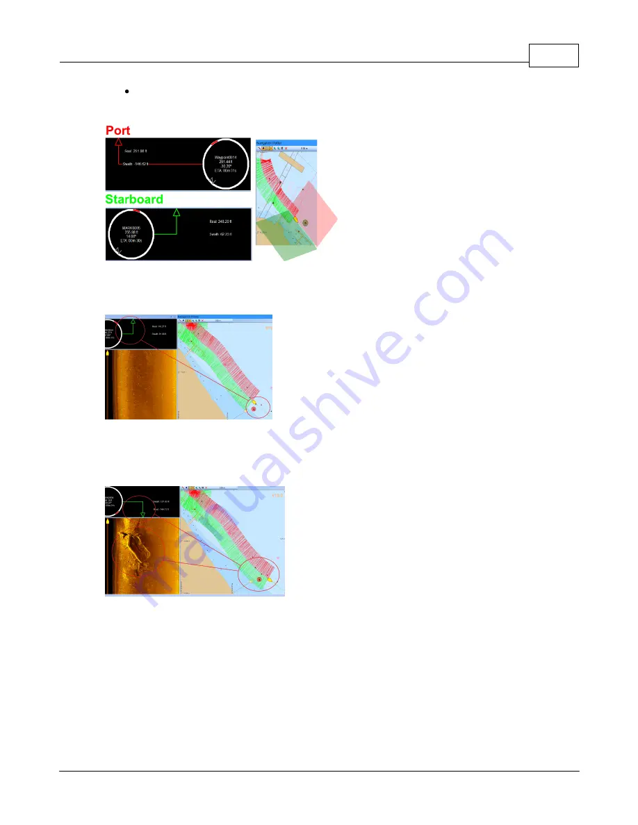
The Real distance shows the actual range between the SONAR and the location of the
waypoint in a straight line.
The Port and Starbord bearings in the Range and Bearing
Window from the Navigation Plotter
This arrow represents where in the swath the
target will show up on the waterfall.
The marker location on the Range and
Bearing Window
Here, the Marker is highlighted and showing in the waterfall
about one-third of the way to the edge of the right
(starboard) side swath.
The marker location behind the boat on the
Range and Bearing Window
Here, the boat's swath went over the target and the target
is now behind the boat. The arrow in the Range and
Bearing window corresponds to the waterfall data. The
boat icon on the waterfall is the location of the boat on the
water compared with the target. The target is slightly
behind the boat and in about the center of the swath.


