


22
Fishing Applications
The RT-9 has the most advanced ice sonar ever offered. We suspect that most, if not all RT-9 users will
come on board with at least a basic working knowledge of how to use a sonar on the ice. So far all of the
RT-9 Sonar, camera, and GPS functions have been covered. The next section will explain how to put it all
together for a successful ice outing.
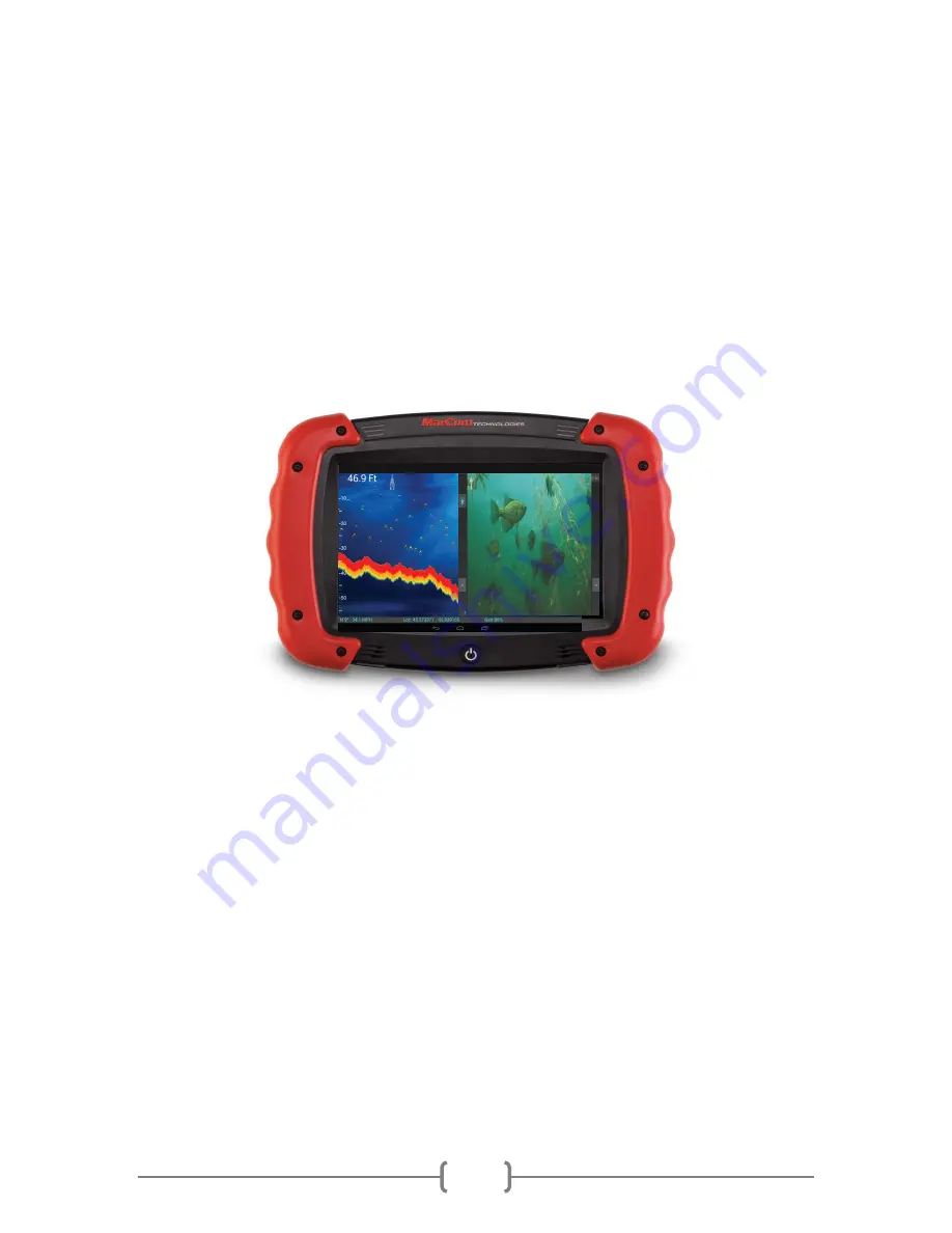
The RT-9 is most commonly used with 2 panels open. When you first open the RT-9 App, you will see a
screen that is mostly blank, but with a “1” and a “2” on the bottom. This indicates that two panels are
open. While it may seem easiest to use the RT-9 with only one panel open, one of the best features is
the ability to have up to 3 panels running at once. You could have GPS, Sonar, and video all going at the
same time! How about this—map on the left, video on the right, and sonar on top of both! There are
countless combinations.
If you are going to use the GPS to navigate to your chosen location, start by having two panels open and
select Navionics map for both. You will now have the map on the entire screen. We hope you have
installed a Navionics mapping chip for your area—with this you will be able to dial in a good location
even without any existing coordinates.
To get started, leave the two panels open. Pressing 1 will allow you to access the panel source for Panel
1. Your options may vary depending on which modules you have installed, but you will have “Navionics
Map” as your first option. Selecting this will get the map to appear on panel 1. To get sonar on panel 2,
press “2” and then select Marcum Sonar. [A sonar module must be installed] You will now need to
decide which of the five sonar displays you want. For this exercise, choose Graph. You will now have the
graph scrolling on Panel 2 against a black background. Now press “2” again, and then press “color”; this
will allow you to change the color of the background. Pick a color of your choosing; and you will now
have the graph scrolling against this color. You will find that you can generally get the sonar to display
on top of anything else—just make sure that you start with “NONE”, then add “SONAR”, and then add
what will be the background.
Some users like to have the graph scrolling across the entire screen, and this is easily accomplished by
now accessing Panel 1 again and selecting the same scrolling graph you have on Panel 2. Once this is
done, it is likely that RT-9 “auto-format” function will auto-fill both panels with the map as well.
There
are going to be other instances where an auto-format function may cause the screen to configure


