86
This is fine if you're always traveling due north. What you see to your
left corresponds to the left side of the map, to your right is shown on
the right side of the map, and so on. However, if you travel any other
direction, the map doesn't line up with your view of the world.
To correct this problem, a track-up mode rotates the map as you turn.
Thus, what you see on the left side of the screen should always be to
your left, and so on.
Another option is course-up mode, which keeps the map at the same
orientation as the initial bearing to the waypoint. When either the
track-up or course-up mode is on, an "N" shows on the map screen to
help you see which direction is north.
To change map orientation: from the Map Page, press
MENU
|
↓
to
M
AP
O
RIENTATION
|
ENT
. Use
↑
or
↓
to select the desired mode, then press
ENT
.
Press
EXIT
|
EXIT
to return to the page display.
NOTE:
In North Up and Course Up, the present position arrow appears in
the center of the map page. In Track Up, the position arrow ap-
pears centered in the lower third of the page.
NauticPath
™
USA Marine Charts
Your unit can display NauticPath electronic charts on MMCs. They
work just like a MapCreate custom map on a MMC.
Nautical Chart Notes
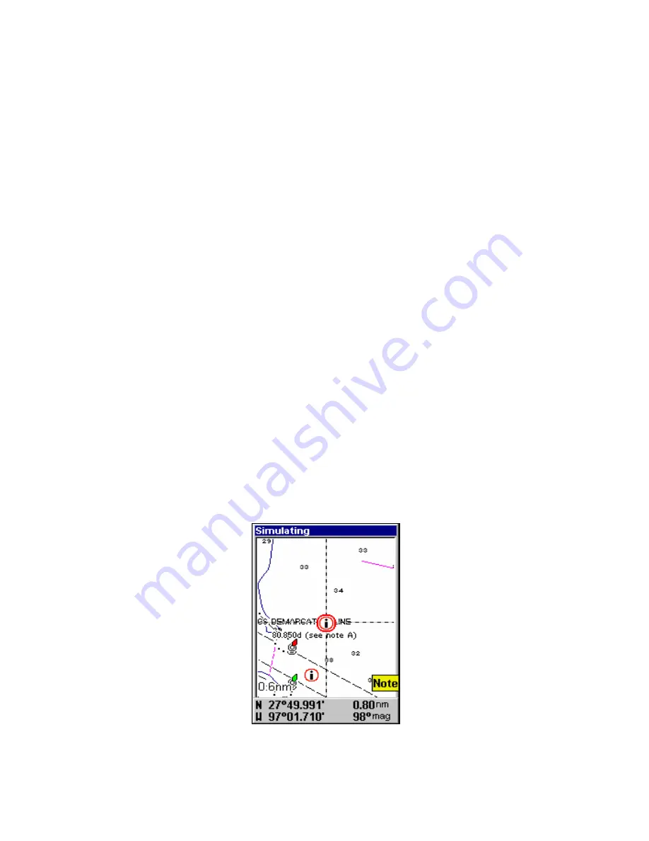
NauticPath charts contain notes or chart information, represented by cir-
cle-i Chart Note icons on the map display. An example is shown in the
following figure.
NauticPath chart showing Chart Note icon selected by cursor (left).
Summary of Contents for GlobalMap 5150C
Page 1: ...Pub 988 0152 221 www lowrance com GlobalMap 5150c Mapping GPS Receiver Operation Instructions...
Page 16: ...10 Notes...
Page 28: ...22 Notes...
Page 110: ...104 Notes...
Page 132: ...126 Notes...
Page 133: ...127 Notes...
Page 134: ...128 Notes...


