background image


13 

© 2021GeoSLAM                                                                                                                                 ZEB

GO User Guide v1.0.7 


DATA PROCESSING 

It is necessary to process the raw data collected by the ZEB-GO portable mapping system 

using GeoSLAM’s novel 3D SLAM 

algorithm  to  generate  a  3D  point  cloud  of  the  environment  that  has  been  mapped.    This  is  done  using  the  GeoSLAM  Hub 
processing software.  


5.1 

GEOSLAM HUB SOFTWARE  

Installation and processing of GeoSLAM Hub software is described in detail a separate User Guide. 

To convert proprietary .zip files into a variety of widely used pointcloud formats, Open Windows Explorer and navigate to the 

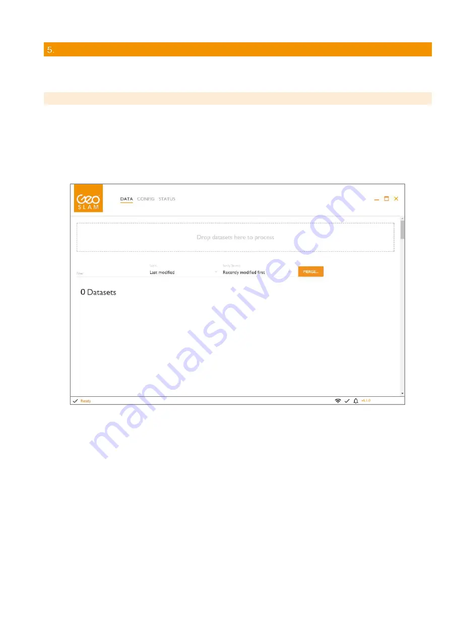
location of the .zip file to be processed. Drag and drop the .zip file in the “Drop datasets here…” field on the user interfa

ce (see 

Figure 5-1). The application will copy the dataset into a processing folder.  

A processing progress bar is displayed as the data set being processed. The data will take approximately as long to process as 
it did to capture (using default processing options). Data processing may take considerably longer if none default settings are 
selected.   


Figure 5-1 


To view the processed dataset, click the VIEW button next to the file name in the dataset list. A 3D view of the dataset opens in 
a new GS View window. 

Further  instructions  for  data  export  and  the  other  post  processing  options  in  GeoSLAM  Hub  are  described  in  the  separate 
GeoSLAM Hub User Guide. 

Once the data has processed, select the Export button to save the data in its preferred format, as described in the GeoSLAM 
Hub User Guide. 


Summary of Contents for ZEB-GO

Page 1: ...1 2021GeoSLAM ZEB GO User Guide v1 0 7 Copyright ZEB GO User Guide 2020 GeoSLAM Ltd All rights reserved ZEB GO User Guide...

Page 2: ...de may cause harmful interference to radio communications Operation of this equipment in a residential area is likely to cause harmful interference in which case the user will be required to correct t...

Page 3: ...g the raw scan data 9 3 4 File naming 9 3 5 Shutting down 9 Usage Guidelines 11 4 1 The environment 11 4 2 Loop closure 11 4 3 Transitioning between environments 11 4 4 Walking speed 11 4 5 Minimum an...

Page 4: ...aken with traditional terrestrial laser scanning methods 1 1 SPECIFICATION Maximum range Up to 30m in optimal conditions Typical max range 15 20m Points per scan line 1080 0 25o interval Field of view...

Page 5: ...ZEB GO captures raw laser range measurement and inertial data This data must be processed using GeoSLAM s SLAM algorithm to convert the raw data into a 3D point cloud The data is processed using the...

Page 6: ...ices Class A Unintentional Radiators This equipment has been tested and found to comply with the limits for a Class A digital device pursuant to part 15 of the FCC Rules These limits are designed to p...

Page 7: ...te to the bottom of the handle using the screw and hex key provided Connect the ZEB GO main cable to the socket on the side of ZEB GO scanner head Use red dots to align correctly Connect the other end...

Page 8: ...mode for 15 seconds the LED will switch to green Scanning mode Press the motor start stop button on the side of the scanner head to start the scanner rotation and commence the survey Step 4 When the...

Page 9: ...capacity or the format is not recognised the AUX LED will flash red The raw data will remain on the internal memory of the data logger The following memory stick file formats are supported exFAT FAT16...

Page 10: ...ing data is being logged Red flash green Warning low battery voltage Red flash x 1 Error scanner not detected Red flash x 2 Error IMU not detected Red flash x 3 Error neither scanner nor IMU detected...

Page 11: ...the compounding of any error introduced causing measure position to drift It is good survey practise to close the loop by re surveying a known position so that the compounded error can be spread arou...

Page 12: ...or short periods of time whilst the operator negotiates difficult access points e g tight squeezes in cave systems The scanning head can also be held in the hand and moved up and down to mimic the nor...

Page 13: ...e Drop datasets here field on the user interface see Figure 5 1 The application will copy the dataset into a processing folder A processing progress bar is displayed as the data set being processed Th...

Page 14: ...ing the battery store in a charged state Recharge after every 6 months Excess heat will degrade the battery rapidly Always store the battery in a cool dry place DO NOT leave for long periods in the su...

Page 15: ...lect the Drive with the USB memory stick see Figure 7 2 and check the tick box against the task you want to perform In order to Download Specific Files enter the date of the required files YYYY MM DD...

Page 16: ...16 2021GeoSLAM ZEB GO User Guide v1 0 7 7 2 APPENDIX 2 DIMENSIONAL DRAWINGS Dimensional drawings with optional mounting plate on rear face...

Page 17: ...17 2021GeoSLAM ZEB GO User Guide v1 0 7 Dimensional drawings with optional mounting plate on bottom face...

Reviews: