


Setting Up the Wi‑Fi Network............ 26
Connecting a Wireless Device to the
Wireless Remote Control...................... 27
Pairing the Wireless Remote Control
With the Chartplotter......................... 27
Turning On and Off the Remote
Backlight............................................ 27
Disconnecting the Remote Control
from All Chartplotters....................... 27
Wireless Wind Sensor........................... 27
Connecting a Wireless Sensor to the
Chartplotter........................................ 27
Adjusting the Wind Sensor
Orientation......................................... 27
Watch..................................................... 28
Viewing Boat Data on a Garmin Nautix™
Device.................................................... 28
Charts and 3D Chart Views............. 28
Navigation Chart and Fishing Chart..... 29
Chart Symbols................................... 29
Zooming In and Out Using the
Touchscreen...................................... 29
Measuring a Distance on the
Information on a Chart...................... 30
Viewing Details about Navaids.........30
Navigating to a Point on the Chart... 31
Premium Charts.................................... 32
Fish Eye 3D Chart View..................... 32
Viewing Tide Station Information.....33
Showing Satellite Imagery on the
Navigation Chart................................34
Viewing Aerial Photos of
Landmarks......................................... 34
Automatic Identification System......... 34
AIS Targeting Symbols..................... 35
Heading and Projected Course of
Activated AIS Targets....................... 36
Activating a Target for an AIS
Vessel.................................................36
Setting the Safe-Zone Collision
Alarm.................................................. 37
Viewing a List of AIS and MARPA
Threats............................................... 37
AIS Aids to Navigation...................... 38
AIS Distress Signals.......................... 39
Turning Off AIS Reception................ 39
Chart Menu............................................ 40
Chart Layers.......................................40
Chart Settings.................................... 44
Fish Eye 3D Settings......................... 44
Supported Maps.................................... 45
Mapping......................................... 45
Mapping a Body of Water Using the
Garmin Quickdraw Contours Feature.. 45
Adding a Label to a Garmin Quickdraw
Contours Map........................................ 46
Garmin Quickdraw Community............ 46
Connecting to the Garmin Quickdraw
Community with ActiveCaptain........ 46
Connecting to the Garmin Quickdraw
Community with Garmin Connect.... 47
Settings.................................................. 48
Navigation with a Chartplotter........ 48
Basic Navigation Questions................. 49
Route Color Coding............................... 49
Destinations.......................................... 50
Searching for a Destination by
Name.................................................. 50
Selecting a Destination Using the
Navigation Chart................................50
Searching for a Marine Services
Destination......................................... 50
Setting and Following a Direct Course
Using Go To....................................... 50
Stopping Navigation.......................... 51
Waypoints.............................................. 51
Marking Your Present Location as a
Waypoint............................................ 51
Creating a Waypoint at a Different
Location............................................. 51
Marking a Man Overboard (MOB)
ii
Table of Contents
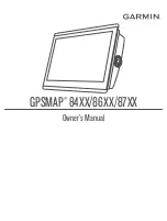
Summary of Contents for GPSMAP 86 Series
Page 1: ...GPSMAP 84XX 86XX 87XX Owner sManual...
Page 12: ......
Page 217: ......
Page 218: ...support garmin com GUID 25CCEC48 337E 47C0 8B89 5C35CCDB65AC v22 September 2022...