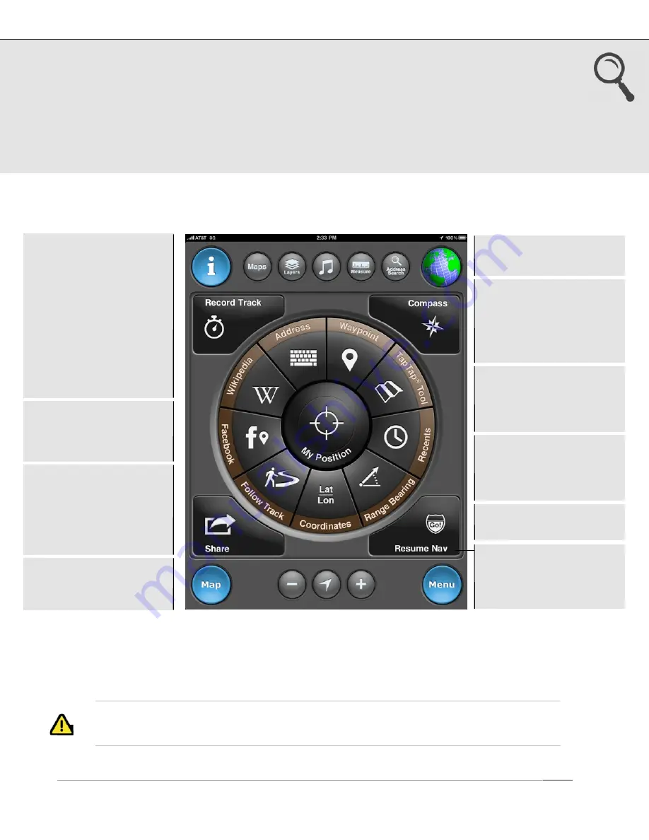
3. Go To
Define a destination waypoint using a variety of methods and navigate to it. After you
select a waypoint and start navigating, the Map screen appears showing the direction
and bearing to the waypoint. View your saved waypoints in a live map preview pane
prior to initiating navigation. There is also an option to follow a previously saved track.
The corner buttons provide quick access to commonly used functions.
1
If UTM, MGRS, or OSGB is selected as the coordinate system, the input format will
reflect the appropriate system.
US and Foreign Patents Granted and Pending.
Fullpower®, MotionX®, TapTap®, and ShakeShake® are registered trademarks of Fullpower Technologies, Inc.
All other trademarks remain the property of their respective owners. © Copyright 2003-2012 Fullpower Technologies, Inc. All rights reserved.
5
TapTap® tool:
Create a
new waypoint by tapping
twice on the map. A new
waypoint will be created
and saved
Coordinates:
Define the
waypoint coordinates
1
Address
input:
•
Country name
•
Location or landmark,
e.g. “Mount Everest”
•
Address, options:
-
full address
-
city name
-
state/province
-
zip/postal code
•
Lat / Lon, for example
“41.89 N, 87.61 W”
Range/Bearing:
Enter a
range (distance) and
bearing (degrees) from
your current position
Follow Track:
Follow
one of your saved tracks
(plotted on the map)
Waypoint:
Select from
your saved waypoints
Recently Found:
View
your waypoints sorted by
date to quickly find
recently saved points
Facebook:
View your
friends’ Facebook check-
ins, and/or post your
current location for your
friends to see
Wikipedia:
View POIs
around you or in a
specified location; read
the associated articles
Resume Nav:
Select a
recent waypoint for
navigation (
Stop Nav
while navigating)


