3.2
Advanced features of aerial survey planning
3.2.1
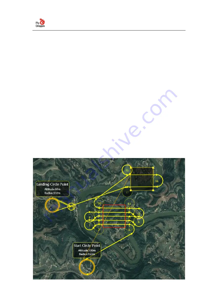
Multi-region task generation
The UAV GCS ground station supports flying multiple independent areas in the
same mission. The operations are as follows: After generating an aerial survey area
task according to the above operation, you can click the aerial survey tab on the
right again, drag the aerial survey shadow area and adjust the polygon shape
(same as above), Set the aerial survey parameters (same as above), click to
generate waypoints, the ground station will prompt "whether to clear the existing
waypoints", click "No", this mission will be superimposed on the existing mission,
and the drone will execute the previous one After the block, continue to execute
the task of this block.
Summary of Contents for FDG30
Page 6: ...Click on Connect Drone...


