Oculus M-Series Sonar
User Manual
17
3.4.
Viewing the Seabed
As discussed in previous sections, the sonar can be thought of like a hand-held torch with an illuminating beam
that is wide horizontally and narrow vertically
–
continuing this analogy, the sonar images shown on the operators
display can then be thought of as a “top
-
down” view of the area being illuminated.
For users wishing to perform search-and-location activities or seabed surveys, Oculus can be mounted such that
different amounts of the seabed can be illuminated and visible on the display:
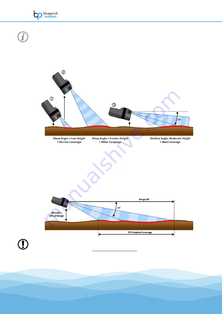
If the sonar is close to the seabed and angled downwards
then only a small strip in front of it will be shown. By
gaining altitude from the seabed the operator can illuminate a wider swathe that will make better use of the
display
.
For situations requiring the sonar to be searching the seabed in front of it, the best use of the display comes from
balancing the altitude above the seabed with the sonar down angle such that the largest amount of the seabed is
illuminated
.
As a very general rule, the sonar can achieve an optimum 70% seabed coverage on the display if has a 15°
down angle and an altitude of above 10% of the operating range
–
i.e. for a 20m range, the sonar should be
mounted approximately 2m above the seabed, while at an 80m range the altitude should be increased to
about 8m.


