


21
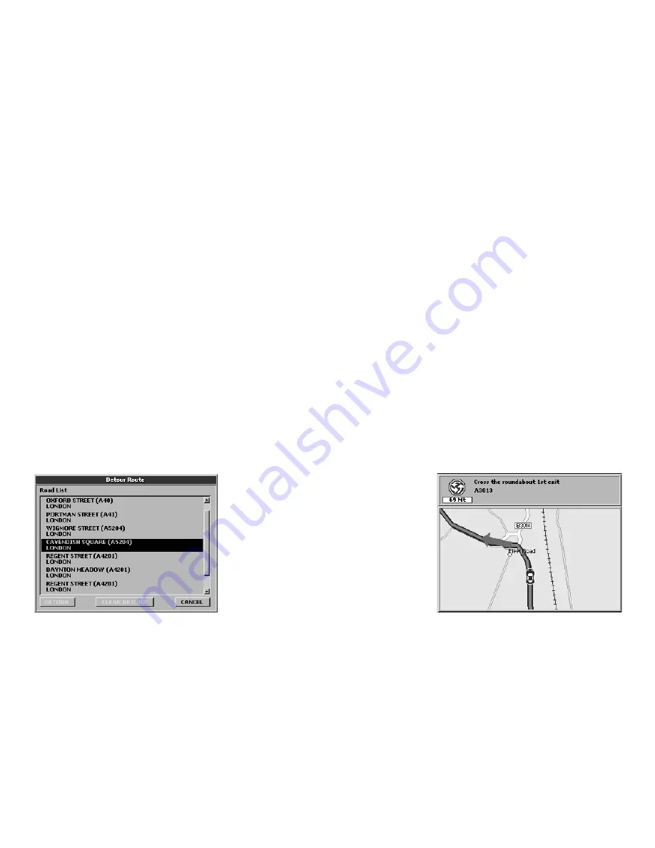
view the list of all the streets along the route
and it is possible to detour the trip to avoid
an undesired street.
1.
Press the
MENU
button to open the
Navigation
menu.
2.
Select
Detour route
to open the list of
the streets along the route and confirm by
pressing
ENT
3.
Select the list pressing
ENT.
4.
Select with the cursor the street to avoid
and press
ENT
to confirm.
5.
Press
ESC
to exit from the list. Select
Detour
and press
ENT
to confirm. The
route will be recalculated excluding the
streets to be avoided.
6.1 Exploring the Map
The position of the vehicle on the map is
represented by an Icon (e.g. a car).
Use the
+
and
–
buttons to zoom in or out
the map. Press the
ESC
button to enter the
cursor mode in order to explore the map.
Press the
ESC
button again to go back to your
current GPS position.
In the system set up it is possible to customize
the level of detail of the Map, that is to say
the quantity of information displayed.
1.
Press the
MENU
button three times to
open the
System Setup
menu.
2.
Move the
JOYSTICK
rightwards to select
the
Map
folder.
3.
Select the submenu
Map Detail
and press
ENT
to confirm.
4.
Select with the
JOYSTICK
simple, normal
or full.
In the same window, in the
Fix Symbol
submenu it is possible to customize the icon
representing the vehicle: standard or car, and
the display of the User Mark info: Off, icon,
icon/label.
For more details read par. 11.3.
6. Using the map
6.2 Alternative Views
Once a route is set, you can choose to display
the trip information in different pages by
pressing the PAGE button: map, maneuvers,
trip computer and video input (displayed
only if an external device is connected to the
audio-video input); while pressing the MODE
button you can choose different view modes
for each Page.
Starting from the Map with info box on the
right side by pressing the
MODE
button you
can obtain the following configurations:
• Map with Next maneuver (upper bar). The
instructions include direction, distance or


