Navsight Solution
– Hardware Manual
NAVSIGHTHM.1.5
5.15. Typical connection topology
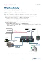
The following use cases are presented to quickly show how to connect the Navsight solution various
external equipment in different applications.
5.15.1. Navsight use in Land/Air survey applications
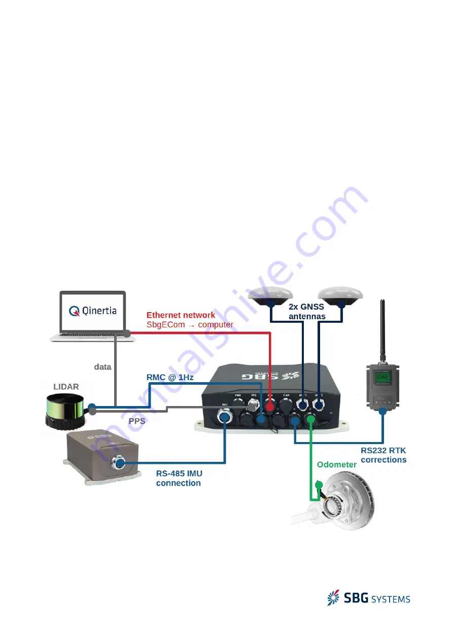
In this setup we use Navsight solution as navigation sensor for any land or air survey application
●
IMU can be installed remotely, where it’s convenient to the user (e.g. close to LIDAR sensor)
●
Two antennas are connected directly on the Navsight processing unit
●
Serial RTK corrections are sent to Navsight unit through PORT D
●
If applicable, the odometer (DMI) pulses are connected to Navsight PORT E
●
Timing information is sent to LIDAR using standard RMC message and PPS
●
Ethernet interface is used for
●
Real time data display on sbgCenter or any dedicated software
●
Get back the mission RAW data (IMU + GNSS) for post-processing purpose using Qinertia using
embedded FTP server
51/73
Figure 5.24: Navsight typical connections in an advanced automotive application

