TND
™
User Manual
31
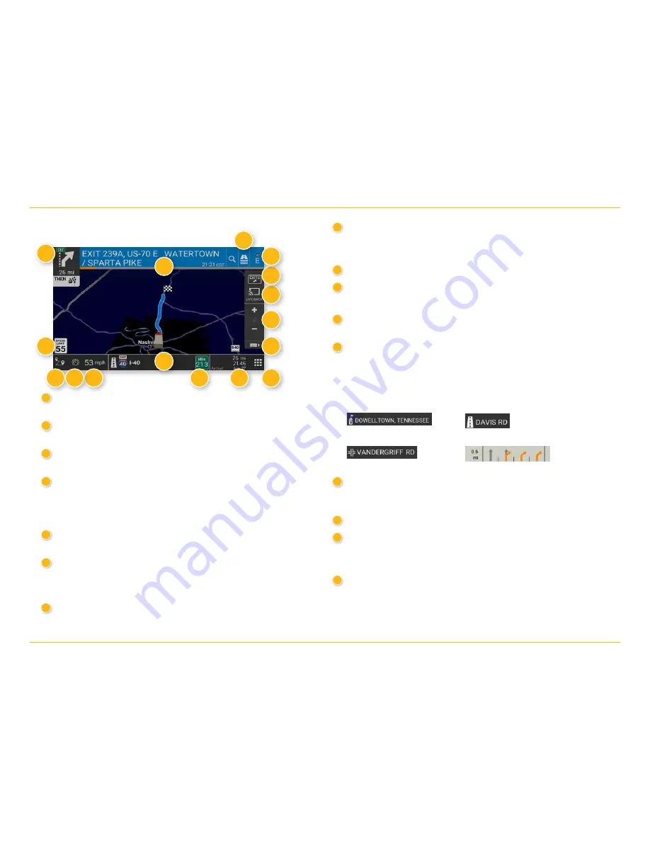
Route Map Window
8
Map View Tab
Tap to simplify the map screen. Icons are minimized to show simply the
zoom, next maneuver, and miles/time.
9
Home Screen
10
Miles/Time
Displays remaining distance. Tap to select from: yard arrival time,
arrival time, remaining time, yard time, and elevation.
11
Current Mile Marker
Tap to open a “Tell Rand” message.
12
Current Information
View current information by city, street, or upcoming intersection. Also
displays advanced lane guidance and weather overlay key, when enabled.
Tap to change. (
Note
: For some destinations, the “Am I close?” feature
counts down addresses as the vehicle approaches.)
13
Current Speed
Tap to display the Virtual Dashboard. Turns red for speed warnings.
14
Virtual Dashboard
15
Location and Route Options
Tap to see current location information, change route settings, detour,
cancel a route, and manage avoided roads.
16
Speed Limit
Orange for truck limit; white for general limit. Tap to open a “Tell Rand”
message about speed limits.
1
Next Maneuver
Tap to repeat spoken next maneuver instructions.
2
Road Name
Name of street you will turn onto next.
3
Directions Slide-Out List
Tap to select a route display option.
4
Compass Direction
Tap to change the map display. An icon in the upper right corner displays
the selected option: North up (N), heading up (arrow), or 3D (3). Also dis-
plays Wi-Fi status.
5
Exits Quick View
Slide out to show upcoming exit information.
6
Live Data
Tap to view Traffic, Weather, and Fuel Price Information.
Note:
This feature requires a Wi-Fi connection.
7
Zoom In/Zoom Out
4. Maps & Routing
City, county, and state
Current street name
Next intersecting street name
Advanced lane guidance
1
2
3
13
12
11
10
8
15
16
7
6
5
4
9
14
17


