14
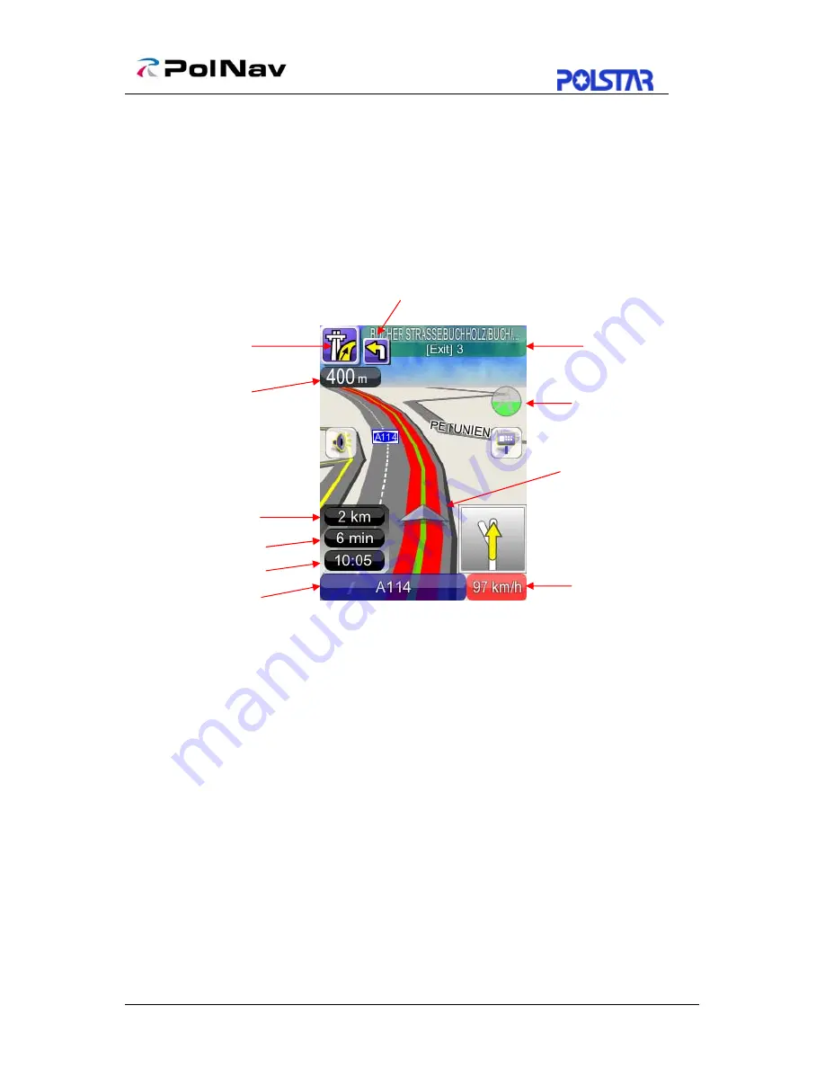
4.6 Navigation Screen
The Navigation Screen will appear whenever a route has been set. It is basically a Map
Screen with additional information about the route, such as distance until next turn,
travel time, and estimated time at arrival. The screen will be centred on your current
location (when you have a GPS fix, or else simulation will move at a constant velocity).
To exit the
Guidance Screen
, simply pan the map. To return to the
Guidance Screen
,
press the
Car Position.
1: Current Turn Manoeuvre (Press to repeat voice instructions)
2: Distance to Current Turn
3: Manoeuvre at Next Turn
4: Total Distance Remaining
5: Total Time Remaining
6: Estimated Time at Arrival
7: Switch between Current Street/Current Town (Press to alternate)
8: If the sign shows in Green color, you could switch between Current Speed / Current
time. If the sign shows in Red color, it means it’s over the setting speed limit and user
could click on the sign to switch to speed limit options. (Please refer
Section 9.2.2
)
9: Car position: with colour indicating GPS status
¾
Green (GPS signal good)
¾
Orange (GPS signal weak)
¾
Red (GPS signal lost)
¾
Gray (Simulation)
10: Switch between 2D North-up, 2D Heading-up, 3D Head-up views.
11. Instruction for Current Turn (Press to Access Turn List)
1
2
3
4
5
6
7
8
9
10
11
Содержание PolNav Navigation
Страница 1: ...PolNav Navigation Software User s Manual Version 2008 R4 0 For use with PC PDA Personal Navigators...
Страница 21: ...17 Note Full Post Code searching function in UK region is an optional...
Страница 36: ...32 8 4 Clear Data Main Menu My Data Clear Data You can clear the data you have saved here...


