


W W W . K A A R T A . C O M
7 6
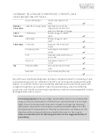
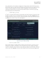
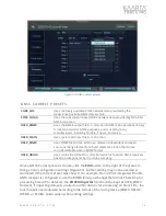
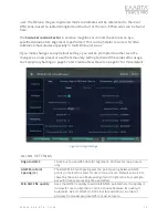
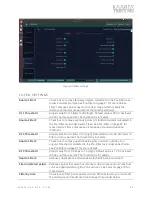
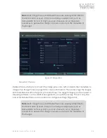
G NSS CORRE CT SE TTING S
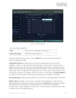
CORS Stations Search
Radius (meters)
Better results can be obtained in a CORS network by computing
corrected GNSS solutions using data from multiple base stations and
selecting the highest quality results. You can refine or expand results by
adjusting the CORS station search radius. The default radius is 50000m
or 50km.
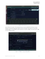
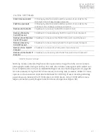
CORS Max # of
Stations
GNSS Correct compares your rover data against the base data from
multiple stations and selects the results that have the highest
percentage of high-precision points. If you have had previous success
with results, you can set a maximum number of stations to search, thus
limiting processing time and analysis.
CORS Preferred
Station
If you have a preferred station to use, enter the four-digit Station ID.
Max. Wait (hours)
Specify the maximum time to wait for CORS data to be retrieved, in
hours.
Include Inactive
Stations
Checkbox to include or exclude inactive stations when searching
stations
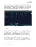
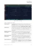
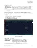
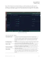
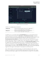
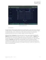
Align
The Align tool performs global smoothing by introducing loop closure techniques as well
as using GNSS inputs for absolute references in correcting drift errors common in mobile
mapping systems. It is useful if there are overlapping paths in the trajectory even if you
do not start and stop at the same location, but even more so if you do. Overlapping
trajectories are not necessary if GNSS data has been recorded by Stencil Pro for your
scan. Drift corrections can be done even if you did not start and stop at the same place.
There are three presets for Align:
GNSS and Loops, GNSS Only,
or
Loops Only
54).
Use GNSS and Loops
for aligning with both GPS data and loop closure techniques. If
you are only interested in global alignment of the data using GNSS data, you can select
GNSS only. Loops only will disregard GNSS data and align with loop closure techniques
only.
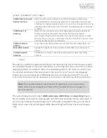
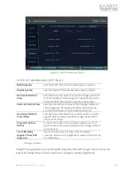
Note:
If using GNSS data for assistance with alignment, you must perform
GNSS Correct prior to Aligning on Stencil Pro. See GNSS Correct on page 72
for more details.