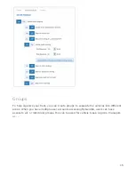
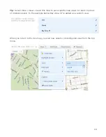


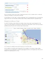


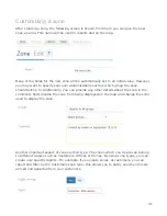


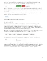

Note: Zone names will be used in place of addresses after you have created zones for customers
locations, workplaces or other places of interest.
If the location is a zone then it will be underlined in the corresponding color to denote the
type of the zone: See list above which shows Yellow and Blue lines for specified zones.
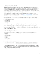
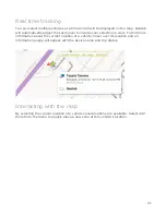
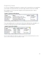
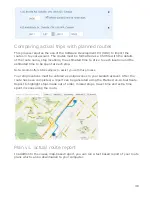
Mapping historic trips
The list of trips also shows when the vehicle arrived, how long it was stopped for, the
trip time and trip distance. Selecting an individual trip will add the trip to the map. Select
additional trips from the list to show many trips at once.
Tip: A shortcut for adding all the trips for the day is to select the date.
The numbers on the trips list correspond to the numbers on the map for that vehicle,
making it easy to relate them. Use the speed graph button on the right side of the row to
display the speed graph for a trip.
25


