background image

Finding a Waypoint

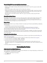
From the app drawer, select Waypoint Manager.
If necessary, select 

 to narrow the search.

If necessary, select an option:

• Select Spell Search to search using the name of the waypoint.
• Select Select Symbol to search using the symbol of the waypoint.
• Select Search Near to search near a recently found location, another waypoint, your current location, or a 

point on the map.

• Select Sort to view the list of waypoints based on nearest distance or alphabetical order.

Select a waypoint from the list.

Editing a Waypoint

From the app drawer, select Waypoint Manager.
Select a saved waypoint.
Select an item to edit, such as the name.
Enter the new information, and select 

.

Deleting a Waypoint

From the app drawer, select Waypoint Manager.
Select a waypoint.
Select 

 > Delete.

Increasing the Accuracy of a Waypoint Location

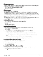
You can refine the accuracy of a waypoint location by averaging the location data. When averaging, the device 
takes several GPS readings at the same location and uses the average value to provide more accuracy.
From the app drawer, select Waypoint Averaging.
Select a waypoint.
Move to the waypoint location.
Select Start.
Follow the on-screen instructions.
When the confidence status bar reaches 100%, select Save.
For best results, collect four to eight samples for the waypoint, waiting at least 90 minutes between samples.

Projecting a Waypoint

You can save a new waypoint by projecting the distance and bearing from a saved waypoint to a new location.
For example, if you would like to navigate to a location you observe on the other side of a river or stream, you 
can project a waypoint from your current location to the observed location, then navigate to the new location 
after crossing the river or stream at a more suitable location.
From the app drawer, select Waypoint Manager.
Select a waypoint.
Select 

 > Project Waypoint.

Enter the bearing, and select 

.

Select a unit of measure.
Enter the distance, and select 

.

Select Save.

24

Waypoints

Содержание Rino 750t

Страница 1: ...Rino 750 750t 755t Owner s Manual...

Страница 2: ...sidiaries registered in the USA and other countries BaseCamp chirp Connect IQ Garmin Connect Garmin Express HomePort and tempe are trademarks of Garmin Ltd or its subsidiaries These trademarks may not...

Страница 3: ...artphone 13 Connect IQ Features 13 Downloading Connect IQ Features 13 Weather 13 Monitoring SAME Weather Alerts 13 Opening the Weather App 13 Viewing Weather Conditions and Forecasts 14 Viewing SAME W...

Страница 4: ...6 Viewing the Elevation Plot of a Route 26 Camera and Photos 26 Taking a Photo 26 Applications 27 Sending and Receiving Data Wirelessly 27 Setting a Proximity Alarm 27 Calculating the Size of an Area...

Страница 5: ...dsets and Microphones 38 Product Updates 38 Maximizing Battery Life 38 Device Care 39 Cleaning the Device 39 Cleaning the Touchscreen 39 Water Immersion 39 Data Management 39 File Types 39 Installing...

Страница 6: ......

Страница 7: ...box for product warnings and other important information Device Overview GMRS antenna GPS antenna Camera lens and flash not available on all models Mini USB port under weather cap 2 5 mm headset jack...

Страница 8: ...ICE Alkaline batteries lose a significant amount of their capacity as the temperature decreases Use lithium batteries when operating the device in below freezing conditions Installing the Lithium ion...

Страница 9: ...r a USB port on your computer 1 Pull up the weather cap from the mini USB port 2 Plug the small end of the USB cable into the mini USB port 3 Plug the USB end of the cable into an AC adapter or a comp...

Страница 10: ...eries for best results The AA battery pack contains two parts 1 If necessary turn the D ring counter clockwise and pull up to remove the battery pack from the device 2 Push down on the lever inside th...

Страница 11: ...ack in place 7 Turn the D ring clockwise to secure the battery pack onto the device Turning On the Device Hold Device Operation You can operate this device using a combination of hardware key and touc...

Страница 12: ...ize the shortcuts on the main menu Customizing the Main Menu page 31 Volume keys Select to adjust the volume App drawer Swipe up to open apps and Connect IQ apps Opening the App Drawer The app drawer...

Страница 13: ...other compatible radio devices In Australia this device uses UHF Citizen Band Radio Service UHF CBRS and in New Zealand this device uses UHF Personal Radio Service PRS for two way communication with o...

Страница 14: ...channel Rino devices are compatible with third party radios as long as the radios use standard frequencies A list of all frequencies used by this device is available in the product specifications Rad...

Страница 15: ...can use two types of squelch tone modes CTCSS and DCS If you cannot hear calls on the same channel with the same code make sure all the radios are using the same squelch tone mode 1 From the radio app...

Страница 16: ...w when location information can be sent again Polling Other Rino Users You can request position updates for other Rino users who are in your saved contacts Saving a New Contact page 10 1 From the cont...

Страница 17: ...ion To send the note without saving it select Send Note To save the note without sending it select Save To save the note and send it select Send and Save Emergency Alerts You can send an emergency ale...

Страница 18: ...d Microphones page 38 VOX Level Sets the sensitivity of a connected Voice Operated Transmission VOX accessory A lower VOX setting is recommended for quiet environments and a higher VOX setting is reco...

Страница 19: ...tive features to your device such as new outdoor and fitness activity types Downloading Connect IQ Features Before you can download features from the Connect IQ app you must pair your Rino device with...

Страница 20: ...To view SAME radio weather alerts on the map you must monitor for the alerts Monitoring SAME Weather Alerts page 13 You can view a county map with color coded SAME watches and warnings 1 From the wea...

Страница 21: ...ature allows you to download a specific geocache from geocaching com when you know the geocache code 4 Select to filter the search results optional 5 Select a geocache The geocache details appear If y...

Страница 22: ...container select Cache Size To filter by Unattempted Did Not Find or Found geocaches select Status To filter by the GPX file live data or pocket queries you have downloaded select Geocache Files To f...

Страница 23: ...next stage of the geocache Removing Live Geocache Data from the Device You can remove live geocache data to show only geocaches manually loaded on the device using a computer From the app drawer sele...

Страница 24: ...a New Activity If none of the preloaded activities fit the needs of your activity or trip you can create a custom activity with its own unique settings and data fields 1 From the app drawer select Set...

Страница 25: ...terval provides the most activity detail but fills up the device memory quicker If you selected Distance or Time for the Record Method enter a value and select Pausing an Activity 1 From the app drawe...

Страница 26: ...the device or stored photos with location information You can use the map or the compass to navigate to your destination Navigating to a Destination 1 If necessary select the activity to use while na...

Страница 27: ...te using the map or the compass Optional Maps You can use additional maps with the device such as BirdsEye satellite imagery BlueChart g2 and City Navigator detailed maps Detailed maps may contain add...

Страница 28: ...obstacles or hazards To enable the course pointer from the app drawer select Setup Heading Go To Line Pointer Course CDI Course line pointer Indicates the direction of the desired course line from yo...

Страница 29: ...Altimeter 2 Select Reset Clear Current Activity Clear Calibrating the Barometric Altimeter You can manually calibrate the barometric altimeter if you know the correct elevation or the correct barometr...

Страница 30: ...raging the location data When averaging the device takes several GPS readings at the same location and uses the average value to provide more accuracy 1 From the app drawer select Waypoint Averaging 2...

Страница 31: ...tional points on the map to add to the route optional 5 Select Editing the Name of a Route You can customize the name of a route to make it distinct 1 From the app drawer select Route Planner 2 Select...

Страница 32: ...on Plot Camera and Photos NOTICE Some jurisdictions may prohibit or regulate the taking of photographs or may require that all parties have knowledge of and provide consent to the taking of photograph...

Страница 33: ...proximity alarm the device sounds a tone TIP You can configure separate alarm tones for when you enter and leave an area Calculating the Size of an Area 1 From the app drawer select Area Calculation...

Страница 34: ...f to perform maintenance on waypoints and routes or to conserve battery life You can set the location manually to view your current location on the map 1 From the app drawer select Satellite Use With...

Страница 35: ...ing an Activity from Your History 1 From the app drawer select Activity History 2 Select an activity 3 Select Delete Using Garmin Connect 1 Connect the device to your computer using the USB cable 2 Go...

Страница 36: ...od measure of exercise intensity Training in certain heart rate zones can help you improve cardiovascular capacity and strength If you know your maximum heart rate you can use the table Heart Rate Zon...

Страница 37: ...ferent page of the main menu Customizing the Dashboard on the Main Menu page 31 3 Select an option To add an item to the main menu select Add Item Here and select an item To move an item on the main m...

Страница 38: ...specified data Dashboards are a custom grouping of data that can be helpful to a specific or general task such as geocaching Enabling the Map Data Fields You can show custom data fields on the map 1 F...

Страница 39: ...on about your route or your location Guidance Text Sets when the guidance text is shown on the map Advanced Map Settings From the app drawer select Setup Map Advanced Setup Detail Sets the amount of d...

Страница 40: ...to set the satellite system to GPS GPS GLONASS GPS and GLONASS page 34 or Demo Mode GPS off WAAS EGNOS Sets the satellite system to Wide Area Augmentation System European Geostationary Navigation Ove...

Страница 41: ...brate Compass Allows you to calibrate the compass if you experience irregular compass behavior for example after moving long distances or after extreme temperature changes Calibrating the Compass page...

Страница 42: ...s you to edit the number of geocaches found This number automatically increases when you log a find Logging the Attempt page 16 ANT Sensor Settings For more information about optional fitness accessor...

Страница 43: ...m type 3 Select On 4 Enter a distance and select Resetting Data and Settings You can reset trip data delete all waypoints clear the current track or restore default values 1 From the app drawer select...

Страница 44: ...accessories allow you to use the device hands free by transmitting automatically when a voice is detected You can adjust the sensitivity level of connected VOX devices Advanced Radio Setup page 12 Pr...

Страница 45: ...loth with water 3 If using a dampened cloth turn off the device and disconnect the device from power 4 Gently wipe the screen with the cloth Water Immersion NOTICE The device is water resistant to IEC...

Страница 46: ...t on the device 3 Plug the large end of the USB cable into a computer USB port Your device and memory card optional appear as removable drives in My Computer on Windows computers and as mounted volume...

Страница 47: ...eries up to 18 hours of typical usage Water rating IEC 60529 IPX72 Operating tempera ture range From 20 to 55 C from 4 to 131 F Charging temperature range From 0 to 40 C from 32 to 104 F Communication...

Страница 48: ...s sold in the United States and Canada use these frequencies NOTE If you plan to use this device in countries outside of the United States or Canada you should check with the government of that countr...

Страница 49: ...67 6625 GMRS Primary 5 13 467 6875 467 6875 GMRS Primary 6 14 467 7125 467 7125 GMRS Primary 7 15 462 5500 462 5500 GMRS Primary 8 16 462 5750 462 5750 GMRS Primary 9 17 462 6000 462 6000 GMRS Primary...

Страница 50: ...Australia and New Zealand use these frequencies NOTE If you plan to use this device in countries outside of Australia or New Zealand you should check with the government of that country for any restri...

Страница 51: ...50 General chat channel 18 476 8500 Caravanners and campers convoy channel 19 476 8750 General chat channel 20 476 9000 General chat channel 21 476 9250 General chat channel 22 476 9500 Telemetry and...

Страница 52: ...nel 45 476 5375 Repeater channel 46 476 5625 Repeater channel 47 476 5875 Repeater channel 48 476 6125 Repeater channel 49 476 6375 General chat channel 50 476 6625 General chat channel 51 476 6875 Ge...

Страница 53: ...ut 75 477 2875 Repeater input 76 477 3125 Repeater input 77 477 3375 Repeater input 78 477 3625 Repeater input 79 477 3875 General chat channel 80 477 4125 General chat channel Weather Radio Frequenci...

Страница 54: ...ies and squelch codes may differ in some radios from third party manufacturers For the best results you should compare CTCSS frequency information from your third party radio with the information in t...

Страница 55: ...77 0 5 79 7 6 82 5 7 85 4 8 88 5 9 91 5 10 94 8 11 97 4 12 100 0 13 103 5 14 107 2 15 110 9 16 114 8 17 118 8 18 123 0 19 127 3 20 131 8 21 136 5 22 141 3 23 146 2 24 151 4 25 156 7 26 162 2 27 167 9...

Страница 56: ...DCS Codes DCS uses a digital signature and is not frequency based DCS squelch codes may differ in some radios from third party manufacturers For the best results you should compare the DCS code infor...

Страница 57: ...al Communications Commission FCC in the United States Operation on the GMRS frequencies is subject to rules as specified in 47 C F R Part 95 In order to transmit on GMRS frequencies you are required t...

Страница 58: ...he device Select Setup Bluetooth The Bluetooth option must be enabled Enable Bluetooth wireless technology on your phone and bring your phone within 10 m 33 ft of the device Go to www garmin com bluet...

Страница 59: ...Avg Lap The average lap time for the current activity Barometer The calibrated current pressure Battery Level The remaining battery power Bearing The direction from your current location to a destina...

Страница 60: ...e based on your user profile and maximum heart rate 220 minus your age Lap Ascent The vertical distance of ascent for the current lap Lap Cadence The average cadence for the current lap Lap Descent Th...

Страница 61: ...ute You must be navigating for this data to appear Total Lap The stopwatch time for all the completed laps Trip Odometer A running tally of the distance traveled since the last reset Trip Time A runni...

Страница 62: ...ion possible Basic cardiovascular training good recovery pace 3 70 80 Moderate pace more difficult to hold conversation Improved aerobic capacity optimal cardiovascular training 4 80 90 Fast pace and...

Страница 63: ......

Страница 64: ...support garmin com GUID 35474A49 ADDB 451D A6DA AA003B2A4ACC v7 April 2023...

Отзывы: