


1. OPERATIONAL OVERVIEW
1-86
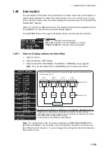
1.46
How to Display and Set Up Navigational Data
Wind, depth, ocean current, water temperature, date and time and waypoint data can
be displayed on this radar, however appropriate sensors are required.
1.46.1
How to set up the navigational data
1. Open the menu.
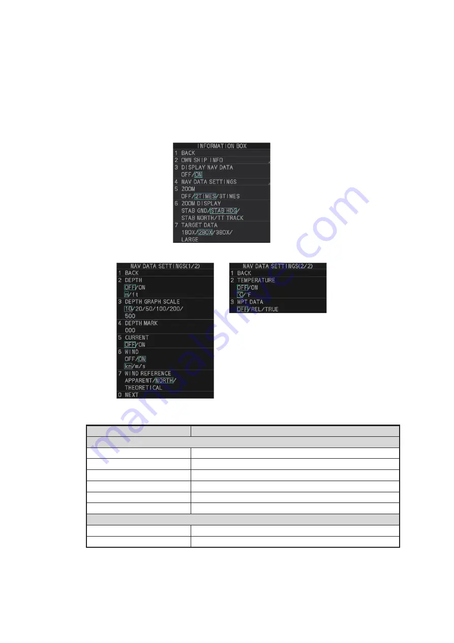
2. Select [7 INFORMATION BOX].
3. Select [4 NAV DATA SETTINGS].
4. Referring to the table below, select the appropriate menu item, then press the
EN-
TER MARK
key.
5. Referring to the table above, select the appropriate setting, then press the
ENTER
MARK
key.
6. Close the menu.
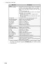
Menu item
Available settings
Page 1
[2 DEPTH]
[OFF], [ON]; [m], [ft]
[3 DEPTH GRAPH SCALE] [10], [20], [50], [100], [200], [500] (m)
[4 DEPTH MARK]
[000] to [500] (m)
[5 CURRENT]
[OFF], [ON]
[6 WIND]
[OFF], [ON]; [kn], [m/s]
[7 WIND REFERENCE]
[APPARENT], [NORTH], [THEORETICAL]
Page 2
[2 TEMPERATURE]
[OFF], [ON]; [°C], [°F]
[3 WPT DATA]
[OFF], [REL], [TRUE]
Содержание FAR-2218
Страница 132: ...1 OPERATIONAL OVERVIEW 1 110 This page is intentionally left blank ...
Страница 176: ...3 TARGET TRACKING TT 3 36 This page is intentionally left blank ...
Страница 202: ...4 AIS OPERATION 4 26 This page is intentionally left blank ...
Страница 232: ...5 VIDEO PLOTTER OPERATION 5 30 This page is intentionally left blank ...
Страница 294: ......