5
HOW TO BEST USE YOUR FISHHUNTER
STEP 1: Create a BATHYMETRIC MAP of the area
Using BATHYMETRIC MAPPING troll around your favorite fi shing spot to
create a contour map so you can fi nd the changes in bottom depth
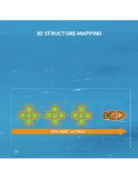
STEP 2: Check the bottom structure using 3D STRUCTURE MAP
Once you’ve identifi ed where the depth changes are using your
bathymetric maps, then navigate back to those spots using your
FishHunter app and create a 3D STRUCTURE MAP to see the bottom
structure across those specifi c areas.
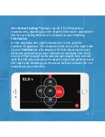
STEP 3 : Check the area for fi sh using DIRECTIONAL CASTING
You know you are in the right spot, but are the fi sh here NOW? Cast or toss
your FishHunter sonar into the water and turn on Directional
Casting and use the 5 Transducer view to see if fi sh are present OR
power up 3D Fishing to see our unique underwater view of
3 transducers simultaneously.
STEP 4 : Log your Catch
Record your catches in your catch log book so you can fi nd the exact bait
and location information again in the future.
or 3D FISHING
Содержание DIRECTIONAL 3D
Страница 7: ...7 95 OF THE FISH ARE IN 5 OF THE WATER KNOW WHERE TO CAST...
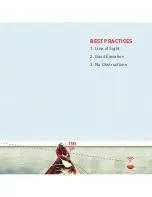
Страница 11: ...11 11 1 Line of Sight 2 Good Elevation 3 No Obstructions BEST PRACTICES...
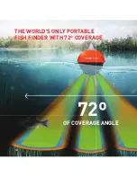
Страница 12: ...12 12 THE WORLD S ONLY PORTABLE FISH FINDER WITH 72 COVERAGE OF COVERAGE ANGLE 72 12...
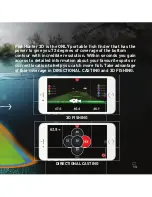
Страница 16: ...16 16 DIRECTIONAL CASTING 16...
Страница 20: ...20 3D STRUCTURE MAPPING 20...
Страница 24: ...24 3D FISHING DEPTH TO BOTTOM DEPTH TO FISH 47 6 ft 44 ft 24...
Страница 26: ...26 Bottom depth shown by different colors COMBINED VIEW 3D 3D FISHING Fish with depth Actual depth...
Страница 28: ...28 28 28...
Страница 34: ...34 34 ICE FISHING FLASHER DEPTH TO BOTTOM 11 meters...

