68
>>>
NAVIGATION MODE
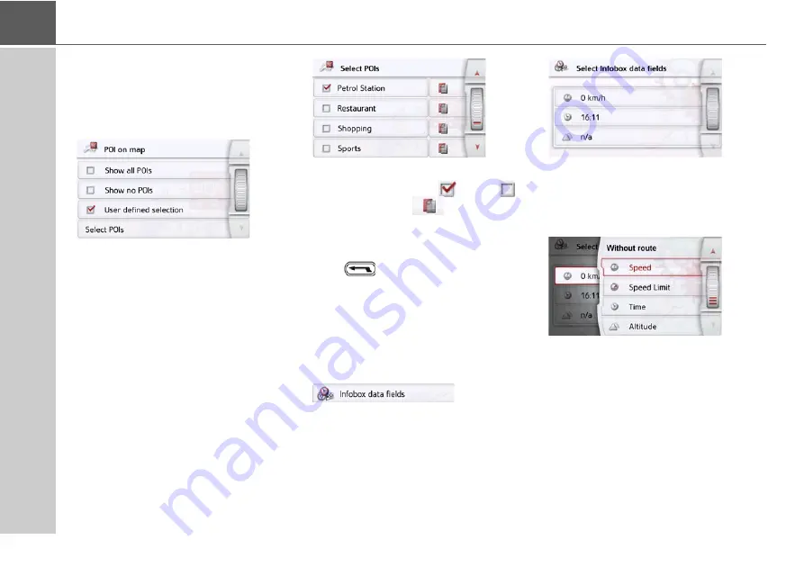
Select POI categories
You can select which POI symbols are to
be displayed on the map.
>
Press the
Select POI categories
button
in the extended settings.
Selecting
Show all POIs
displays all
points of interest on the map.
Selecting
Show no POIs
displays no
points of interest on the map.
Selecting
User defined selection
and
then pressing the
Select POIs
button
allows you to determine for yourself in
the menu which then appears whether
each individual points of interest
category is displayed or not.
>
You can then switch the display of
entire categories on (
) or off (
).
After pressing the
button beside a
category you can switch subcategories in
further menus on or off.
>
Confirm all your settings by pressing
the
button.
Selecting Info box data fields
In this menu you can define the data to be
displayed in the Info box in the top left
corner of the map view.
>
Press the Info box data fields button.
The Info box data field selection window
appears.
Touch the first field to select one of the
possible options.
An options list appears on the right side
over the window.
For the selected route (category With
Route) you can choose from the display
options Remove, remaining time, arrival
time, speed, speed limit, time, altitude
and traffic delays on the entire route
(selected models).
Содержание active.5s EU
Страница 1: ...OPERATING GUIDE ...
Страница 156: ...156 NOTICE ...
Страница 157: ...3LGRCBÍ TGE RGMLÍ K J ͱ ͱEͱ LJ Á Á KL E JG Germany UUU KW CAICP AMK FMI 12229 ...


