ENGLISH
ENGLISH-34
Use the stylus to browse the map. The selected position will be
identified by a cursor.
Clicking on an icon on the map will open an overlay window with
information about the selected item.
To zoom in or out, press the + or - icons. As soon as you press
one of the icons, the zoom slider is displayed to enable smooth
zooming.
Use the compass icon (in the bottom left hand corner) to adjust the
orientation.
If you want to return to the tracking mode, press the back icon.
•
•
•
•
ENGLISH
ENGLISH-35
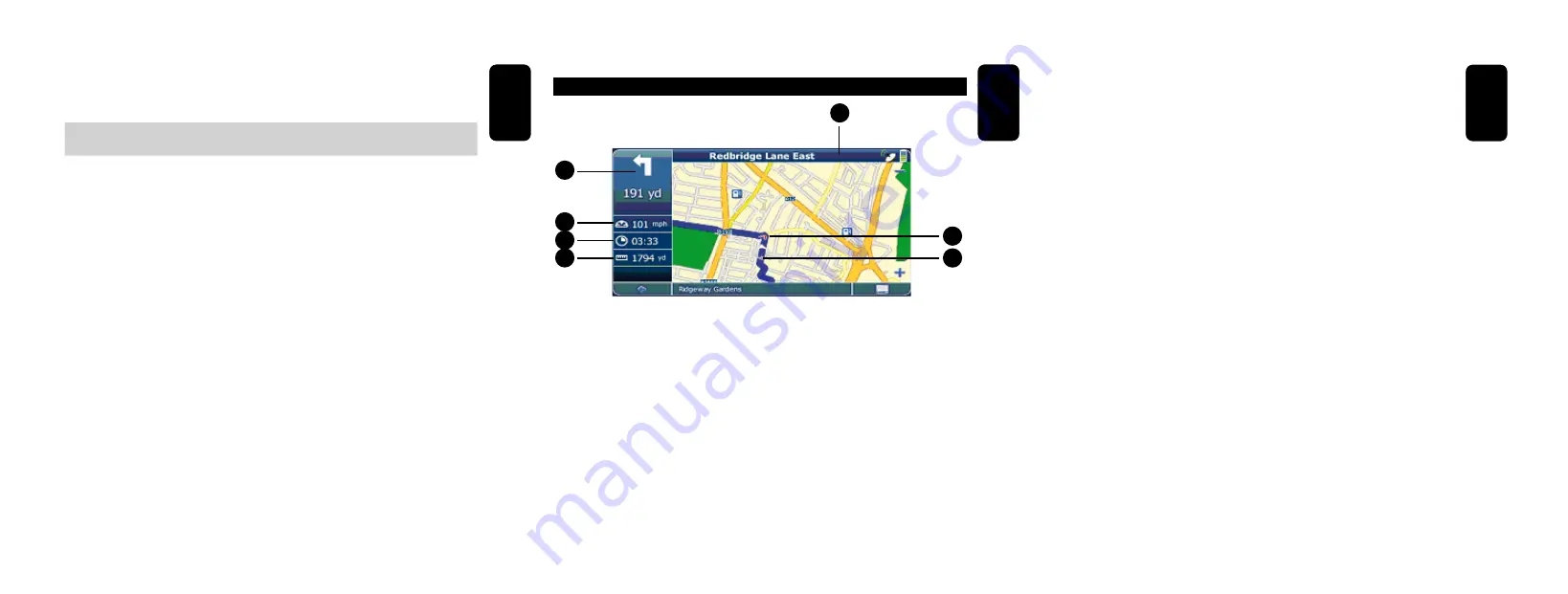
NAVIGATION SCREEN
1.- Distance to destination
2.- Estimated arrival time
3.- Speed
4.- Next manoeuvre
5.- Next exit, junction, turn
6.- Direction
7.- Position
1
2
3
4
5
6
7
ENGLISH
ENGLISH-36
The navigation screen displays your route (in blue) and your
surroundings. The GPS position symbol identifies your current position.
The red arrow indicates the direction of your next turn. The upcoming
manoeuvre is always displayed in the upper left corner – together with
the distance to it. When you approach a turn, there will be a voice
command at the appropriate time.
On the left side, additional information is displayed, such as
current/estimated arrival time, and the distance to your destination.
For one-way streets, the direction of travel is indicated by a red arrow.
For more information about navigation, see page 50.


