
24
Horizon GPS Chart400 User Manual
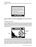
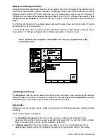
Zoom In
Zoom In
Zoom Out
Zoom Out
3 6 4 8 . 1 7 3 S
3 6 4 8 . 1 7 3 S
1 7 4 4 2 . 9 9 6 E
1 7 4 4 2 . 9 9 6 E
!
!
Waypts
Routes
B R G
D I S T
Scale :
085
0.21M
Dist
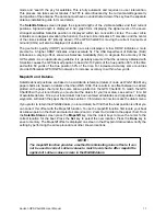
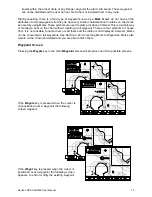
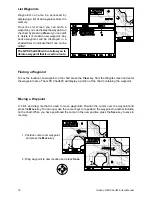
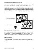
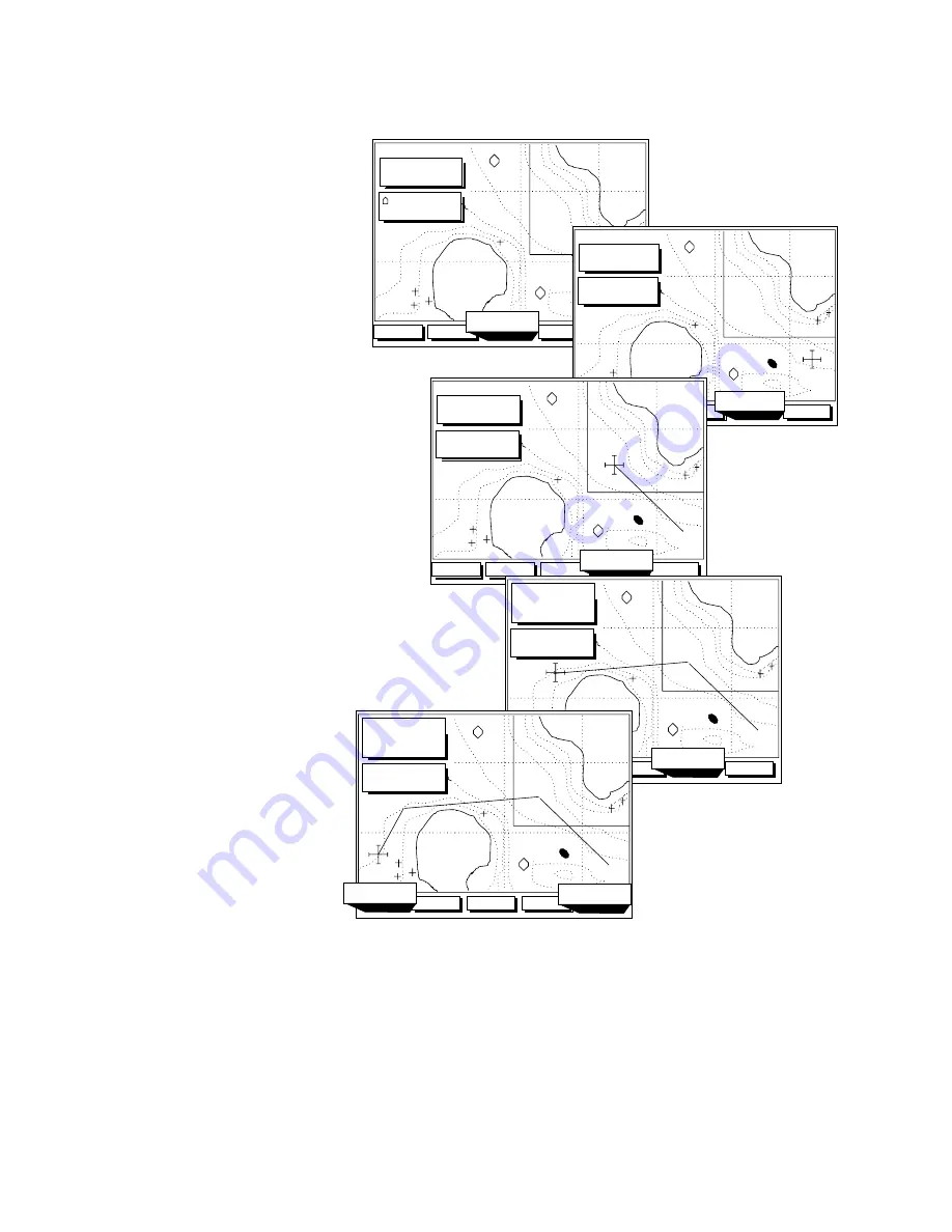
You also have the option
of saving the displayed
course as a route. Press
the
key for this
option.
Save
Alternatively, you can
press the
key to exit
the Distance function
End
3 6 4 8 . 1 7 3 S
3 6 4 8 . 1 7 3 S
1 7 4 4 2 . 9 9 6 E
1 7 4 4 2 . 9 9 6 E
!
!
B R G
D I S T
+ WPT002
+ WPT002
BOAT TO CURSOR
BOAT TO CURSOR
End
+
Clear
Start
3 6 4 8 . 1 7 3 S
3 6 4 8 . 1 7 3 S
1 7 4 4 2 . 9 9 6 E
1 7 4 4 2 . 9 9 6 E
!
!
B R G
D I S T
+ WPT002
+ WPT002
End
Save
Clear
+
1.6M
+
314
Next
3 6 4 8 . 1 7 3 S
3 6 4 8 . 1 7 3 S
1 7 4 4 2 . 9 9 6 E
1 7 4 4 2 . 9 9 6 E
!
!
B R G
D I S T
+ WPT002
+ WPT002
End
+
3.5M
+
288
LEG DIST
LEG DIST 1.9M
Next
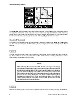
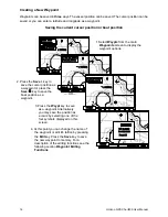
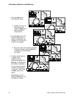
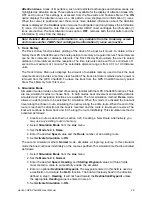
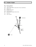
4. Move the cursor to the position required
for the second leg. Press the
key
to add this leg to the distance
calculation.
Next
5. Continue to add legs as
required. At the
completion of the
measurement press the
key to add this leg to
the distance calculation.
Next
3. Press the
key at the
end of the first leg. The
distance and bearing are
displayed in the upper left
section of the display.
Next
2. Position the cursor at
the start position.
Press the
key to
start the distance
measurement.
Start
1. Press the
key to
enter distance mode.
Dist
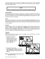
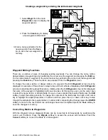
3 6 4 8 . 1 7 3 S
3 6 4 8 . 1 7 3 S
1 7 4 4 2 . 9 9 6 E
1 7 4 4 2 . 9 9 6 E
!
!
B R G
D I S T
+ WPT002
+ WPT002
Next
Clear
+
+
LEG DIST
LEG DIST
270
4.2M
0.7M
End
Save
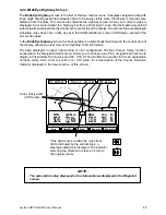
Calculating Distances and Bearings


