


3 - Logging Options
3.2.6
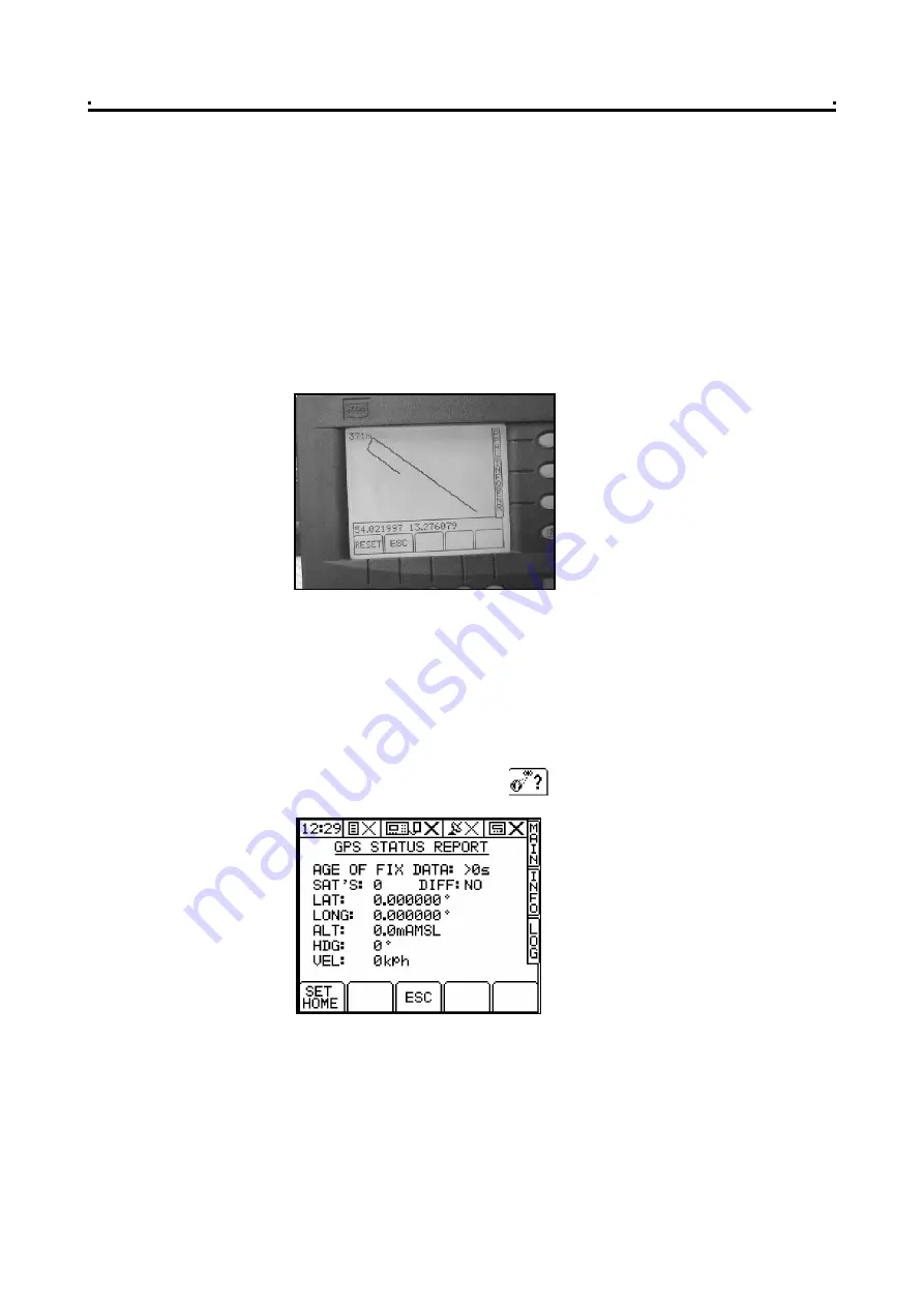
Display vehicle track - "MAP"
From the LOG screen (fig. 20), press the "MAP" key.
The screen displays the real time position of the vehicle (the "+" cursor), and the
vehicle track for the last 100 logged data points.
The screen also displays the latitude and longitude in decimal degrees, and the
number of points. As the vehicle proceeds from the start of the job, the screen plots
and automatically zooms out to display up to a maximum of 100 logged data points.
Beyond this, as the job progresses, the display pans in the direction of movement to
keep the previous 100 data points on screen.
Press the 'RESET' key to start the plot again from the current position.
If you selected the "LOG TREATMENT" option from the LOG screen page, the track
data is saved to a dynamic logging file on the data module, which can then be
viewed in PLOT/PLAN.
3.2.7
Display GPS Status
From either the LOG page, "RUNNING TREATMENT PLAN" page or "RECORDING A
DYNAMIC JOB" page, press the key to view the current GPS status.
This page displays;
Age of Fix Data (when reception is good, the time should not be more than 1
second); Number of Satellites (minimum of 4 for full differential fix); Differential
Status; Latitude and Longitude (in decimal degrees); Altitude; Heading and
Velocity.
All this data is read directly from the NMEA GGA and VTG messages. You can also
set the "Home Position" from this screen (for a full explanation of "Home Position",
please refer to the calibration manual).
Figure 22
Displaying the vehicle track
Figure 23
GPS Status
26


