


1-268
Mitsubishi Multi Communication System
1
Vehicle Position
E08120600013
The name of the current location, latitude and longitude, and
the number of GPS satellites being received can be viewed.
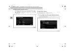
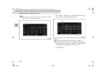
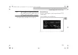
Press the [INFO] key, and touch [Vehicle Position].
NOTE
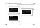
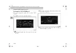
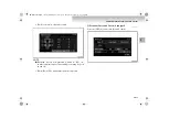
●
Touch [North-Up] to switch to displaying north at the top
of the map.
●
Touch [Heading-Up] to switch to displaying the vehicle
direction at the top of the map.
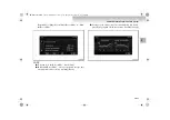
●
Touch the[
], [
], [
] and [
] to view the sky
maps by rotating or changing the angle.
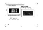
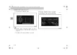
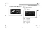
The Vehicle screen is displayed.
1- GPS satellite position diagram
Shows the direction of vehicle travel and the position of the
GPS satellite receivers.
2- Longitude and latitude of current location
3- Number of receiving GPS satellites
4- GPS position measuring status
Shown when valid signals can be received
from only 4 or more GPS satellites. (The posi-
tion is calculated in 3D: Latitude, longitude,
and altitude.)
Shown when valid signals are received from
only 3 or fewer GPS satellites. (The position is
calculated in 2D: Latitude and longitude.)
No icon:
Valid signals cannot be received from any GPS
satellite and position cannot be calculated.
5- Name of current location
BK-MMCSE12007EN_Combi01_ENG_NLD.book Page 268 Thursday, November 16, 2006 4:13 PM


