Type
Value
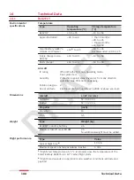
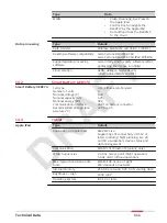
Maximum speed, obstacle avoidance active
3 m/s
Maximum wind resistance
12 m/s
Maximum flight altitude above sea level
1800 m (5900 ft)
Flight time
13 min
5)
Hovering accuracy: P-mode, with GPS
Vertical: ±0.5 m,
Horizontal: ±1.5 m
Maximum pitch angle
25°
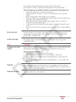
According to the safety standard IEC 61010-1, it is neces-
sary to wear hearing protection at levels higher than 80 dB.
Therefore, a minimum distance of 6 m from the BLK2FLY must be maintained
during take-off and landing. There, the value is lower than 80 dB. For each
country, the pilot is responsible for clarifying the valid limit values beforehand.
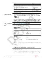
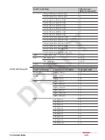
Multi-band GNSS high precision receiver.
Supported signals
System
Signal
GPS
L1C/A, L2C
Galileo
E1B/C, E5b
BeiDou
B1I, B2I
QZSS
L1C/A, L1S, L2C
SBAS
L1C/A
RTK network
RTK data protocols
RTCM v3.3
Network RTK protocols
VRS, FKP, iMAX, MAC (RTCM SC 104)
Instrument channels
Depending on the satellite systems and signals configured, a maximum number
of 184 channels is allocated.
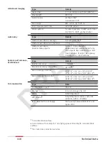
Accuracy
Centimeter level accuracy
6)
In this release the pointcloud cannot yet be geo-referenced.
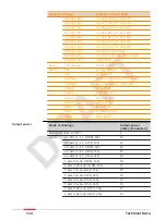
Sound power level
Power management
GNSS
5)
400 m above sea level
6)
Accuracy is dependent upon various factors including the number of satel-
lites tracked, constellation geometry, observation time, ephemeris accuracy,
ionospheric disturbance, multipath and resolved ambiguities.
Technical Data
109


