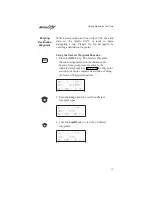

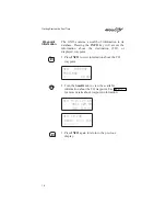
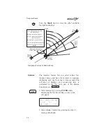
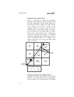

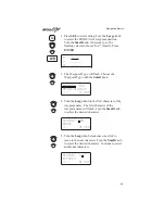

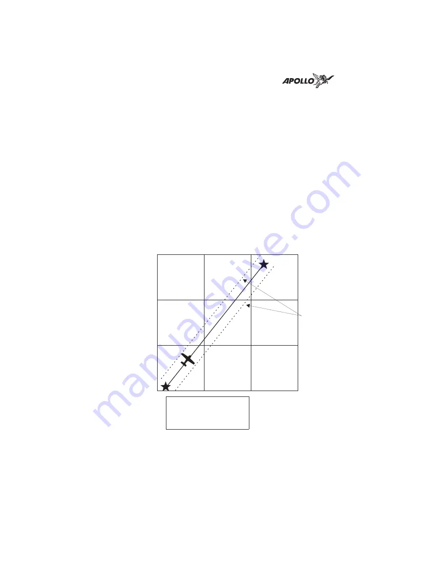
Minimum Safe Altitude (MSA)
MSA is calculated by taking the Maximum
Elevation Figure (MEF) from the sectional chart
grid that corresponds to your current position. In
areas below 3,000 feet, 1,000 feet is added. In areas
above 3,000 feet, 2,000 feet is added. In the
example below, the current aircraft would be
considered to be at 7,000 feet. If you are within 5
nm of another grid with a higher MEF, the higher
MEF will be used. The MEF on the sectional chart
is derived by taking the altitude of the highest
obstruction within the grid, rounded up to the next
100 feet, and adding 300 feet. For example, if the
highest obstruction is 4,728 feet, the MEF would
show as 5,100 feet.
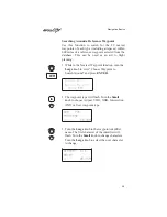
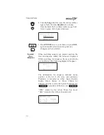
eta aSLE
01:23
MinSafeA
7200’
EnrtSafeA 16800’
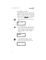
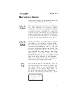
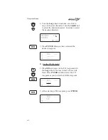
Minimum En Route Safe Altitude (MESA)
Minimum En Route Safe Altitude is the highest
MSA for every point between the aircraft present
position and the “TO” waypoint with a 5 nm buffer
6
5
2
8
14
8
5
2
6
3
14
1
4
5
2
4
6
3
FROM
Waypoint
TO
Waypoint
5 nm
Buffer
Navigation Basics
26