


1-21
KMD 250 Pilot's Guide
Section 1
Basic Operation
Rev 2 Apr/2004
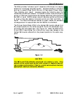
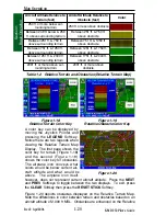
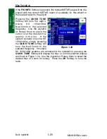
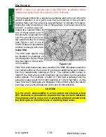
Terrain display to provide situational awareness by displaying a 1/2 nm
ring around the obstacle. For example, the obstacles displayed with a
red ring, as shown in Figure 1-20, are easily identifiable and are within
250 ft. of the present aircraft altitude.
NOTE: The color scale for obstacles is more severe than terrain so that
they stand out on the map.
CAUTION
NEVER USE THE TOPOGRAPHIC ELEVATION DISPLAYED ON
THIS EQUIPMENT AS YOUR SOLE REFERENCE FOR TERRAIN
AVOIDANCE.
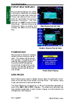
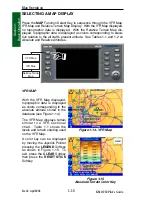
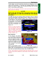
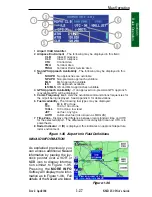
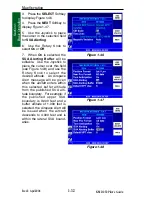
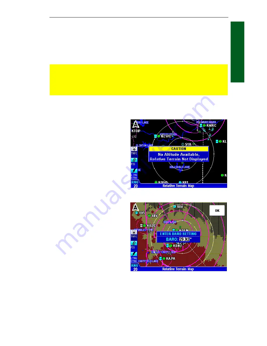
The KMD 250 must be receiving altitude information from an altitude
source for the Relative Terrain Map to function. Altitude sources may be
GPS altitude, pressure altitude (ARINC 429 or Gillham) or baro-cor-
rected altitude. The altitude
source options are determined
at installation. If no altitude
information is received a cau-
tion will be displayed as in
Figure 1-21.
NOTE: If a baro-corrected or
pressure altitude source is
used, the Relative Terrain Map
may not display colors accu-
rately in operations above
18,000 feet when the altimeter
setting is 29.92 in. Hg.
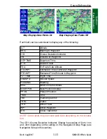
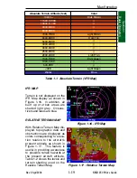
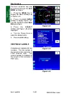
Baro Correction
If the altitude information
source is Gillham pressure alti-
tude, then a baro correction
must be entered manually. If
the baro correction is not kept
current the Relative Terrain
Map will not display the proper
color coding for the aircraft’s
actual altitude.
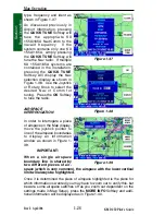
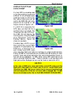
When on the Relative Terrain
Map the KMD 250 will prompt for an entry every 30 minutes as shown in
Figure 1-22. Turn the Rotary Knob to enter the desired barometric set-
ting. After the desired setting is entered, press the
OK
Softkey.
NOTE: The manual baro correction entry must be kept current on both
the KMD 250 and the altimeter for the Relative Terrain Map to function
properly.
Figure 1-21
Figure 1-22
Map Operation
Summary of Contents for KMD 250
Page 1: ...B KMD 250 Multi Function Display GPS Pilot s Guide N ...
Page 9: ...R 6 Intentionally left blank ...
Page 19: ...Table of Contents x KMD 250 Pilot s Guide Rev 4 Aug 2007 Intentionally left blank ...
Page 111: ...1 92 Rev 2 Apr 2004 KMD 250 Pilot s Guide Section 1 Basic Operation Map Display Icons ...
Page 112: ...1 93 Rev 2 Apr 2004 KMD 250 Pilot s Guide Section 1 Basic Operation Map Display Icons ...
Page 113: ...1 94 Rev 2 Apr 2004 KMD 250 Pilot s Guide Section 1 Basic Operation Map Display Icons ...
Page 273: ...I 14 Rev 4 Aug 2007 KMD 250 Pilot s Guide Index Index Intentionally left blank ...


