Viewing a Vertical Route Profile
If you are using maps that contain topographical data (such as U.S. TOPO 24K), you can view a vertical profile
of your routes. This vertical profile shows changes in elevation along your route.
NOTE
: This feature is not
available with all map products.
To view a vertical route profile:
1. Click
the
Saved Routes
Tab.
2. Right-click the route you want to edit and select
Route Properties
. The Route Properties window
appears.
3. Click
Show Profile
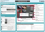
. The Vertical Profile window appears.
The graph shows the distance and elevation information from the starting point to the ending point of your
route. The graph also includes symbols to represent waypoints along the route.
4. Use
the
Zoom Tool
and the
Zoom In
and
Zoom Out
to zoom in and out on the profile as
desired. See Zooming In and Out on the Map for more information.
5. Click
the
Red Marker Tool
, then click a point on the vertical profile. The point is marked with a red
symbol. The distance from the starting point of the route and the elevation of the selected point are
displayed.
6. Click
the
Blue Marker Tool
, then click a point on the vertical profile. The point is marked with a blue
symbol. The distance and elevation change from the red marker point to the blue marker point are
displayed.
79
Summary of Contents for nRoute
Page 1: ...nRoute GPS navigation software help contents...
Page 32: ...Legend of Map Symbols Legend Businesses and Attractions 30...
Page 33: ...Legend Points of Interest 31...
Page 34: ...Legend Map Lines 32...
Page 35: ...Legend Map Areas 33...
Page 41: ...39...
Page 43: ...41...
Page 82: ...7 Click Close to exit the Vertical Profile window 80...
Page 129: ......