background image

AFMS, Garmin GTN GPS/SBAS System 

190-01007-A2 Rev. 6 

FAA APPROVED


Page 7  

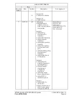
LNAV:


Lateral Navigation 

LNAV +V:

 Lateral Navigation with advisory Vertical Guidance 

L/VNAV:

  Lateral/Vertical Navigation 

LOC:


Localizer 

LOC-BC:

  Localizer Backcourse 

LP: 

Localizer Performance


LPV:


Localizer Performance with Vertical Guidance 

LP +V:


Localizer Performance with Advisory Vertical Guidance 

MLS:


Microwave Landing System 

MMC:


Multi-Media Card 

NOTAM:

  Notice to Airmen 

OBS:


Omni Bearing Selector 

PED:


Portable Electronic Device 

RAIM:


Receiver Autonomous Integrity Monitoring 

RF Leg:


Radius-To-Fix Leg of a Charted Instrument Procedure 

RMT:


Remote 

RNAV:


Area Navigation 

RNP:


Required Navigational Performance 

SAR: 

Search and Rescue 

SBAS:


Satellite Based Augmentation System 

SD:


Secure Digital 

SDF:


Simplified Directional Facility 

SUSP:


Suspend 

TACAN:

  Tactical Air Navigation System 

TAS: 

Traffic Awareness System 

TAWS:


Terrain Awareness and Warning System 

TCAS:


Traffic Collision Avoidance System 

TFR:


Temporary Flight Restriction 

TIS:


Traffic Information Service 

VHF:


Very High Frequency 

VFR: 

Visual Flight Rules 

VLOC:


VOR/Localizer 

VMC: 

Visual Meteorological Conditions 

Summary of Contents for GTN 625

Page 1: ...FTTOB 3 4 5...

Page 2: ...Michael Warren ODA STC Unit Administrator Garmin International Inc ODA 240087 CE Date 04 12 2013 4 11 24 14 7 11 16 18 20 20 21 26 27 32 34 Table 1 x Added new functions Section 1 4 x New section Sec...

Page 3: ...d Autopilot limitations x Added polar operation limitation x Added text regarding new data units in the GTN x Added Fuel Range Ring description and limitations x Added Flight Stream 210 limitation Sec...

Page 4: ...Added Flight Stream 510 data Section 1 2 x Removed text Section 1 5 x Added definitions Section 2 1 x Updated CRG Revisions Table 3 x Added Flight Stream 510 line Section 2 7 x MMC additions Section 2...

Page 5: ...Page v LOG OF REVISIONS Page Revision Number Date Number Description FAA Approved 32 33 34 38 41 42 Section 7 9 x Added Flight Stream 510 Section 7 10 x Reworded Table 4 x Added PTC Section 7 19 x Fl...

Page 6: ...Autopilot Coupling 14 2 14 Terrain Proximity Function All Units 15 2 15 TAWS Function Optional 15 2 16 Polar Operations 15 2 17 Datalink Weather Display Optional 16 2 18 Traffic Display Optional 16 2...

Page 7: ...7 6 GMA 35 35c Audio Panel Optional 31 7 7 Traffic System Optional 31 7 8 StormScope Optional 32 7 9 Power 32 7 10 Databases and Flight Plan Waypoints Procedures 33 7 11 External Switches 34 7 12 Air...

Page 8: ...335 4 MHz tuning range X X Moving map including topographic terrain aviation and geopolitical data X X X X X Display of datalink weather products SiriusXM FIS B Connext all optional X X X X X Control...

Page 9: ...D The GPS navigation functions and optional VHF communication and navigation radio functions are operated by dedicated hard keys a dual concentric rotary knob or the touchscreen Figure 1 GTN 750 Contr...

Page 10: ...entation System complying with ICAO Annex 10 for IFR enroute terminal area and non precision approach operations including those approaches titled GPS or GPS and RNAV GPS approaches The Garmin GNSS na...

Page 11: ...e minimum system functions required for P RNAV operations in accordance with JAA Administrative Guidance Material Section One General Part 3 Temporary Guidance Leaflets Leaflet No 10 JAA TGL 10 Rev 1...

Page 12: ...refore not approved for Advanced RNP operations The following table describes the six Advanced RNP capabilities and the GTN capabilities Advanced RNP Feature GTN Capability RF legs Available if enable...

Page 13: ...s requiring such approval there are no limitations precluding operators from obtaining their own operational approval for the checklist function 1 5 Definitions The following terminology is used withi...

Page 14: ...ctor PED Portable Electronic Device RAIM Receiver Autonomous Integrity Monitoring RF Leg Radius To Fix Leg of a Charted Instrument Procedure RMT Remote RNAV Area Navigation RNP Required Navigational P...

Page 15: ...01007 A2 Rev 6 AFMS Garmin GTN GPS SBAS System Page 8 FAA APPROVED VOR VHF Omnidirectional Range VRP Visual Reporting Point WAAS Wide Area Augmentation System WFDE WAAS Fault Data Exclusion XFR Trans...

Page 16: ...primary navigation during IFR operations Interfaced Equipment Number installed Number Required for IFR External HSI CDI EHSI 1 or more 1 External GPS Annunciator See Note 1 1 Table 2 Required Equipme...

Page 17: ...are not available the availability of GPS RAIM shall be confirmed for the intended route of flight In the event of a predicted continuous loss of RAIM of more than five minutes for any part of the int...

Page 18: ...into the flight plan individually Selecting and inserting individual named fixes from the database is permitted provided all fixes along the published route to be flown are inserted Manual entry of wa...

Page 19: ...able and may slow system performance 2 8 Navigation Database GPS SBAS based IFR enroute oceanic and terminal navigation is prohibited unless the flight crew verifies and uses a valid compatible and cu...

Page 20: ...re and notes on the IAP chart Navigating the final approach segment that segment from the final approach fix to the missed approach point of an ILS LOC LOC BC LDA SDF MLS VOR TACAN approach or any oth...

Page 21: ...ying without the aid of the autopilot or flight director x The active waypoint must be displayed in the pilot s primary field of view 2 13 Autopilot Coupling The flight crew may fly all phases of flig...

Page 22: ...ich to base decisions and plan maneuvers to avoid terrain or obstacles NOTE Terrain and TAWS are separate features and mutually exclusive If TAWS B is shown on the bottom right of the dedicated terrai...

Page 23: ...All text weather displayed on the GTN also includes the raw weather text for pilot review 2 18 Traffic Display Optional Traffic may be displayed on the GTN when connected to an approved optional TCAS...

Page 24: ...l range data is derived by the interfaced fuel totalizer data Data entered in the Fuel Planning pages will not update the fuel range ring 2 22 Glove Use Covered Fingers No device may be used to cover...

Page 25: ...on regarding portable electronic devices The Flight Stream interface and data provided to a portable electronic device is not approved to replace any aircraft display equipment including navigation or...

Page 26: ...AND MAINTAIN SAFE ALTITUDE Advise ATC of Altitude Deviation if appropriate NOTE Only vertical maneuvers are recommended unless either operating in visual meteorological conditions VMC or the flight c...

Page 27: ...n will be based upon the last valid GPS position then estimated by Dead Reckoning methods Changes in true airspeed altitude heading or winds aloft can affect the estimated position substantially Dead...

Page 28: ...GPS may be used to execute the missed approach otherwise alternate means of navigation must be utilized 3 2 3 LOSS OF COM RADIO TUNING FUNCTIONS If alternate COM is available Communications USE ALTER...

Page 29: ...display relative terrain and obstacle elevations The crew must maintain compliance with procedures that ensure minimum terrain and obstacle separation 3 2 8 DATA SOURCE HEADING SOURCE INOPERATIVE OR...

Page 30: ...Panel Circuit Breaker PUSH 3 2 11 DATA SOURCE PRESSURE ALTITUDE SOURCE INOPERATIVE OR CONNECTION TO GTN LOST MESSAGE Without a barometric corrected altitude source to the GTN the following features wi...

Page 31: ...arity to avoid becoming too engrossed at the expense of basic instrument flying in IMC and basic see and avoid in VMC Garmin provides training tools with the Pilot s Guide and PC based simulator Pilot...

Page 32: ...rating as prescribed in the LIMITATIONS section of this manual Autopilots coupled to the GTN system in an analog NAV mode will follow GPS or VHF navigation guidance as they would with existing VOR rec...

Page 33: ...equires the pilot to enable the approach outputs just prior to engaging the autopilot in APR mode To couple an approach Once established on the final approach course with the final approach fix as the...

Page 34: ...elative to the desired path if coupled when using Search and Rescue patterns 4 7 Database Conflict Resolution When a conflict occurs between databases on different GTNs that are utilizing Database SYN...

Page 35: ...190 01007 A2 Rev 6 AFMS Garmin GTN GPS SBAS System Page 28 FAA APPROVED Section 5 PERFORMANCE No change Section 6 WEIGHT AND BALANCE See current weight and balance data...

Page 36: ...d to the GTN a popup will appear prompting the flight crew to manually sequence the leg once the altitude prescribed in the procedure is reached This installation has a barometric corrected altitude s...

Page 37: ...support the TAWS requirement of 91 223 Terrain on the dedicated terrain page or main map overlay is depicted in the following manner x Terrain more than 1 000 feet below the aircraft is not depicted...

Page 38: ...e GTN display screen Optional Bluetooth pairing functionality can be accessed from the associated System Connext Setup page GMA 35c only Volume controls for the audio panel are accessed by pressing th...

Page 39: ...e If the GTN system is not receiving valid heading information either because a compatible heading system is not installed or the interfaced heading system has malfunctioned the StormScope page will c...

Page 40: ...nd is updated as frequently as every 56 days The HOT Line wire database only includes the continental United States and portions of Canada Mexico Only the Obstacle HOT Line wire database may be used i...

Page 41: ...icates OBS or SUSP mode GTN annunciator bar indicates which is active Push OBS button to change OBS or SUSP mode OBS SUSP Performs an OBS or SUSP function TERR INHB Toggles the TAWS Inhibit function o...

Page 42: ...your aircraft independent of the direction the target is pointed A green relative motion vector pointed towards your ownship indicates that the traffic target is converging on your aircraft If more th...

Page 43: ...is overlaid on the main map page the weather data is displayed below an overlaid procedure chart When airborne weather radar is overlaid on the main map page the radar data is displayed above an over...

Page 44: ...Left Wire Overlay Icon Right 7 18 2 Map Page The Map page may be configured to depict point obstacles and wire obstacles at various zoom scales by the pilot by using the Map page menu The obstacle or...

Page 45: ...tainment audio information and attitude information is sent from the Flight Stream to the PED The PED is capable of sending flight plans and databases 510 only to the Flight Stream which will then be...

Page 46: ...ap setup menu Changes to the fuel reserve time are persisted over GTN power cycles Visibility of the fuel range ring may be affected by the underlying map data selectable by the pilot The pilot may ma...

Page 47: ...OSSFILL ON or OFF x User Waypoints x FPL Catalog x Traffic Alerts x Missed Approach Popups x Altitude Leg Popups x Heading x Date Time Conventions x CDI Scale The following unit changes will crossfill...

Page 48: ...o mute audio inputs on the audio panel for the respective seat positions Supplemental commands that allow map zooming and page navigation are also available x BACK x CANCEL x ZOOM IN x ZOOM OUT Each c...

Page 49: ...X 7XX Telligence Voice Command Guide 190 01007 50 When using ASR for TUNE commands it is recommended that the pilot enable Reverse Frequency Lookup RFL on the associated GTN 7 26 European Visual Repor...

Reviews: