background image

DeLorme Topo North America 9.0 User Guide 

232 


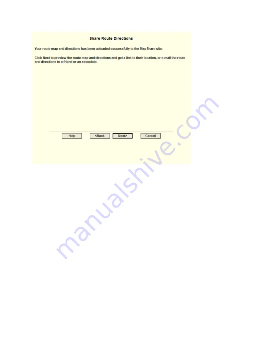
Step 7—Preview or e-mail the route 

Click E-mail the MapShare Link for Your Route Map and Directions to email a link of 

your route map and directions. This option is available only if an email program is detected. 

If an email program is not detected, copy and paste the link provided into your email 

program.  

AND/OR  

Click Preview Your Route Map and Directions to preview your route map and directions 

as they appear on the MapShare site.  

Note  Print your route map and directions from the MapShare site by clicking Print in the 

upper right corner of the page. 

Summary of Contents for Topo North America 9.0

Page 1: ...DeLorme Topo North America 9 0 User Guide Created June 8 2010 ...

Page 2: ......

Page 3: ... Location on the Map 57 Using Address Book Contacts 72 Printing 78 Using the Draw Tools 89 Routing 141 Using GPS 159 Using Voice Navigation 177 Geocaching 186 Using Earthmate PN Series GPS Devices 189 Using Third party GPS Devices 207 Using Small screen Devices 212 Profiling Linear Objects 213 Viewing Your Map in 3 D 222 Using NetLink and MapShare 228 Using GeoTagger 233 Legal Information 236 Inde...

Page 4: ......

Page 5: ...me Topo North America Features These are just some of the many features that you can enjoy with DeLorme Topo North America 9 0 Try our data downloads for free Included with your purchase is a download certificate for 40 worth of data and imagery using the NetLink tab registration required You can also subscribe to the DeLorme Map Library and get unlimited downloads for an annual fee of only 29 95 ...

Page 6: ...s DeLorme Earthmate GPS Laptop Devices LT 40 and previous versions and BT 20 for laptops USB GPS Support DeLorme software can use the data output from a USB GPS if the device meets one of the following criteria When the GPS is attached to the computer it is recognized and displayed under Ports in the Microsoft Windows Device Manager The unit is a Garmin USB device and the Garmin drivers are instal...

Page 7: ...earch in the Find tab You can then print your search results using the Along the Way print option Use the following steps to search for a name category along your current route and print the results 1 Click the Find tab and then click Advanced The Advanced dialog area displays 2 Select Category from the From drop down list 3 Select CurrentRoute from the Within drop down list 4 Type the appropriate...

Page 8: ...ns to reflect that stop When you add a stop you can recalculate to include it This map shows the area between Portland Maine and Yarmouth Maine with two vias and one stop What s the difference between adding and inserting a stop or via The Insert Stop Via function arranges stops vias geographically in the route The Add Stop Via function adds stops vias in the order you add them to the route For mo...

Page 9: ...ng a Route What s the best way to measure a large area on the map The best way to measure a large area on the map is with the area tools on the Draw tab such as the polygon tool When you draw an area object on the map the area displays next to the object on the map If you click off the object you can view the area again by clicking the Select tool in the Draw tab and then clicking the area object ...

Page 10: ...1 24 000 1 100 000 1 500 000 and so on to quickly change the zoom level of the map view Notes Increase the data zoom level number to show a smaller geographic area at greater detail Decrease the data zoom level number to show a larger geographic area at lesser detail If you view both the right primary and left secondary maps at different data zoom levels a box or lines depending on the current dat...

Page 11: ...e Control Panel The zoom tools for the left map are located at the top of the left map view Right Map Controls Click the up arrow to zoom out one minor data zoom level at a time Click the down arrow to zoom in one minor data zoom level at a time Click the Zoom In 1 tool to increase the detail number to the next full level Click the Zoom Out 1 tool to decrease the detail number to the next full lev...

Page 12: ... the new location Use the search features on the Find tab to center the map on a particular location Assign shortcut keys to pan the map up down left or right in small increments Copying Your Map to the Clipboard Click the Copy to Clipboard button on the Print tab to copy your map to the clipboard You can then paste it into another program You can also right click anywhere on the map and click Cop...

Page 13: ... is the location and photo zoom you want to save If not pan the map to the location and zoom to the level you want Note Changing the photo zoom enlarges reduces the map features and changes the map area that you save as an image If you increase the photo zoom level map text lines symbols etc are larger and your map area is reduced If you decrease the photo zoom level map text lines symbols etc are...

Page 14: ...near distance or area on the map 1 Verify you have the correct units of measure selected in the Display tab of the Options dialog box For more information see Setting Units of Measure Preferences 2 On the toolbar click the Measure tool The pointer changes to 3 Click point by point to draw a measurement line on the map A text box displays next to your pointer indicating the total distance of the me...

Page 15: ...4348n 7009w n4348 w7009 n4348 w7009 4348 N 7009 W 4348 N 7009 W N 4348 W 7009 N 4348 W 7009 4348 n 7009 w 4348 n 7009 w n 4348 w 7009 n 4348 w 7009 434829 700950 434829 700950 4348 491 7009 844 4348 491 7009 844 4348 491 7009 844 4348 491 7009 844 434829 46 700950 64 434829 46 700950 64 43 80818333 70 16406667 43 80818333 70 16406667 43 48 4910 N 70 09 50 64 W 43 48 4910 N 70 09 50 64 W 43 48 4910...

Page 16: ...in a specific format Tips Use punctuation as in the examples in the table below Do not use periods Search with the minimum amount of information to increase the number of results For example if you search for Kalalau Trail in Hawaii but you are not sure of the spelling type Kal HI and then scroll through the results until you find a match This table shows formats for search types For this type of ...

Page 17: ...scard changes and close the program Click Cancel to return to DeLorme Topo North America No changes are saved If you made more than one change to the project or changes to more than one project once you save your project the Exit dialog box opens Click Save and Exit to save changes to the selected files and close the program Note Clear the check box for any file you do not want to save Click No to...

Page 18: ...pan or zoom up to 256 times Map Rotation Tool The arrow in the graphic indicates True North in relation to the rotated map Use the Map Rotation Tool to rotate the map in any direction You can rotate the map by clicking or dragging the square map graphic in the direction you want or by selecting typing the degree of map rotation from the drop down list Map Coordinates Coordinates for the current ma...

Page 19: ...inter becomes a drag the view box to the new location Toolbar You can show or hide toolbar options You can change the order of the toolbar options Default Toolbar This is the default toolbar click an area on the toolbar image for more information You can also view these topics in the Using the Toolbar section of the Help Additional Toolbar Options These button groups are hidden in the default tool...

Page 20: ...on your screen ToolTips also display in windows and dialog boxes when you point to a button icon or other feature Information Boxes Several tabs contain information boxes Information boxes provide descriptions about the features and functions of the selected tab Help System Click the Help button on the toolbar to view the Help menu and then click an item to select it Tip To access a Help menu item...

Page 21: ...key on your keyboard Note If you don t find what you re looking for in the index click the Search tab and try a search for your keyword Search Use the following steps to search for particular words or phrases within topics in the Help system 1 While in the Help system click the Search tab 2 Type a keyword in the entry field and then click List Topics or press the ENTER key on your keyboard A list ...

Page 22: ...table of contents and then click Print Web Help A web version of the Help system is available on the DeLorme Technical Support website On the support site select your product from the Browse by Category drop down list and click the link for Help topics Map Legend Map Legend The features that display on the map may display differently depending on which map colors you chose on the Display tab of th...

Page 23: ...ation see Recreational Contacts Routable Road Features Ferry Passenger Ferry Vehicle Interstate Highway can also include this symbol Limited Access Road Local Road Major Connector Forest Road Minor Connector Non Limited Access Interstate Primary State Route State Route can also include this symbol Toll Road U S National Route can also include this symbol Unclassified Road Unimproved Road Land Cove...

Page 24: ...es Topo Colors Street Colors Description Amusements Airport private Airport commercial public Airport general aviation public Business Amusement Recreation Specialty or Dept Store Camping at data zoom level 14 Camping at data zoom level 11 thru 13 Cemetery Educational Facility Exit with services at data zoom levels 10 thru 11 7 Exit without services at data zoom levels 10 thru 11 7 Exit food at da...

Page 25: ...ildings Rest Area with Facilities at data zoom levels 10 thru 11 Rest Area with Facilities at data zoom level 12 Rest Area without Facilities at data zoom levels 10 thru 11 Rest Area without Facilities at data zoom level 12 Restaurants general Restaurants specialty Small City State Capital Unique Natural Feature at data zoom level 8 Line Features Topo Colors Street Colors Description County Bounda...

Page 26: ...m levels 11 and 12 Developed Boat Ramp at data zoom level 13 Freshwater Fishing at data zoom levels 11 and 12 Freshwater Fishing at data zoom level 13 Hunting at data zoom levels 11 and 12 Hunting at data zoom level 13 Saltwater Fishing at data zoom levels 11 and 12 Saltwater Fishing at data zoom level 13 Undeveloped Boat Ramp at data zoom levels 11 and 12 Undeveloped Boat Ramp at data zoom level ...

Page 27: ...lbar options with a selected check box next to them are displayed on the toolbar 2 Click an item to activate or inactivate it in the toolbar Reordering the Toolbar Options To reposition the toolbar groups horizontally or vertically just drag the dotted vertical bar that separates each group to the new location left right up or down To Create a New Project To create a new project click the New butt...

Page 28: ...on the toolbar The Save File dialog box opens 2 Browse to the location where you want to save the project If you want to rename the project type a new name in the File Name text box 3 Click Save To Open the Map Library To open the Map Library subtab on the NetLink tab click the Map Library button To Share Maps Help To Create a Route To set route points using the toolbar 1 Type the location where y...

Page 29: ... window Note To use the current GPS location in a route you must connect your device to your computer and click the GPS button on the toolbar hidden by default or on the GPS tab Tip Once a route is calculated you can use the subtabs in the Route tab to view route directions edit a route and more Click the Directions subtab to view the route directions the Advanced subtab to display the advanced ro...

Page 30: ...tton 2 Click the map feature you want information for such as a road town measurement line waypoint track draw symbol or point of interest The Info tab opens and displays a list of information categories Note Descriptive information may include a name or feature type length area ZIP Postal Code town name county name state province coordinates and Standard Industrial Classification categories 3 Cli...

Page 31: ...op of the terrain profile These lines indicate the height and distance of the particular location A small crosshair follows along the corresponding object on the map You can also right click a linear object or route on the map and click Profile For more information about profiles see the Help topics under Profiling Linear Objects To Add Images and Data to a GPS Location To open the GeoTagger Wizar...

Page 32: ... any direction click the Map Panning button on the toolbar The Map Panning button is hidden by default to show it right click the toolbar to open the menu and click Map Panning Tip With your cursor anywhere on the map press the CTRL key on your keyboard the cursor becomes a white hand Hold down your left mouse button to drag the map to a new location To Start Stop Your GPS Connection The GPS butto...

Page 33: ...b click the Print button on the toolbar The Print button is hidden by default to show it right click the toolbar to open the menu and click Print For more information see Printing a Map To Print the Map Screen To print the current view as it displays on the screen click the Print Screen button on the toolbar The Print Screen button is hidden by default to show it right click the toolbar to open th...

Page 34: ...book Mode to turn the optimized small screen device view on or off For more information see Using Small screen Devices Notes You can also use keyboard shortcuts to customize the interface Your settings are saved until you change them Click Options in the menu to open the Options dialog box Displaying Basic Map Features You can show or hide basic map features on your map You can also customize map ...

Page 35: ...te vegetation and land cover areas on the map such as rock and sand forests transitional areas and wetlands Grids The Grids option can be used to identify coordinate points on the map Grid lines automatically adjust for the data zoom level of your map Parks or Reserves Parks and Reserves are available at data zoom level 7 0 or greater and include areas such as parks preserves recreational area and...

Page 36: ...neral points of interest including educational technology government and religious buildings locations Business Major View many different travel related points of interest including hospitals camping restaurants and more Business Minor View general points of interest including small shops and food stores laundromats and golfing ZIP Postal Codes ZIP Postal Code boundaries display at data zoom level...

Page 37: ... the item in the Search text box A list of matching keywords displays and corresponding feature types are listed in the Search Results window Results for the number of keywords and types found also display A selected check box indicates the feature displays on the map Select clear the individual feature check box to show or hide that feature Click the small None button to the right of the Search R...

Page 38: ... Options toolbar button to open the menu Then click Options to open the dialog box 2 Click the Display tab 3 From the Map Colors drop down list select High Contrast Colors to make the map display darker for improved in vehicle visibility Street Colors to emphasize streets and highways on the map or Topo Colors to emphasize contours parks and public lands land cover and so on 4 Click OK to accept t...

Page 39: ...agnification percentage 50 75 100 125 150 175 or 200 from the Magnification drop down list Note Although the size of the image changes the degree of geographic detail does not 4 Click OK to accept the change and exit the Options dialog box OR Click Apply to accept the change and keep working in the Options dialog box Changing the Contour Details Preferences Contour detail preferences affect how co...

Page 40: ...on the basic map features you selected on the Map Features tab in the Options dialog box For more information see Displaying Basic Map Features This table shows the actions that may happen if you display major and minor POIs If you view large symbols at data zoom level You will see the following information at data zoom level 13 0 You will see the following information at data zoom level 14 0 You ...

Page 41: ...nates display or print Use the following steps to change how coordinate measurement units display 1 Click the Options button on the toolbar OR Click the arrow next to the Options toolbar button to open the menu Then click Options to open the dialog box 2 Click the Display tab 3 Select the coordinate display format from the Coordinates drop down list Degrees Degrees Minutes Deg Min Sec UTM UPS Univ...

Page 42: ...en click Options 2 Click the Display tab 3 Select the measurement from the Measurements drop down list Statute Miles statute feet are used for small distances Kilometers meters are used for small distances Nautical Miles Feet statute feet are used for small distances Nautical Miles Meters meters are used for small distances 4 Click OK to commit the change and exit the Options dialog box OR Click A...

Page 43: ...e is restored To Resize the Map Area Using the Resize Tools The map resize tool runs perpendicular to the tab area If the secondary and primary maps are both displaying the resize tool is the bar that separates them When the bar is moved all the way to the left of the map only the primary map displays When the bar is moved all the way to the right of the map only the secondary map displays There a...

Page 44: ...mode double click the bar to return the tab height to its default percentage Double click the bar between the up and down arrows to return the tab height to its default view Using the Vertical Resize Tool Drag the vertical bar left to expose the area of the overview map you want to see Drag the vertical bar right to expose the tab area you want to see Click the right arrow on the vertical resize t...

Page 45: ...0 50 a box or lines displays on the map that is covering the larger amount of screen area The box lines indicate the area that is in view on the opposite map Both windows are centered on the same coordinate position Panning or rotating in one map causes the same action on both maps The left map window has its own zoom level controls You can change the zoom level of the left map without affecting t...

Page 46: ...o the Options button on the toolbar and select Tab Manager from the menu OR From the Start menu point to Programs DeLorme Topo Tools and then click Tab Manager 2 Select the check box next to each tab you want to display in the program Note Click Default to show all the tabs in the program in the default order 3 Click OK 4 Exit DeLorme Topo North America 5 Open DeLorme Topo North America To Hide In...

Page 47: ... your application 6 Open your application To Export Tab Manager Preferences Use the following steps to export your Tab Manager preferences as a configuration file 1 If your application is open click the arrow next to the Options button on the toolbar and click Tab Manager OR From the Start menu point to Programs DeLorme Topo Tools and then click Tab Manager 2 Click File and then click Export The E...

Page 48: ...o North America 8 Open DeLorme Topo North America Using Keyboard Shortcuts Selecting a Keyboard Shortcut Scheme Your application comes with the following DeLorme keyboard shortcut schemes 3 D Navigation Desktop Mapping In vehicle Navigation You cannot edit DeLorme schemes but you can create custom schemes that you can edit You can create as many additional custom schemes as you need To Select a Ke...

Page 49: ...rme keyboard shortcut schemes that you cannot edit however you can create a custom scheme that you can edit with Keyboard Shortcuts tab in the Options dialog box To Assign Keyboard Shortcuts in a Custom Scheme Use the following steps to edit a custom scheme 1 Click the Options button on the toolbar OR Click the arrow next to the Options toolbar button to open the menu Then click Options to open th...

Page 50: ... C Copy o CTRL V Paste o CTRL X Cut o CTRL Y Redo o CTRL Z Undo o ALT M Set Focus on Map o You cannot use the following keys when assigning shortcuts o Windows Key o Application Key o Print Screen o Scroll Lock o Sleep o Pause Break o Enter o Caps Lock o Num Lock o Spacebar o Insert o Backspace o Multi media Keys o You cannot assign a letter or number on its own For example you cannot assign a key...

Page 51: ...me Renaming a Custom Scheme Custom schemes can be renamed to whatever name you choose You cannot rename DeLorme schemes To Rename a Custom Scheme Use the following steps to rename a custom scheme 1 Click the Options button on the toolbar OR Click the arrow next to the Options toolbar button to open the menu Then click Options to open the dialog box 2 Click the Keyboard Shortcuts tab 3 Select the c...

Page 52: ... Options button on the toolbar OR Click the arrow next to the Options toolbar button to open the menu Then click Options to open the dialog box 2 Click the Keyboard Shortcuts tab 3 Click File and then click Import The Import Scheme File dialog box opens 4 Browse to the location where you saved the keyscheme file select it and then click Open The imported file is now your active scheme Exporting a ...

Page 53: ...t box begin typing the name of the command or command group you are searching for As you type the list box under the Commands text box displays word matches Viewing All of the Shortcut Keys for a Scheme The Reference Card option in the Keyboard Shortcuts tab lets you view a complete list of all of the scheme s shortcut keys To View a List of Shortcut Keys Use the following steps to view a list of ...

Page 54: ... the program and click Change The Program Maintenance screen opens OR Insert the DeLorme Topo North America DVD into your DVD ROM drive Browse to the DVD drive on your computer and view the contents Double click setup exe The Program Maintenance screen opens 3 Ensure Modify is selected and click Next 4 Follow the on screen instructions to complete installation 5 When prompted click Finish Connecti...

Page 55: ...les Overview You can save all of your work as a single project file so you can open it again later You can create various map views and save each in a different project What is a project A project consists of the map center coordinates the current data zoom level the current magnification rotation preferences and links to routes or draw layers you have added to it As you create routes and draw lay...

Page 56: ...o create a new project 1 Click the Map Files tab 2 Click File and then click New OR Click the New File button on the toolbar 3 Click the Save button on the toolbar Projects have tpx extensions and are saved by default in C DeLorme Docs Projects OR Click File and then click Save As to give the project a name other than the default Note You can also use the toolbar to create and save map files To De...

Page 57: ... You can also pan and zoom the map as needed and then save all these project changes To Add Delete Files Contained in a Project Use the following steps to add or delete specific files contained in a particular project in DeLorme Topo North America using the Map Files tab 1 Open a project 2 Click File click Current View and then click Contents to view the contents of the project To add a file click...

Page 58: ...itate emailing or copying You can create a transfer file with or without hyperlinked file attachments When you create a transfer file with hyperlinked files you have the option of saving the common directory structure of the hyperlinked files Saving the directory structure of common files can be helpful when you are sharing and updating transfer files Note Transfer files do not include map data To...

Page 59: ...If you do not want to include the directory information for the hyperlinked files in the transfer file select Do Not Include Directory Info and go to step 7 6 Type the common base directory location of the hyperlinked files up to the folder location that you want to maintain in the text box OR Click the Browse button and browse to the common base directory location 7 Under Select Files to Be Inclu...

Page 60: ... files that have been e mailed to you by other DeLorme users 1 Click the Map Files tab 2 Click File click Transfer and then click Import The Import Transfer File dialog box opens The default location is C DeLorme Docs Projects Browse to another location as needed Transfer files have dmt extensions 3 Click a file to select it The name displays in the File Name text box 4 Click Import to finish the ...

Page 61: ...wns ZIP Postal Codes and coordinate positions If the item you are looking for is not recognized the Advanced tab displays automatically POIs Search for specific points of interest such as hotels restaurants hospitals department stores etc Search a specified distance from the current map center or along an active route GPS Radar Search for points of interest and waypoints within a designated distan...

Page 62: ...oll or browse through the list of search results until you find the one you want to locate To center an item on the map double click it or select it and then click Go To A MapTag displays if the MapTags check box is selected Tip Single click an item in the results list to highlight it on the map without adding a MapTag or centering it in the map view For more information on viewing results see Tip...

Page 63: ... can also search for more types of items than you can in the QuickSearch tab such as by category street intersection and more To Perform an Advanced Search Follow the steps below to use the advanced search function 1 Click the Find tab and then click the Advanced subtab Note This screen automatically displays if you performed an unsuccessful QuickSearch 2 From the Find drop down list select the Fi...

Page 64: ...splay in a browse list Latitude Longitude A single result is returned using a latitude longitude coordinate search There are no Within options Coordinates must be in one of the many formats recognized by the program and are based on your Display settings in the Options dialog box 3 From the Within drop down list select an option Available choices are based on what you selected as your Find type Cl...

Page 65: ...t of the Find and Within fields The text boxes available are based on the selected Find and Within fields Tip A few text boxes are optional and you may get more results by leaving them blank To see if a text box is optional hold your cursor over the text box label or down arrow and read the ToolTip for that text box 5 Click Search or press the ENTER key on your keyboard The Results list displays y...

Page 66: ... category that best fits your POI name for example type Hotel if you are searching for a Sheraton type Department Store if you are searching for Wal Mart in the Keywords text box See Keywords for Category Searches for more information OR Select an appropriate keyword from the Keywords drop down list examples and history 5 Type the distance you want to search in the Distance text box Type the numbe...

Page 67: ... to find gas stations along your route as you travel Step 1 Get ready Use the program to create a route using your current GPS location as the route start point and an address book entry as your finish Step 2 Set your preferences Set your GPS Radar preferences on the Find tab in the Options dialog box Select Road to calculate the distance you will have to travel by road to reach the result Select ...

Page 68: ...ing 2 Launch DeLorme Topo North America 3 Make sure the NavMode button on the toolbar is on appears indented 4 Click the GPS button on the toolbar to start your GPS Note If you do not see the GPS button on the toolbar right click the toolbar and select the GPS NavMode option Step 4 Pick what you want to search for 1 Click the Find tab it is minimized at the bottom of the screen and click GPS Radar...

Page 69: ...nt or POI and get directions to it What you need to know Before you start set your Find preferences in the Options dialog A GPS Radar search finds items that are the shortest driving distance from your current location within just a few miles Unless you select the Only in Direction of Travel check box some of the search results may be behind you GPS radar calculates a route to each point and the f...

Page 70: ...ur Location Use the following steps to find points near your location 1 Set your GPS Radar preferences on the Find tab in the Options dialog box 2 In the program s tab area click the Find tab 3 Click the GPS Radar subtab button 4 From the Find drop down list select the category to search for example Gas Stations Restaurants etc OR From the Find drop down list select Custom and then click the Custo...

Page 71: ...elp you view Find tab search results To make it easier to view a long list of search results increase the height of the tab by dragging the top of the tab area up or by clicking the increase up tab height arrow at the top of the tab To sort results by another column click the column header An arrow identifies the sort column Click a second time to reverse the sort order Note This feature is not av...

Page 72: ...ent search types result in different column orders There are two types of results lists Most searches provide a fixed number of results If all of the results do not fit in the screen area a scroll bar automatically displays Some searches provide results you can browse This means the entire database displays with the best match highlighted It is possible to continue browsing to the first or last it...

Page 73: ...cal Park Park School State Park University Atlas Gazetteer Camping or RV Park Department Store or Mall Farm Geographic Feature Golfing Landmark Library Park Tourist Attraction Miscellaneous Cemetery Hiking Mine Note Park Natural Features Beach Canyon Crater Desert Forest Glacier Hill Island Mountain River Stream Valley ...

Page 74: ...pen Space Tourist Attraction Notes on Category Searches The following list provides notes you may find helpful for performing category searches Category keyword searches must be at least three characters in length Keywords are not case sensitive Some generic keywords water for example match many categories and display a dialog box with specific categories Select or clear these categories depending...

Page 75: ...to MapNotes To change all of the MapTags on the map to MapNotes which can be retained when you save the project right click the map click Manage Draw and then click Convert All MapTags to MapNotes A new draw layer called MapNotes is created in your project To Move a MapTag You cannot detach a MapTag from its anchor point you can move only the text area Use the following steps to move the MapTag te...

Page 76: ...ame of the contact Use the Route tab to search for an address book entry as a route start stop or finish browse for the contact or type the name of the contact Use the toolbar to search for an address book entry as a route start or finish browse for the contact or type the name of the contact With these functions you can select the From Address Book option from the applicable drop down list or you...

Page 77: ... If your contacts do not display on the map check the Located column in the Address Book dialog box to verify a successful match was made If Not Located displays next to any of your records either address coordinate information was not provided with the contact or the address coordinate information could not be found in the program Notes The address book has a 200 record limit You can resize and m...

Page 78: ...og box To Center the Map on an Address Book Contact Use the following steps to center the map on an address book contact 1 Click the Find tab 2 Click the Address Book button The DeLorme Address Book dialog box opens 3 Click the contact 4 Click Go To The map centers on the selected contact Notes The address book has a 200 record limit You can resize and move the Address Book dialog box You can resi...

Page 79: ...ss book contact 3 Click and drag the contact to a different location on the map The Located status for that record in the Address Book dialog box changes to Manual 4 Click the move address book entry icon again to resume normal map operations Notes The address book has a 200 record limit You can resize and move the Address Book dialog box You can resize the columns inside the Address Book dialog b...

Page 80: ...on The DeLorme Address Book dialog box opens 3 Click the record you want to delete 4 Click Delete 5 Click OK to confirm the deletion 6 Click Done Notes The address book has a 200 record limit You can resize and move the Address Book dialog box You can resize the columns inside the Address Book dialog box Showing Hiding Address Book Contacts on the Map Once you add contacts to your address book you...

Page 81: ...r Address Book You can export your address book to another program using the Export function in the Address Book dialog box Exported address books are in DeLorme Address Book binary format dab or comma separated file csv format Latitude and longitude values are not exported To Export Your Address Book Use the following steps to export your address book 1 Click the Find tab 2 Click the Address Book...

Page 82: ...rint a full page 3 D map use the map resize tool to expose only the left map window 5 Under Print Layout select Page the map print area is based on the paper size you have specified in the Setup options or Screen the map print area is based on the screen size The print area for a Page map displays as a red box on the map which may not always be visible The overview map and the print area for a Scr...

Page 83: ...raphics Consult your printer manual for additional information 8 Click the Print button to print your map Tips To save a map to a file see Saving a Map as a Bitmap or JPEG Image To adjust the print area of a Page map select the Lock Print Center check box select the Select tool and then drag the frame to the new position Printing a Route and Directions You can print maps of your route and route di...

Page 84: ...per page that you want your route to cover from the Miles Per Page drop down list Note When setting the number of miles per page keep in mind that the number of miles is not the distance of the route Instead it equals the width of the strip map and determines the scale of the map 6 Select Increasing from the Trip Time Distance drop down list to end the route directions with the total time and dist...

Page 85: ...he item on the map To make graphic items added to your map the same size press and hold the SHIFT key on your keyboard or drag to select two items right click select Make Same Size and select Width Height or Both from the menu After you add text graphic items to your map you can align snap or layer them on the map To Add Text to Your Map Use the following steps to add text to your map 1 Click the ...

Page 86: ...d a North Arrow to Your Map Use the following steps to add a North arrow to your map 1 Click the Print tab and then click the Map subtab 2 Select your Map and Print Layout options For more information see Printing a Map 3 Under Layout Tools click and hold the text and graphics button to reveal the hidden text and graphic tools 4 Click the North Arrow tool All of the North Arrow styles display to t...

Page 87: ...w position 6 Select an image file jpg bmp or gif to place on your map and then click Open The image displays on the map and the file name displays in the text box next to the Image tool under Layout Tools You can update the image at any time by clicking the Browse button and browsing to an alternative image 7 Select the Maintain Aspect Ratio check box to maintain the image s width to height ratio ...

Page 88: ...st not be locked for example the Maintain Aspect Ratio check box should be cleared for any images only text items with default size text boxes can be resized and so on To delete multiple text or graphic items click the Edit tool drag the mouse on the map to encompass the items you want to delete and then press the DELETE key on your keyboard Snapping Text and Graphic Items on Your Map After you ad...

Page 89: ...elect Send to Back Tips To make multiple text and graphic items the same size press the SHIFT key on your keyboard and select each item Then right click point to Make Same Size and click Width Height or Both When you attempt to make multiple items the same size the largest item is always the basis for the size change To delete multiple text graphic items select the Edit tool drag the mouse in a do...

Page 90: ...e ready to assemble the map Before you begin be sure you have a clear work surface large enough to accommodate the final map size You will need the following tools to assemble your map Pencil Razor knife Straight edge ruler longer than the edge of the longest sheet Permanent tape invisible or magic type Removable tape To Manually Assemble a Multi page Map Use the following steps to manually assemb...

Page 91: ... two adjacent sheets placing the trimmed edge on top of the non trimmed edge Notes Piece together the multi page map one seam at a time This is especially important for a 3 x 3 multi page map Build the multi page map from the inside out to minimize any misalignment ...

Page 92: ...ogether 6 With the multi page temporarily pieced together use small pieces of removable tape to secure the corners and edges of the multi page map Note Place the removable tape on the corners and edges not along the seams 7 For each seam fix the tape to the work surface not on the sheet so the tape is in alignment with the seam 8 Spool off enough permanent tape to cover the entire seam Be careful ...

Page 93: ...e map at the seams where the tape is affixed to the workspace 13 Peel off the removable tape at the corners and the edges You are now ready to display your multi page map Using the Draw Tools Draw Overview You can add draw objects such as routable roads routable trails waypoints tracks text symbols MapNotes images lines arcs splines circles polygons and rectangles to your map with the tools provid...

Page 94: ...2 with indicating the number order in which the file was created You can rename draw files to better identify your specific information See Creating a New Draw File You can have multiple draw files displaying at once while working on your map Work can be done on one draw file at a time while viewing other files beneath it You can select different draw files to be the active editable file from with...

Page 95: ...e When you select a draw object on the map shape points display along the active object as small magenta squares The line object below was drawn with the spline tool End points are the first and last points of individual line segments on a draw object When you select a shape point of a line segment within an active line spline or polygon A small green circle indicates the start end point of the se...

Page 96: ...point of the selected line segment The same spline with end points indicating a selected spline segment Notes When you click the start or last end point of the line segment within a line draw object and the Show Measurement check box is available when using the Polygon or Line tool and selected it displays the bearing or angle of that point of the line the length of the line segment leg and the to...

Page 97: ...segment leg and the total length of the entire line object on the map When you click the start or end point of the line segment within a polygon draw object a text box displays the bearing or angle of that point of the line the length of the line segment leg and the total area of the polygon on the map Points in Rectangles Circles and Arcs Draw objects such as rectangles circles and arcs also cont...

Page 98: ...otes do not have shape or end points They contain an anchor point at the end of the text box Clicking the MapNote displays a central crosshair at the anchor point Viewing Hidden Draw Tools The Draw tab tools allow you to add routable roads trails waypoints tracks lines straight lines arcs and splines shapes polygons rectangles and circles MapNotes text labels images and symbols to a draw file Some...

Page 99: ...e editing area is categorized by draw file type For example all roadlayer files are grouped together in the list all drawlayer files are grouped together and so on 3 Click New and then click Draw Road Trail Waypoint or Track The new file is now the active draw file Each draw file type has an active file 4 Optional If you want to rename the draw file Right click the draw file in the draw file editi...

Page 100: ...nd so on 4 Select a draw file from the file list and then click Delete Click Yes in the confirmation message box to delete the object or click No to cancel OR Right click the draw file in the list and click Delete Click Yes in the confirmation message box to delete the object or click No to cancel 5 Click Done to return to the main Draw tab area Hiding Draw Files You can hide draw files you create...

Page 101: ...es you made to the draw file 8 Click Done to return to the main Draw tab area To Lock a Draw File Use the following steps to lock a draw file 1 Click the Draw tab 2 Click File to open the draw file editing area 3 Select the Lock check box for each draw file you want to lock Note Clear the Lock check box to make changes to a draw file 4 Click Done to return to the main Draw tab area Exporting Draw ...

Page 102: ...e to open the draw file editing area Any draw file with a selected check box displays on the map The Active column shows the active layers 3 From the file list click the track file to export 4 Click Export The Export Draw File dialog box opens 5 Browse to a directory in which to save the file or use the default destination of C DeLorme Docs Export 6 Select Channel Data Text File from the Save as T...

Page 103: ... many types of files as draw files The file items display as draw objects within the draw file You can also use Earthmate GPS Sync to download waypoints and tracks to the Draw tab from a PN Series GPS see the Help topics under Using DeLorme PN Series GPS Devices for more information See the chart at the end of this topic to learn what is imported for each type of file Important To add a track Draw...

Page 104: ...inish point For more information see Sample Survey File If you import this type of file That results from this source The following is imported Address Book txt csv Address Book File Draw objects display with the current symbol and style selections Notes Files must be tab or comma delimited Format name address city state ZIP Code phone Files must be less than 250 records long Text File txt Lat Lon...

Page 105: ...with the current symbol and line style selections MapDocs sa7 sa8 sa9 mn5 mn6 mn7 Street Atlas USA 9 0 9 0 and 9 0 AAA Map n Go 5 0 6 and 9 0 Draw objects display with the current symbol and line style selections Formatting a Text File to Import as a Draw File These are the formatting conventions with examples for creating a text file to import as a draw file Draw Object Format Example Line BEGIN ...

Page 106: ...621 70 165392 43 808692 70 165392 END Circle BEGIN CIRCLE LAT LON Radius END BEGIN CIRCLE 43 807662 70 163935 0 114611 END Symbol BEGIN SYMBOL LAT LON Name Symbol Name END BEGIN SYMBOL 43 807662 70 163935 DeLorme Blue Pin END MapNote BEGIN NOTE LAT LON Text END BEGIN NOTE 43 807662 70 163935 DeLorme END Text Label BEGIN TEXT LAT LON Text END BEGIN TEXT 43 807662 70 163935 DeLorme END Copying a Map...

Page 107: ...ew GPS log is created Viewing the Contents of a Draw File Once you create a draw file draw road trail waypoint or track layer you can view the contents of that file using the More button in the File view of the Draw tab To View the Contents of a Draw File Use the following steps to view the contents of a draw road trail waypoint or track file 1 Click the Draw tab 2 Click File to open the draw file...

Page 108: ...ascending order click the column header Click the column header again to sort in descending order 7 Optional To modify a draw object s name comment or URL in the table click the draw file in the draw file editing area and then click it again do not double click Type the new name in the Name box and press the ENTER key on your keyboard OR Right click the draw file in the draw file editing area and ...

Page 109: ...quires line objects Tip You can also change a draw object type using the right click feature on the map For more information see Changing Draw Object Types Changing Draw Object Types When you add a draw object to the map a draw file is automatically created that includes that object The draw file type varies depending on the draw object that was created Draw Object Type Draw File Type Routable Roa...

Page 110: ...object right click the object on the map point to Manage Draw point to Copy to Draw Object and then click the object to copy to OR To change a track to a GPS log right click the track on the map point to Manage Draw and click Copy Track to GPS Log OR To change a symbol to a waypoint right click the symbol on the map point to Manage Draw and click Copy Symbol to Waypoint Tip You can also change a d...

Page 111: ...File Use the following steps to copy a draw object 1 Click the Draw tab 2 Click File to open the draw file editing area All the files you created display in a table A draw file with a selected check box displays on the map 3 Click to select the file that includes the contents you want to copy 4 Click More The tab area increases in height and the file details table displays The information that dis...

Page 112: ... file OR to select multiple sequential files press and hold the SHIFT key and click the first and last file Using Draw Objects Copying and Placing Draw Objects You can copy any draw object you place on the map To Copy Draw Objects Use the following steps to copy draw objects 1 Open the project that contains the draw object you want to copy 2 Click the Draw tab 3 To copy a single draw object click ...

Page 113: ...bjects 1 Open the project that contains the object you want to move 2 Click the Draw tab 3 Click the Select tool and click the draw object you want to move A box displays around the active object You can move draw objects in different ways If the object is a n Then Routable Road Routable Trail Track Line Arc Spline Polygon Rectangle or Circle Press and hold the SHIFT key on your keyboard and drag ...

Page 114: ...r on the map To Rename a Draw Object in the File List Use the following steps to rename a draw object in the file list 1 Click the Draw tab 2 Click File to open the draw file editing area All the files you have created display in a table Any draw file with a selected check box displays on the map 3 Click to select the file that includes the draw object you want to rename 4 Click More The tab area ...

Page 115: ...he File button in the Draw tab click to select the Draw File that contains the object you want to delete click More right click the object and then click Delete To select multiple draw objects in the file list press and hold the CTRL key and click each file OR to select multiple sequential files press and hold the SHIFT key and click the first and last file To Delete Multiple Draw Objects Use the ...

Page 116: ... Select tool and then click the draw object on the map A box displays around the active object Shape points display as small magenta squares 3 Select an end point from any of the line segments within the draw object It displays as a red or green circle 4 Drag the point to Any other shape point within a line spline polygon arc or rectangle The center point of a circle The anchor of a symbol The bas...

Page 117: ...ext box indicating the new point s bearing or angle length of the new segment leg and total object s length on the map Tip To undo the addition of the point to the draw object click the Undo button to undo the last action If you decide not to undo the last action click the Redo button Deleting Points and Line Segments from Draw Objects You can delete points from routable road routable trail track ...

Page 118: ...d Images MapNotes Symbols Text Labels Waypoints 1 Place the object on the map The URL Label text box opens 2 Type the label for your draw object in the Label section of the text box Note When viewing a hyperlinked draw object on the map the object displays as an active hyperlink If you want to click the object without opening the hyperlink press the CTRL key on your keyboard while you click the dr...

Page 119: ...oad or trail enter the last point on the map screen and click Done The new road or trail displays on the map with the name you typed in the Road Trail Name text box You can also finish the line draw by pressing the ENTER key on your keyboard or double clicking while entering the last point of the line Drawing a Line Arc or Spline on the Map You can add lines arcs and splines to a draw file and adj...

Page 120: ... line or spline click the map to designate the start and end points of each line segment You can also drag your cursor on the map to draw a squiggly line OR To draw an arc click the map to designate the start and end points of the arc The coordinates of each point display in the corresponding text boxes to the right of the line options The distance and bearing angle of each new point from its prev...

Page 121: ...ad Routable Trail Line Arc or Spline Once you create a line object routable road routable trail line arc or spline you can edit including reshaping or changing line color or width copy move or delete it at any time To Edit a Line Object Use the following steps to edit the shape of a routable road trail line arc or spline 1 Open the project containing the draw layer with the line object you want to...

Page 122: ...to create the line display as small magenta squares 5 Change any of the track style color or weight options of the existing track To edit any label on a track click the Select tool select the line twice then type the label in the text box that displays next to the track Reshape the track by dragging any of the points in the line to a new location When you select a shape point of a line segment wit...

Page 123: ...click Trail The track is converted to a trail Step 3 Join broken trail lines The large red circle indicates a break in the user trail The small red circle indicates a break between the user trail and the existing trail To ensure that the trail is routable you must join the trail lines and then snap them to existing trails roads 1 Click Done to return to the main Draw tab area ...

Page 124: ...oint of your trail that is closest to the existing road trail it will display as a red circle and drag it to the existing road trail A yellow diamond defines the snap point 3 Release the point when the snap point displays The new trail is now snapped to the existing road trail and can be used when creating a route Placing a Routable Road Routable Trail Line Arc or Spline at a Specific Location You...

Page 125: ...the first point coordinate move your pointer to the map screen and place the other points by hand by clicking on the screen 5 To place additional points lines or other draw objects on the map in reference to the first line enter a specific distance and bearing into the corresponding text boxes and click Apply Joining and Breaking Linear Objects You can join two or more routable roads trails tracks...

Page 126: ...ctangles to designate land boundaries or any other rectangular map feature Use polygons to designate water bodies land boundaries or any other irregular map feature Once you have created an area draw object you can edit including reshaping or changing line color or weight copy move or delete it at any time Note The best way to measure a large area on the map is with the circle rectangle and polygo...

Page 127: ...els display when end points are clicked if the Show Measurement check box is selected 10 Click the Select tool and then click the area object on the map A box displays around the object indicating that it is active 11 Click the object again A text box displays Type the label in the text box and press the ENTER key on your keyboard Editing a Circle Rectangle or Polygon Once you have created an area...

Page 128: ...r Polygon on the Map You can place any area object circle rectangle or polygon at a specific coordinate location To Place an Area Object on the Map Use the following steps to place a circle rectangle or polygon on the map 1 Click the Draw tab 2 Click and hold the Polygon Rectangle Circle tool and select the tool you want 3 Select the circle fill outline and or width options 4 To place a circle on ...

Page 129: ... select the tool you want Then select the font style size and color for your point object s label from the text style options 2 Click the location for the point object on the map The URL Label text box opens 3 Optional Click the Hyperlink button and browse to the document you want to link your point object to Then click the file name and click Open The address appears in the URL field 4 Type the n...

Page 130: ...phrase into the Label field The coordinates or distance and bearing angle numbers of the location appear in the corresponding Coordinate or Distance and Bearing Angle text boxes 5 Press the ENTER key on your keyboard or click the map outside of the object s active area when you are finished Tip Search for a point object by its label name using the QuickSearch function in the Find tab or by typing ...

Page 131: ... of the options OR To place an image click and hold the MapNote Text Label Symbol Image tool to view its hidden options Select the Image tool Under Images select an existing image or click Add browse to an image and click Open to add a new image to your Images selection 3 Select the Coordinate option or use the Distance and Bearing Angle option in conjunction with the Coordinate option and type th...

Page 132: ...ox 4 You can Drag the stem to a new location to move the MapNote Drag the text box to a new location leaving the anchor point in the same location on the map Drag the anchor point to a new location leaving the text box in the same location on the map To Delete a MapNote Use the following steps to delete a MapNote 1 Click the Draw tab 2 Click the Select tool 3 Click the MapNote to select it 4 Press...

Page 133: ... waypoints click the Select tool and then drag a box over the waypoints you want to send A box displays around the active waypoints 3 Right click the waypoint you need right click only one for multiple selections point to Manage Draw and then click Send to GPS The Earthmate PN Series GPS Exchange dialog box opens and the waypoint s appears under Selected Waypoints 4 Click the Send button Custom Sy...

Page 134: ...reate a new symbol 1 Click the Draw tab 2 Click and hold the Symbol MapNote Text Label Image tool to view its hidden options Select the Symbol tool 3 Under Symbols select the symbol set you want to add your new symbol to from the drop down list OR select New to create a new symbol set 4 Under Symbols click Edit to display the DeLorme XSym dialog box 5 Under Symbols in Set click New to clear the Sy...

Page 135: ...o XSym Dragging a Bitmap into XSym GPS Device Custom Symbols You can use DeLorme XSym to create custom symbol sets for use with your DeLorme PN Series GPS device or a compatible third party GPS device If you are assigning waypoint IDs to symbols for a third party device use the Waypoint ID text box shaded green to make the assignment If you are assigning symbols to use with a PN Series GPS click t...

Page 136: ...ypoint tool 3 Create a new symbol set 4 Paste the third party GPS device s waypoint symbol into XSym 5 Use the transparency option to make the area behind the symbol transparent 6 Type the waypoint identification number for the symbol in the Waypoint ID text box 7 For each additional symbol click New and then repeat steps 4 7 8 Click OK when finished Notes Waypoint ID numbers vary by manufacturer ...

Page 137: ...ace on the map retains the new symbol name in addition to the default symbol name of symbol 8 Click OK when finished Note As you create a symbol an image preview displays to the upper left of the Symbol Editing Grid You can make edits to the symbol in either the Image Preview or the Symbol Editing Grid Any edits done in one view are mirrored in the other view See also Importing a Bitmap Copying an...

Page 138: ... be 24 x 24 pixels or less You can assign a new category name for the symbol to help locate it under the Find tab in the DeLorme mapping program To Import a Bitmap Use the following steps to import a bitmap to use as a symbol 1 Click the Draw tab 2 Click and hold the Symbol MapNote Text Label Image tool to view its hidden options Select the Symbol tool 3 Under Symbols click Edit The DeLorme XSym d...

Page 139: ...en options Select the Symbol tool 3 Under Symbols select the symbol set that contains the symbol you want to edit 4 Click Edit The DeLorme XSym dialog box opens 5 Under Symbols in Set select a symbol from the symbol selection 6 In the Draw Tool Box click the Select tool 7 Select the area of the symbol you want to copy or select the whole symbol and then click the Copy button under Edit Symbol 8 Cl...

Page 140: ...portant Notes below 8 Use the tools in the Draw Tool Box and under Transparency and Anchor to edit the symbol To undo the last action click the Undo button under Edit Symbol To repeat the last action click the Redo button under Edit Symbol 9 To assign a symbol name to the current symbol type a name or phrase in the Symbol Name text box under Edit Symbol 10 Click OK when finished Notes If you attem...

Page 141: ... in the Symbol Name text box under Edit Symbol Click OK when finished Notes If you attempt to import a bitmap larger than 24 x 24 pixels into XSym a message box warns you the selected bitmap is larger than 24 x 24 pixels and the image is reduced If the bitmap is less than 24 x 24 pixels the remaining area is filled to the edge of the Symbol Editing Grid with one of the symbol pixel colors As you c...

Page 142: ...d Ellipse Create a filled ellipse by clicking and dragging until you achieve the size or shape of the filled ellipse you want Rectangle Create a rectangle by clicking and dragging until you achieve the size of the rectangle you want Filled Rectangle Create a filled rectangle by clicking and dragging until you achieve the size of the filled rectangle you want Fill Use the fill tool to fill an area ...

Page 143: ... color from the color palette and fill the area on the symbol you want to display as transparent with the new color Use the Select Color tool to select the new color in the symbol grid Anchor Position Being aware of Cursor Position is important for choosing the anchor position of a symbol The anchor is the pixel position on the symbol that corresponds to the geographic coordinate of the point sele...

Page 144: ...ber of pixels down the Y coordinate from the upper left corner of the grid beginning with zero Symbol Sets Creating a New Symbol Set Symbols created in DeLorme XSym are saved within a symbol set dim file which can contain up to 250 symbols To Create a New Symbol Set Use the following steps to create a new symbol set 1 Click the Draw tab 2 Click and hold the Symbol MapNote Text Label Image tool to ...

Page 145: ...oute tab to view route directions edit a route and display routes on a map Routes are calculated using the default routing preferences To show remove routing MapNotes waypoint labels state borders and route vias enable disable GPS voice navigation or to change the default speed road type or routing preference see Setting Your Routing Preferences Important If you have only the left map window open ...

Page 146: ...ttons in the Find tab must be selected to search for address book contact names 6 Select a calculation method the program adjusts the default calculation values based on your selection Driving Use this method to calculate the route when you are driving a vehicle Cycling Use this method to calculate a bicycle route Walking running Use this method to calculate routes when you are on foot 7 Select a ...

Page 147: ...eating a route on the Route tab You can designate a start stop via and finish for your route You can also designate Your method of transportation car bicycle or on foot The route calculation road quickest road shortest direct or trail Special routing preferences such as establishing speeds for particular road types preferred roads roads to avoid and more You can also create a route on a map using ...

Page 148: ...location that you used for your start point in step 1 Step 5 Select your activity type To ensure the route is calculated for your activity select the Walking Jogging button and then select Trail as the route calculation method Step 6 Calculate the route Click Calculate to calculate the trail The route displays on the map Tip Select the Auto check box next to the Calculate button to automatically c...

Page 149: ...hen you click it To Add a Stop or Via To Your Route The Add Stop Via function adds stops and vias in the order you add them to the route Use the following steps to add a stop or via to your route 1 Create a route 2 In the New Edit dialog area in the Route tab make sure the button next to the Stop tool if you are adding a stop or the Via tool if you are adding a via is labeled Add If it is not clic...

Page 150: ...sition as a stop to the current route To Insert a Stop or Via Into Your Route The Insert Stop Via function arranges stops vias geographically in the route Use the following steps to insert a stop or via to your route 1 Create a route 2 In the New Edit dialog area in the Route tab make sure the button next to the Stop tool if you are adding a stop or the Via tool if you are adding a via is labeled ...

Page 151: ... find the one you want to locate click the item to select it and then click OK 4 Click Directions to view the route directions OR Click Advanced to display the advanced routing options OR Click Plan Trip to assign end of day or fuel breaks to your route OR Click Back on Track to add your current GPS position as a via to the current route Changing the Routing Method You can change your routing calc...

Page 152: ...ou can do on the Advanced subtab is set your route preferences to fine tune the way the route is created Step 2 Set your end of day and fuel break preferences Click Plan Trip on the Route tab and set your preferences Then click Apply Your End of Day Breaks and Fuel Breaks are displayed on the map To view the estimated fuel cost click Fuel Cost Step 3 Print your route map and directions You can pri...

Page 153: ... start location of your trip you will be prompted to navigate with it or hide it Click Navigate 4 If your map file is not open open it Step 2 Optional Find points of interest along your route You can use the GPS Radar option on the Find tab to find points of interest along your route as you travel 1 Set your GPS Radar preferences on the Find Tab in the Options dialog box If you are using NavMode m...

Page 154: ...alog box opens 3 To designate the stop as an end of day stop select the End of Day check box click Apply and then click Done OR To designate the stop as a fuel break select the Fuel check box click Apply select the Duration check box select the duration of the fuel break using the Hrs and Mins drop down lists and then click Done Note It is not necessary to allocate a fuel stop duration Viewing Rou...

Page 155: ...ple regions to avoid To Avoid a Specified Area When Routing Use the following steps to designate an area to avoid when calculating your route 1 Create a route 2 Click the Draw tab to open the Draw dialog area 3 Click and hold the Polygon Rectangle Circle tool to view its hidden options Select the tool you want to use 4 Optional Select one or more of the following From the Fill drop down list selec...

Page 156: ... you want to save from the Name drop down list If the route you want to save is not available in the Name drop down list you may not have the correct project open 3 Under Options select Directions or Along the Way 4 Click the Save button on the Route tab 5 To rename the txt file type the new name in the File Name text box and click Save Setting Your Routing Preferences Once you master basic routin...

Page 157: ...ish labels on the map when the route is created Include State Borders Shows or hides state borders in your route directions only available when Road is the selected route type GPS Voice Navigation Provides spoken route directions when you are tracking with a GPS receiver After initializing the computer speaks the directions for the next turn in your route It repeats the instructions approximately ...

Page 158: ... via select the stop or via in the route list and then click the Delete button To change a stop to a via select the stop and click Make Via To change a via to a stop select the via and click Make Stop Click Reverse Rte to reverse the order of all of the points in the route Click Calculate if the Auto check box is not selected in the New Edit subtab Editing Roads You can change the characteristics ...

Page 159: ...he coordinate information for each point in your route Show Comments MapNotes Displays comments about each point of the route as specified in the Route Advanced subtab To modify route comments click the Route tab click the Advanced subtab select the route and then click in the Comments column twice do not double click next to the route point you want to create a comment for The information you typ...

Page 160: ...e and then click Hide Route To Center the Map on a Route Use the following steps to center a route on the map 1 Click the Route tab and then click the Directions subtab 2 Double click the route in the route list on the left Tip To center a route that is not in the current map view click the Route tab click the New Edit subtab and select the route from the Name drop down list Saving a Route The rou...

Page 161: ...ces You can schedule end of day and fuel breaks along a route by using the Plan Trip option in the Route tab You can schedule end of day breaks according to the miles or other distance unit selected in Map Display or hours driven and you can schedule fuel breaks according to your current fuel level your vehicle s fuel consumption rate and so on This feature works with the route preferences you hav...

Page 162: ...the distance unit you have selected in the Display tab of the Options dialog for your vehicle in the Fuel Rate text box Select the amount closest to your current fuel tank level from the Starting level drop down list Select the amount of fuel you would like to have in your tank when warned to stop for fuel from the Warning Level drop down list 3 Click Apply Estimating the Fuel Cost of Your Route T...

Page 163: ... is minimized and the Control Panel is hidden but you can opt to show them GPS tab view This option allows you to use the GPS tab to control navigating and tracking By default the tabs and Control Panel are visible but you can opt to hide them For more information see Using NavMode or GPS Tab View Safety Warnings Bring a passenger along to serve as GPS operator while you are driving a vehicle Do n...

Page 164: ...he following steps to change the date and or time settings 1 Connect your GPS receiver to your computer set the receiver to the mode specified in your user manual and then turn the receiver on 2 Click the Options button and then click the GPS Settings tab 3 To use the date and time on your computer select the Use Current System Date Time check box OR To use the time and date of your choice clear t...

Page 165: ...ne hour and 20 minutes worth of points This setting does not affect the number of points captured in the GPS log file To change the point number type the new number in the Trail length box Enable GPS voice navigation Provides spoken directions when tracking a route with a GPS receiver Recalculate when off route Automatically recalculates the route by the designated threshold distance 100 ft 200 ft...

Page 166: ...er manual for further information 6 You can also change the location coordinates update the date time options set tracking options and select GPS options See To Set GPS Options above 5 Click OK 6 Click Start GPS on the GPS tab OR Click the Start GPS button on the toolbar Notes The status of your GPS connection displays on the screen Once your GPS receiver acquires a fix on your location your posit...

Page 167: ...n the units selected on the Display tab in the Options dialog box Speed Displays the speed you are traveling based on the units selected on the Display tab in the Options dialog box ETA The estimated time of arrival at the finish of your route This is based on the time and time zone set on your computer If your trip goes beyond the current day the day of arrival also displays The ETA does not incl...

Page 168: ...ing 2 Start DeLorme Topo North America Step 2 Start the GPS Click the GPS button on the toolbar to start your GPS If you are using a GPS device that is not an Earthmate GPS device and you have not initialized it in DeLorme Topo North America before you will need to initialize the device using the GPS Settings tab in the Options dialog box Note If you do not see the GPS button on the toolbar right ...

Page 169: ...t of interest may be behind you For more information see Finding Points Near Your Current Location Tutorial Route with GPS NavMode This tutorial explains routing with GPS in NavMode using your laptop computer or small screen device This is the default GPS view a hands free full screen view that you can display in 2 D or 3 D By default the Control Panel is hidden and the tabs are minimized however ...

Page 170: ...e behind you 3 Select the Repeat Search Every check box and enter a number of minutes Important You must select this for your results to display 4 If you want to hear the search results click the Speech button 5 From the Search Area scroll list select a distance in miles to limit your search to a certain driving distance from your current location For more information about GPS Radar see Finding P...

Page 171: ...splay tab in the Options dialog box Speed Displays the speed you are traveling based on the units selected on the Display tab in the Options dialog box ETA The estimated time of arrival at the finish of your route This is based on the time and time zone set on your computer If your trip goes beyond the current day the day of arrival also displays The ETA does not include any layover time at a stop...

Page 172: ...ose to view the left map in 2 D or 3 D or the right map in 2 D Click the button for the view you want To view both the right and left map use the resize tool to change the map area NavMode in 3 D Tracking a Route with GPS When tracking you can follow along a road route you created using any of the routing methods in your mapping program As you travel the current leg segment of your route is highli...

Page 173: ...k the Status subtab For more information see Monitoring Your GPS Status Then click Start GPS or click the GPS button on the toolbar Click here for a description of the Show Turns area on the Route tab Next Turn Displays the next turn and a turn graphic indicating the direction the distance to the next turn based on the units selected on the Display tab in the Options dialog box and the time to the...

Page 174: ...n off course select the Auto check box next to the Back on Track button in the Route tab If you do not want the program to automatically recalculate your route when off track clear the Auto check box and click the Back on Track button to manually recalculate the route Panning the Map Automatically While GPS Tracking When using the application with a GPS receiver to track a route your map automatic...

Page 175: ...hen you play back a log file in NavMode the tab area is not minimized this allows you to control the playback To Play Back a Log File Use the following steps to play back and review a log file 1 Click the GPS tab and then click the GPS Log subtab 2 Click Clear Trail to clear any existing GPS points from the map display 3 Click File and then click Open 4 Single click the file you want to view The b...

Page 176: ... 1 Click the GPS tab and then click the GPS Log subtab 2 Click Clear Trail to clear any existing GPS points from the map display 3 Click File and then click Open 4 Single click the file you want to view The bottom of the Open a GPL File dialog box opens the start location start time start coordinate total distance duration finish location finish time finish coordinate and the number of readings fo...

Page 177: ...degrees T True North or M Magnetic North based on the bearing selected on the Units area on the Display tab in the Options dialog box Heading is provided as a numerical value as well as a compass direction Coordinates Elevation Coordinates The coordinate fields display based on the units you selected on the Display tab in the Options dialog box Elevation Displays the current elevation if the GPS s...

Page 178: ...ur speed To view other GPS status information use the tab view Speed Displays the speed you are traveling based on the units you selected on the Display tab in the Options dialog box Monitoring GPS Satellite Information Click Sat Info in the GPS tab to view the current satellite status Sat Info is a toggle button that switches to Status Click Status to return to the original Status dialog area Dil...

Page 179: ... is tracking the satellite ephemeris data is available but the satellite is not being used for navigation Green Indicates your GPS receiver is tracking the satellite ephemeris data is available and the satellite is being used for navigation Dark Green WAAS enabled receivers only Indicates your receiver is tracking the satellite ephemeris data is available the satellite is being used for navigation...

Page 180: ...to the GPS receiver The satellite s identity code provides the location of the satellite and the distance to the receiver creates a sphere of possible locations for the GPS receiver Without more information the receiver only knows that it is located somewhere on that sphere Two additional satellites are necessary to narrow down the receiver s possible position Each of these satellites sends a simi...

Page 181: ...companies Such speech recognition engines must support SAPI 5 1 to be available to you in your application See the Speech settings in the Windows Control Panel for more information about your engine If you have purchased other voices text to speech engines that are SAPI 5 1 compatible they are available in your application You must have a microphone attached to your computer to use speech recognit...

Page 182: ...eps to activate and monitor the speech recognition feature 1 Click the Voice tab 2 Select the Microphone check box to activate your microphone and to turn on the speech recognition feature The tab name turns red if the microphone is listening to your commands Note If your microphone is active when you exit the program it will still be active when you re enter the application 3 To trigger an audibl...

Page 183: ...F7 Displays current location and next stop Displays the Directions subtab in the Route tab Center on next stop Centers map on the next stop Displays the Directions subtab in the Route tab After that Speaks the next stop or turn information depending on the previous spoken direction Are we there yet Speaks the finish name time to finish and distance to finish Show finish F8 Displays current locatio...

Page 184: ...ll left ALT Left Pan right ALT Right Pans or scrolls the map right Scroll right ALT Right Pan up ALT UP Pans or scrolls the map up Scroll up ALT UP Pan down ALT DOWN Pans or scrolls the map down Scroll down ALT DOWN Zoom in ALT PAGE DOWN Zooms in one level Zoom out ALT PAGE UP Zooms out one level Zoom in times Zooms in the specified number of levels Zoom out times Zooms out the specified number of...

Page 185: ... Turns automatic map rotation off Autozoom map on ALT Z When GPS tracking turns automatic zoom on Autozoom map off ALT Z When GPS tracking turns automatic zoom off Voice Tab Commands The following table shows Voice tab voice commands and the response Spoken Command Response What can I say Displays the Monitor dialog box More commands Displays next page of voice commands Repeat last command Repeats...

Page 186: ...lts Before training ensure your microphone is active and the speech recognition feature is on For more information see Activating and Monitoring Speech Recognition To Train the Engine to Recognize Your Speech Patterns You should train the speech recognition engine to recognize your specific speech patterns This is often done by reading a predetermined piece of text supplied by the creator of the s...

Page 187: ... the Microphone Wizard to ensure your microphone is working correctly and to view tips on microphone selection and placement To use the wizard click Microphone Setup on the Voice tab of the Options dialog Or from the Start menu on your computer browse to the Control Panel and double click the Speech icon to open the Speech Properties dialog box To increase the likelihood of correct speech recognit...

Page 188: ...ot hear itself If you are speaking with someone else in the room have a radio or television on and so on the computer may think those sounds are commands to follow Select the Microphone check box on the Voice tab only when you intend to use it If you exit the program with the Microphone check box selected the program will start speech recognition again when you restart the program Voice recognitio...

Page 189: ...compatible voices from another software vendor they are included in this list 4 From the Device drop down list box select the output device from which you want to hear the computer s voice for example your speakers or a headset 5 To preview the voice click Test Voice type a sample sentence and then click OK The sample sentence is spoken in the selected voice 6 Use the Voice Volume spin box to adju...

Page 190: ...nizing your voice Note Your application comes equipped with Microsoft English Recognizer Version 5 1 You may have a premium version for example Microsoft Office 2003 installs Microsoft English U S Version 6 1 Recognizer Select the most recent version To View and Update Voice Output Preferences To change voice output preferences click the Options button on the toolbar or click the arrow next to the...

Page 191: ...e files contain the cache code cache name and the latitude and longitude for the cache location GPS Exchange gpx files have full cache descriptions and hints that you can view in the Waypoint comment field Geocaching Menu Click Geocaching on the Map Files tab to view the Geocaching menu Geocaching com Log In You must have an premium account at Geocaching com to create pocket queries Logging in thr...

Page 192: ...d Field Notes check box is selected the file is deleted once it is uploaded Managing Pocket Queries If you have a premium membership for Geocaching com you can create custom geocache files in gpx format called pocket queries on the Geocaching com website When you download a pocket query it creates waypoint layer on the Draw tab You can manage your pocket queries from within DeLorme Topo North Amer...

Page 193: ...Files category After sync they appear on your device as gpx files When you sync your device with Topo North America after you finish geocaching and log finds or make changes a new draw layer is created that includes your updates the new file has Changes at the end of the name This way your original pocket query layer is kept for your next update and you can work on your desktop or on your device t...

Page 194: ...h America projects with your Earthmate PN Series GPS device or an SD card you plan to use in your device Before you start set your preferences for using Earthmate GPS Sync See the tutorials to learn more about using Earthmate GPS Sync Tutorial Add a Map to a PN Series GPS Tutorial Sync Data with a PN Series GPS When you open Earthmate GPS Sync you can see a summary of the project open in Topo Nort...

Page 195: ...f files is indicated and an arrow displays Click the category to view the list of contents Project Contents include Routes tracks waypoints and geocaches from the open project Map files that you have downloaded from the NetLink Map Library Note Only maps in the DeLorme Docs Mobile Maps folder on your computer are displayed GPS SD Card Contents include All maps and files that you have synced to or ...

Page 196: ... side indicates where you are sending the file to select GPS for the device s internal drive Select SD for an SD card in the device The toggle on the GPS side allows you to move a file layer or map For example if you have a waypoint file on your device s internal drive you might want to move it to the SD card If an option is grayed out it is unavailable for that data View Available Memory The Memo...

Page 197: ...hed you are notified that the sync is complete Tutorial Add a Map to an Earthmate PN Series GPS Map Library Imagery and Data Download imagery and data to layer over the device s topographic and street maps Use Earthmate GPS Sync to send a downloaded map package to your device or an SD card Note You can create a custom map package if you want to control the zoom levels at which the map displays or ...

Page 198: ... the Select button and then click each grid on the map or click and hold the left mouse button and drag the cursor on the map to quickly select multiple grids 3 When you have finished selecting grids click Submit Step 3 Name your selection and process the order On the next screen type a name for your selection This is the name you want for your map file Then click Process Order ...

Page 199: ...computer and a map file for use in the desktop mapping program is saved to the DeLorme Docs Downloads folder Step 5 Sync the project with your PN Series GPS 1 Connect your device to your computer with the USB cable If syncing with an SD card you can insert the card in the device or use an SD card reader 2 Click the Sync button on the toolbar to open the Earthmate GPS Sync dialog box 3 To verify yo...

Page 200: ...omputer On the device go to Map MENU Data Management Then highlight the map file press MENU and select View Map Tutorial Sync Data with a PN Series GPS Use Earthmate GPS Sync to send and receive waypoints including geocaches tracks and routes to and from an Earthmate PN Series GPS When planning a trip use DeLorme Topo ...

Page 201: ...tep 1 Create your trip information Use DeLorme Topo North America to create your trip information To easily manage your information create a new project for each trip For more information see the following Help topics Creating a Route Adding Waypoints to the Map Geocaching Overview Drawing a Track on the Map Step 2 Connect your device to your computer Connect the device to your computer with the U...

Page 202: ...ar its check box To change the location for the file after sync click the toggle in the Select Destination column The selected location is blue The toggle on the project side indicates where you are sending the file to select GPS for the device s internal drive Select SD for an SD card in the device The toggle on the GPS side allows you to move a file layer or map For example if you have a waypoin...

Page 203: ...DeLorme Topo North America Help 199 Step 5 Sync Click Sync on the dialog box You are notified when sync is complete ...

Page 204: ...Earthmate GPS Sync dialog box 3 On the right device SD card side of the dialog box click GPS Contents and then click the category for the file you want to delete to display the files on the device SD card The last column shows the file location 4 Select the red X outline for each file to delete A solid red X indicates a file is selected for deletion the check box for the file is cleared so it isn ...

Page 205: ...able Click the Options button on the toolbar or click the menu arrow and click Options and then click the Sync tab Select the Open Earthmate GPS Sync check box to open the Earthmate GPS Sync dialog box when you connect your device to your computer Select the Automatically start Sync when Earthmate GPS Sync is opened check box to start the sync process as soon as you open the dialog box ...

Page 206: ...updates for Earthmate PN Series GPS devices When an update is available for a device connected to your computer with the USB cable you will be notified when you start Earthmate GPS Sync An Internet connection is required for firmware update notification and download Creating Custom Map Packages ...

Page 207: ... all selected items 3 To change the maximum and minium zoom levels for the data click the cell under Min or Max and type the new number Click the arrow next to the range in the table to open a dialog with more zoom controls For more information about zoom levels see the Data and Zoom Level Information box below 4 Select an appropriate grid size from the Grid Size drop down list for more informatio...

Page 208: ...e other symbols they will be changed to PN symbols for display on the device Data and Zoom Level Information IMPORTANT The data types listed may not exist in your project The data shown in the list is determined by the data you have connected on the Map Files tab Click a data type below for more information The optimum data zoom level ranges for each raster data type is provided o Draw Layers 1 17...

Page 209: ...ced by the National Oceanic and Atmospheric Administration NOAA Downloaded using the NetLink tab o USGS Hi resolution 133 City Imagery 13 17 Color aerial imagery over the country s largest metropolitan areas with a resolution of approximately 1 3 meter or about 1 foot Click Use Defaults to return the slider controls to their default minimum and maximum values Raster imagery such as USGS Quads aeri...

Page 210: ...12 second grids A 1 minute grid 25 12 second grids Grid Size Factor of Grids of Grids of Grids of Grids Display Range 1 5 degree 9 x 30 minute 1 N A N A N A 4 20 30 minute 36 x 5 minute 9 1 N A N A 6 20 5 minute 25 x 1 minute 324 36 1 N A 8 20 1 minute 25 x 12 second 8 100 900 25 1 11 20 12 second N A 202 500 22 500 625 25 13 20 Data Zoom Level Scale Bar Translation Your DeLorme application and yo...

Page 211: ... 17 12m 40ft 40ft 12m Using Third party GPS Devices Sending Route Information Third party GPS If you have a compatible GPSor athletic device you can use the Exchange Wizard to send route points or route directions to your device To Send Route Points Use the following steps to send route points to your device 1 Connect your device to your computer You may have to use specific settings for your devi...

Page 212: ...N receiver interface to GRMN GRMN For more information see your device owner manual 2 Click the arrow next to the Sync button on the toolbar and click Other Device to open the Exchange Wizard 3 Under Select Device select GPS or point to Athletic Device and then select your device 4 Select Send to Device 5 Select Route Directions from the Object Type drop down list 6 Click Next 7 From the Route dro...

Page 213: ... you can use the Exchange Wizard to send waypoints to your device To Send Waypoints Use the following steps to send waypoints to your device 1 Connect your device to your computer You may have to use specific settings for your device For example if you are using a GARMIN GPS receiver set your GARMIN receiver interface to GRMN GRMN For more information see your device owner manual 2 Click the arrow...

Page 214: ...he device that you want to receive 9 Select the route file you want to add the route information to If you want to create a new route file select New from the Route drop down list and type the new route name in the available text box 10 Click Receive from Device 11 Repeat the steps for every route file you want to receive from your device 12 Click Finish Receiving a Track Third party GPS If you ha...

Page 215: ...PS If you have a compatible GPSor athletic device you can use the Exchange Wizard to receive waypoints created on your device and save them as a draw file or as a waypoint file Once imported you can use the file in your mapping program To Receive Waypoints as a Waypoint File Use the following steps to receive waypoints from your device 1 Connect your device to your computer You may have to use spe...

Page 216: ...use your mapping application with small screen devices such as netbooks and UMPCs Ultra Mobile PCs If you are installing the software on a netbook or small screen device select Netbook Mode as the default mode during installation If you do not select Netbook Mode when you install you can enable it at any time tlick the Options menu arrow and click Netbook Mode to select the check box To turn off N...

Page 217: ...phs of linear objects on the map Linear objects can be part of the map or part of a draw layer A linear object is profiled from one end of the line to the other The profile includes statistical data you can determine which available data you want to display You can also create a profile that includes user data from some athletic devices from Timex and Suunto The list below includes samples of map ...

Page 218: ...ile on the map 2 Click the Profile button on the Profile tab or on the toolbar to activate it 3 Move your pointer over the 2 D map The pointer changes from to when it passes over an object that you can profile 4 Select a linear object or route on the map to generate its profile When you select the object it is highlighted and the Profile graph displays in the Profile tab area 5 Move your pointer a...

Page 219: ...nates elevation grade and so on See Statistical Data for more information about this data If you downloaded an object with supported profile data the info box may also include additional data for example speed See User Profile Data for more information As you move your cursor along the profile graph a small crosshair follows along the corresponding object on the map 3 Click the More button near th...

Page 220: ...e overview profile graph displays at the bottom of the screen it is a smaller version of the main profile graph 2 To zoom in to a specific part of the profile place the cursor over one of the horizontal bars on either side of the overview profile graph When the pointer changes to a horizontal arrow drag the bar towards the center of the overview profile graph When you move the bars the main profil...

Page 221: ...r more information To View Your Current Options To view all options you currently have selected click the More button near the bottom of the Profile tab to expand your view To Remove an Option Use the following steps to remove an option from the statistics list 1 Move your cursor over the statistic you want to delete An X appears in the cell 2 Click the X to remove the option To Add an Option When...

Page 222: ...otal distance where the terrain is uphill Descending Distance The total distance where the terrain is downhill Current Elevation The elevation above sea level at a specific point Elevation Gain The difference in elevation from the start of the profile to the end of the profile Climbing Elevation The amount of ascending vertical distance Descending Elevation The amount of descending vertical distan...

Page 223: ... as parallels Longitude The measure of a position on the surface of the earth east or west of the Prime Meridian in degrees minutes and seconds Defined as the angle from the vertical plane running through the polar axis and the prime meridian Longitude is measured in degrees minutes and seconds All lines of longitude meet at the poles and are often referred to as meridians Calculated from the star...

Page 224: ...graph Click the Clear button on the Profile tab OR Press the CTRL key on your keyboard while clicking a profiled object on the map OR Right click the profiled object and click Clear Profile User Profile Data User profile data is data you add to a DeLorme mapping program You can attach it to a track or gpl file using GeoTagger or use the Exchange Wizard to download a track that contains the data fr...

Page 225: ...ut viewing the profile graph see Viewing the Profile Elevation Graphs To Hide or Show a Specific Data Type You can hide and show data on the profile graph 1 Profile a track with user data The data types display in the profile toolbar The scale for the currently followed data type displays to the right of the profile graph 2 To hide or show a data type on the toolbar click the data type button to t...

Page 226: ...ete on the 3 D tab For more information see Flying Over a 3 D Map If the 3 D tab does not work properly it may be because you have turned off hardware acceleration in your display settings To check you hardware acceleration status view the Advanced Display Settings in the Windows Control Panel To View a Map in 3 D Use the following steps to view a 3 D map 1 Expose the left map window using the map...

Page 227: ... to increase the pitch Press and hold the down arrow to decrease the pitch Drag the reference arrow to the new pitch Click anywhere on the graphic to update the pitch 5 If you selected the Outside looking in perspective you can adjust the distance from the map center using the Distance up down buttons by clicking the Distance graphic at the distance you want or by dragging the numeric distance dis...

Page 228: ...drop down list 4 Click OK to activate the selected scheme 5 To rotate the map to the right press ALT D on your keyboard OR To rotate the map to the left press ALT A on your keyboard 6 To increase the pitch press ALT W on your keyboard OR To decrease the pitch press ALT S on your keyboard 7 To increase the distance elevation press ALT Page Up on your keyboard OR To decrease the distance elevation p...

Page 229: ... 3 D map select the Show Billboards check box Note If you receive a message saying that 3 D billboards cannot be displayed ensure that you have a 32 MB video card with the latest drivers and that it supports DirectX and transparencies To select the cursor graphic that you want to display on the 3 D map when GPS tracking select the symbol type from the GPS Tracking Cursor drop down list To select a...

Page 230: ...DeLorme Topo North America 9 0 User Guide 226 Step 2 Save the route as a GPS log file Right click the calculated route and click Save as GPS Log File ...

Page 231: ...he Play button to play back the GPS Log file Step 5 Adjust 3 D settings Use the tools in the 3 D tab to adjust the rotation pitch and more Step 6 View the map in 3 D while you play back the GPS log file Drag the resize tool to the right or double click the bar above the right arrow to view the map in full 3 D mode Make sure 3 D is selected in the select map view drop down list ...

Page 232: ...k Help button on the Map Library subtab for more information and detailed help See the Add a Map to PN Series GPS tutorial to learn how to add a map to your GPS device Map Library Use the Map Library subtab to select imagery and data and process your map order Info Get Map Library news information about your account and check for available updates Downloads View information about in progress order...

Page 233: ...family and associates Step 1 Open the MapShare Wizard Click the MapShare button on the toolbar to open the MapShare Wizard Step 2 Select the type of information you want to share Select Share the Current Map View a static map Share a Route Map and Directions or Share the Current Profile and then click Next For this tutorial we will share a route map and directions Step 3 Select the route to share ...

Page 234: ...DeLorme Topo North America 9 0 User Guide 230 Step 4 Add a title or notes to the route map To add a title or notes to your route map type the appropriate information in the text boxes and click Next ...

Page 235: ...he directions Then if you would like to add notes to display with your directions type them in the Notes text box and click Next Step 6 View upload confirmation A message informs you that your map has been uploaded successfully to the MapShare site Click Next ...

Page 236: ...s option is available only if an email program is detected If an email program is not detected copy and paste the link provided into your email program AND OR Click Preview Your Route Map and Directions to preview your route map and directions as they appear on the MapShare site Note Print your route map and directions from the MapShare site by clicking Print in the upper right corner of the page ...

Page 237: ...ur heart rate from an athletic device and view the data in the Profile tab The program uses the following file formats Suunto sdf Timex Trainer CSV csv or Generic CSV File csv To open the GeoTagger Wizard click the GeoTagger button on the toolbar The Geotagger button is hidden by default to show it right click the toolbar to open the menu and click GeoTagger Important Make sure the time and date o...

Page 238: ...r GPS Data select Track or GPL File 6 If you selected Track the list of track layers in the Draw tab displays in a tree menu Click the plus sign to expand the tree menu and click the track You can select only one track at a time If you selected GPL File in the GPS Data box type the path and file name for the file or click Browse to search for the file on your computer 7 Click Next The Image list d...

Page 239: ...menu and click the track You can select only one track at a time If you selected GPL File in the GPS Data box type the path and file name for the file or click Browse to search for the file on your computer 7 Click Next 8 For Generic CSV Files only under Data File select the appropriate data type for each category from the drop down lists The top row categories are the types of data and units that...

Page 240: ... Wizard 1 Click Cancel to exit the GeoTagger Wizard 2 Click the Draw tab and view your track or GPS log 3 Find a point on the track or GPS log where you know you took a picture or recorded data 4 Make a note of the time 5 Start the GeoTagger Wizard and follow the on screen steps until you get to the screen with the offset option 6 Highlight the image or data point in the file list The image or dat...

Page 241: ...may reproduce paper copies or static digital images such as PDF or TIFF files of any DELORME TOPO NORTH AMERICA map for personal or household use or if you are a business or institution for in house purposes provided that distribution and use of such printouts and copies of printouts is limited to the location where the System is installed or limited to use by employees based at that location Pape...

Page 242: ...mitted in this Agreement you do not have the right to sell or to reproduce or distribute for sale any part of the System or output of the System alone or in combination with any other text data software or graphic matter No Interactive Use You do not have the right to combine the System interactively with the operation of other software unless licensed to do so by DeLorme No Modifications or Decom...

Page 243: ...interrupted or error free TO THE MAXIMUM EXTENT PERMITTED BY LAW EXCEPT FOR THE WARRANTIES SET FORTH ABOVE THE SYSTEM IS LICENSED AS IS AND DELORME DISCLAIMS ANY AND ALL OTHER WARRANTIES EXPRESS OR IMPLIED INCLUDING WITHOUT LIMITATION IMPLIED WARRANTIES OF MERCHANTABILITY OR FITNESS FOR A PARTICULAR PURPOSE No Consequential Damages IN NO EVENT SHALL DELORME BE LIABLE FOR ANY SPECIAL INDIRECT INCID...

Page 244: ...er which the software is delivered by DeLorme and as provided in DFARS 227 7202 1 a and 227 7203 3 a or DFARS 227 225 7013 OCT 1988 as applicable or FAR 12 212 a FAR 52 227 14 or FAR 52 227 19 as applicable Copyright 2009 DeLorme Curl License Copyright 1996 2009 Daniel Stenberg daniel haxx se All rights reserved Permission to use copy modify and distribute this software for any purpose with or wit...

Page 245: ... Neither the name of the Autodesk Inc nor the names of its contributors may be used to endorse or promote products derived from this software without specific prior written permission THIS SOFTWARE IS PROVIDED BY Autodesk Inc AS IS AND ANY EXPRESS OR IMPLIED WARRANTIES INCLUDING BUT NOT LIMITED TO THE IMPLIED WARRANTIES OF MERCHANTABILITY AND FITNESS FOR A PARTICULAR PURPOSE ARE DISCLAIMED IN NO E...

Page 246: ...THIS DISCLAIMER OF WARRANTY CONSTITUTES AN ESSENTIAL PART OF THIS LICENSE NO USE OF THE SOFTWARE IS AUTHORIZED HEREUNDER EXCEPT UNDER THIS DISCLAIMER THE SOFTWARE IS PROVIDED BY THE COPYRIGHT HOLDERS AS IS WITHOUT WARRANTY OF ANY KIND EXPRESS OR IMPLIED INCLUDING BUT NOT LIMITED TO THE WARRANTIES OF MERCHANTABILITY FITNESS FOR A PARTICULAR PURPOSE AND NON INFRINGEMENT OF THIRD PARTY RIGHTS IN NO E...

Page 247: ...es the Software to deal in the Software without restriction including without limitation the rights to use copy modify merge publish distribute sublicense and or sell copies of the Software and to permit persons to whom the Software is furnished to do so subject to the following conditions The above copyright notice and this permission notice shall be included in all copies or substantial portions...

Page 248: ...ar in supporting documentation GDAL pcraster Format License Copyright 1997 2003 Utrecht University All rights reserved Redistribution and use in source and binary forms with or without modification are permitted provided that the following conditions are met Redistributions of source code must retain the above copyright notice this list of conditions and the following disclaimer Redistributions in...

Page 249: ...g without limitation any implied warranties of merchantability or fitness for a particular purpose In no event will NWS be liable to you or to any third party for any direct indirect incidental consequential special or exemplary damages or lost profit resulting from any use or misuse of this data As required by 17 U S C 403 third parties producing copyrighted works consisting predominantly of the ...

Page 250: ... which the editorial revisions annotations elaborations or other modifications represent as a whole an original work of authorship For the purposes of this License Derivative Works shall not include works that remain separable from or merely link or bind by name to the interfaces of the Work and Derivative Works thereof Contribution shall mean any work of authorship including the original version ...

Page 251: ...nt trademark and attribution notices from the Source form of the Work excluding those notices that do not pertain to any part of the Derivative Works and If the Work includes a NOTICE text file as part of its distribution then any Derivative Works that You distribute must include a readable copy of the attribution notices contained within such NOTICE file excluding those notices that do not pertai...

Page 252: ...her in tort including negligence contract or otherwise unless required by applicable law such as deliberate and grossly negligent acts or agreed to in writing shall any Contributor be liable to You for damages including any direct indirect special incidental or consequential damages of any character arising as a result of this License or out of the use or inability to use the Work including but no...

Page 253: ...Category Searches 68 Center on GPS 170 Centering Routes on the Map 156 Centering the Map 8 Centering the Map on an Address Book Contact 74 Changing Draw Object Types 105 Changing How POIs Display on the Map 36 Changing the Background Color of a Printed Map 85 Changing the Map Colors 34 Changing the Map Magnification 35 Chart of Supported Coordinate Formats 10 Clear Trail 171 Clearing a Profile 220...

Page 254: ...the Map 156 Drag and Zoom 6 Dragging a Bitmap into XSym 136 Draw 89 94 95 96 97 98 99 103 105 107 108 109 110 111 112 113 115 116 122 123 125 134 137 141 151 Draw Layer 95 Draw Tool Box 138 E Earthmate GPS Sync 152 Easting 217 Editing a Contact In Your Address Book 74 Editing a Route 153 Editing a Symbol 132 Editing Draw Objects 117 118 123 126 Editing Roads 154 Editing Locking Draw Files 97 Eleva...

Page 255: ...abeling a Draw Object 114 Labeling a Route Point with a MapNote 155 Land Cover 30 Large POI Symbols 36 Latitude 217 Layering Multiple Text and Graphic Items on a Printed Map 85 Legend 18 Line 115 Linear Distance 217 Longitude 217 M Magnification 35 159 Make Stop 153 Make Via 153 Map Center Crosshair 30 Map Colors 34 Map Coordinates 14 Map Features 30 33 Map Files 51 52 53 Map Legend 18 Map Rotatio...

Page 256: ...eference Card 49 Relocating Address Book Contacts 75 Removing a Symbol 137 Renaming a Custom Scheme 47 Renaming a Draw Object 110 Reordering the Tabs 43 Reordering the Toolbar 23 Resizing the Map and Tab Areas 39 Reverse Route 153 RoadLayer 95 Rotate Map in GPS Direction 159 Routable Roads 114 117 120 Routable Trails 114 117 120 Route 24 107 145 150 153 154 155 156 157 Route Avoid 151 Route Direct...

Page 257: ...6 27 28 29 Topo Colors 34 Town Borders 30 Track 98 103 116 118 168 170 189 208 210 TrackLayer 95 TrailLayer 95 Transfer File 54 56 57 Travel Package 79 Turn Details 79 U UMPC 27 30 212 Urban Area Color 30 Use Custom Map Features 33 Use High Contrast Colors 159 USGS Quadrangle Coverage 30 Using the Transparency Option 138 V Vertical Resize Tool 39 Vias 145 Viewing a 3 D Map 222 Viewing All of the S...

Reviews: