


CCI.Command
– Operation
58
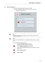
Depiction of the implement in map view
The implement depiction is fixed in the bottom third of the map. The map rotates
about the implement.
The arrow (1) indicates the position of the tractor reference point (aerial position).
According to the set geometries, the sections (2) are positioned behind it.
The white line (3) appears if the working depth is set for the sections. This is, for
example, supported by a number of fertilizers.
Summary of Contents for CCI 100
Page 92: ...CCI Cam Visual implement monitoring Operating instructions Reference CCI Cam v5 ...
Page 118: ...CCI Control Documentation and task management Operating instructions Reference CCI Control v4 ...
Page 224: ...107 10 Notes ...
Page 227: ...110 Edit 38 ...
Page 228: ...CCI TECU Tractor data Operating instructions Reference CCI TECU v6 ...
Page 366: ...CCI GPS GPS settings and tractor geometry Operating instructions Reference CCI GPS v2 ...


